Bonar Creek
| Bonar Creek | |
| River | |
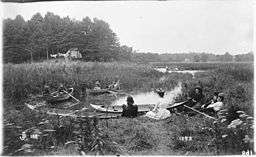 Confluence of Bonar Creek and Mimico Creek in 1889 | |
| Country | Canada |
|---|---|
| Province | Ontario |
| Region | Greater Toronto Area |
| Municipality | Toronto |
| Part of | Lake Ontario drainage basin |
| Mouth | Mimico Creek |
| - location | Mimico |
| - elevation | 367 m (1,204 ft) |
| - coordinates | 43°37′20″N 79°29′00″W / 43.62222°N 79.48333°WCoordinates: 43°37′20″N 79°29′00″W / 43.62222°N 79.48333°W |
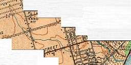 Course of Bonar Creek, a tributary to Mimico Creek. | |
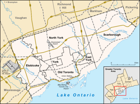 Location of the mouth of the creek in Toronto | |
Bonar Creek was a creek in Mimico, Ontario, Canada. It was a tributary of the still-existing Mimico Creek, a watercourse that empties into Lake Ontario.[1][2] Bonar Creek joined Mimico Creek 130 metres (430 ft) north of Lake Shore Boulevard, in the marsh at the mouth of the Mimico Creek.
The creek is named for Irish immigrants Bill and Letitia Bonar who lived in a pumphouse near the waterway.[3]
Almost the entire creek has been buried, except for a short stretch where the former watercourse joined Mimico Creek, and that remaining portion has been canalized.[2] There are plans to restore part of the wetlands at the confluence of the two creeks.[4]
See also
References
- ↑ "Etobicoke and Mimico Creeks Watersheds Technical Update Report". Toronto Regional Conservation Authority.
- 1 2 "Lost Creeks of South Etobicoke: Bonar Creek". Lost Creeks of South Etobicoke.
- ↑ http://citiesintime.ca/toronto/story/mimico-creek/
- ↑ "Bonar Creek Stormwater Management Facility and Legion Road Extension Municipal Class Environmental Assessment". City of Toronto. 2010-07-26. Archived from the original on 2013-01-15. Retrieved 2012-01-21.
This article is issued from
Wikipedia.
The text is licensed under Creative Commons - Attribution - Sharealike.
Additional terms may apply for the media files.