Georgia State Route 91
| ||||
|---|---|---|---|---|
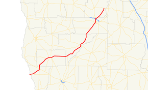 State Route 91 highlighted in red | ||||
| Route information | ||||
| Maintained by GDOT | ||||
| Length | 85.8 mi[1] (138.1 km) | |||
| Existed | 1930[2][3] – present | |||
| Major junctions | ||||
| South end |
| |||
| North end |
| |||
| Location | ||||
| Counties | Seminole, Miller, Baker, Dougherty, Lee | |||
| Highway system | ||||
| ||||

State Route 91 (SR 91) is an 85.8-mile-long (138.1 km) south-to-north state highway in the southwest part of the U.S. state of Georgia. The highway travels from its southern terminus at the Florida state line, southwest of Donalsonville, where the roadway continues as State Road 2, northeast through Albany to its northern terminus, an intersection with SR 32 at a point northeast of the city. It also travels through Donalsonville, Colquitt, and Newton.
Route description
SR 91 begins at the Florida state line, where the roadway continues as State Road 2. Just east of the state line, the highway has an intersection with SR 285. Northeast, in Donalsonville, the highway intersects US 84/SR 38/SR 39. The four highways have a very brief concurrency through the city. Just prior to leaving the city, SR 39 departs the concurrency to the south, while SR 91 departs to the north. Southwest of Colquitt, is an intersection with SR 273. Just west of the city, SR 91 intersects SR 45. The two highways begin a concurrency to the northeast. Just after that, they intersect US 27/SR 1. The three-highway concurrency heads east to Colquitt. In the city, US 27/SR 1 depart to the southeast, while SR 45/SR 91 continue to the east. Just to the east, SR 45 departs to the north, while SR 91 heads east. SR 91 heads northeast to an intersection with SR 253. The highway heads northeast to Newton. In Newton, the highway intersects SR 37 and SR 200. Just southwest of Albany, SR 91 intersects SR 62. In the city, is an intersection with SR 234. Farther into the city, is an intersection with US 19 Bus./US 82 Bus./SR 520 Bus. Just before leaving Albany, the highway has an interchange with the Liberty Expressway (US 19/US 82/SR 3/SR 133/SR 520). SR 91 heads northeast until it reaches its northern terminus, at an intersection with SR 32. The roadway continues as Philema Road North.[1] The only part of SR 91 that is included as part of the National Highway System, a system of routes determined to be the most important for the nation's economy, mobility and defense, is from the SR 62 intersection near Albany to just north of the Liberty Expressway interchange in the city.[4]
History
1930s
SR 91 was established between October 1929 and June 1930 from US 84/SR 38 in Donalsonville northeast to Colquitt and then east-northeast to SR 37 in Newton.[2][3] In January 1932, it was extended north-northeast to Albany.[5][6] In April, it was extended south-southwest to the Florida state line.[7][8] By the beginning of August, the southern terminus was truncated to just east of the Florida state line.[8][9] That month, the southern terminus was re-extended to the Florida state line.[9][10] The next month, the southern terminus was truncated again to just east of the Florida state line. From the SR 62 intersection southwest of Albany, SR 91 was under construction.[10][11] In October, the southern terminus was re-extended yet again to the Florida state line.[11][12] In August 1933, the segment from the SR 62 intersection to Albany had a "completed hard surface".[13][14] By the middle of 1937, the portion of SR 91 from Newton to the SR 62 was under construction.[15][16] By the beginning of October, a small portion in the southwestern part of Albany was under construction.[16][17] At the end of the year, the highway was extended north on US 19/SR 3 to the northern part of Albany and then on a sole path to the Dougherty–Lee county line just east of the Chehaw State Park. Nearly the entire segment from the Florida state line to Donalsonville was under construction.[17][18] By September 1938, the Dougherty County portion of the Newton–Albany segment had a completed hard surface. Two segments had completed grading, but was not surfaced: the entire Seminole County portion and the Baker County portion of the Newton–Albany segment.[18][19] By July 1939, the entire portion of SR 91 in Donalsonville had a completed hard surface. A small portion just west of the Miller–Baker county line had completed grading, but was not surfaced. The sole portion of the extension north of Albany (northeast of US 19/SR 3) was under construction.[19][20] By October, the Baker County portion of the Newton–Albany segment had a "sand clay or top soil" surface.[20][21] By the end of the year, the Miller County portion of the Colquitt–Newton segment was under construction.[21][22]
1940s
In the first quarter of 1940, the bridge over the Chattahoochee River at the Florida state line was indicated to be a toll bridge. Two segments had completed grading, but were not surfaced: nearly the entire portion from Florida to Donalsonville and the sole portion north of Albany. Three segments were under construction: the southern terminus, the Miller County portion of the Donalsonville–Colquitt segment, and the Colquitt–Newton segment.[22][23] By October, the bridge over the Chattahoochee River was no longer indicated to be a toll bridge. The sole portion north of Albany had a completed hard surface. From the southern terminus to the southwest part of Donalsonville, SR 91 was under construction.[23][24] By the end of the year, two segments had a completed hard surface: from Colquitt to a point east of the Miller–Baker county line and the Baker County portion of the Newton–Albany segment.[24][25] By the middle of 1941, nearly the entire segment from the Florida state line to Donalsonville had a sand clay or top soil surface.[26][27] By the end of the year, the Colquitt–Newton segment had a completed hard surface.[27][28] Between the beginning of 1945 and November 1946, the entire length of SR 91 from the Florida state line to the Dougherty–Lee county line had a completed hard surface.[29][30]
1950s to 1980s
In 1952, an unnumbered road was built from the northern terminus of SR 91 northeast to SR 32 in the southeastern part of Lee County.[31][32] Between June 1955 and July 1957, SR 32's path between Leesburg and Ashburn was shifted to the northeast. This meant that the unnumbered road no longer ended at SR 32.[33][34] In 1971, SR 91 was extended north-northeast to SR 32's new path through Lee County, at a point east of Leesbsurg.[35][36] In 1973, the path of SR 91 in the Newton area was shifted southeast to travel through the city. Its former path around the northwest part of the city was redesignated as SR 702.[37][38] By March 1980, SR 702 was decommissioned, and SR 91 was reverted to its previous path around Newton.[39][40]
Major intersections
| County | Location | mi[1] | km | Destinations | Notes |
|---|---|---|---|---|---|
| Seminole | | 0.0 | 0.0 | Florida state line (Chattahoochee River bridge) | |
| | 1.9 | 3.1 | |||
| Donalsonville | 8.3 | 13.4 | |||
| 8.6 | 13.8 | Southern end of SR 39 concurrency | |||
| 9.2 | 14.8 | ||||
| 9.4 | 15.1 | Northern end of SR 39 concurrency | |||
| | 10.2 | 16.4 | |||
| Miller | | 19.5 | 31.4 | ||
| Colquitt | 21.5 | 34.6 | Southern end of SR 45 concurrency | ||
| 21.7 | 34.9 | Southern end of US 27 / SR 1 concurrency | |||
| 23.1 | 37.2 | Northern end of US 27 / SR 1 concurrency | |||
| 23.3 | 37.5 | traffic circle around Miller County Courthouse north end of SR 45 overlap; south end of SR 45 Truck overlap | |||
| north end of SR 45 Truck overlap | |||||
| Baker | | ||||
| Newton | 50.4 | 81.1 | |||
| 50.6 | 81.4 | ||||
| Dougherty | | 66.8 | 107.5 | Southern end of SR 62 concurrency | |
| Albany | 70.3 | 113.1 | Northern end of SR 62 concurrency | ||
| 70.5 | 113.5 | ||||
| 72.8 | 117.2 | ||||
| 74.9 | 120.5 | Liberty Expressway exit 5; southern end of SR 133 concurrency | |||
| 75.2 | 121.0 | Northern end of SR 133 concurrency | |||
| Lee | | Northern terminus | |||
1.000 mi = 1.609 km; 1.000 km = 0.621 mi
| |||||
Special routes
Donalsonville alternate route
| |
|---|---|
| Location | Donalsonville |
| Length | 1.9 mi[41] (3.1 km) |
| Existed | 1969[42][43]–present |
State Route 91 Alternate (SR 91 Alt.) is a 1.9-mile-long (3.1 km) alternate route of SR 91 that begins at an intersection with the SR 91 mainline, in the southern part of Donalsonville. It heads north to an intersection with US 84/SR 38. It heads north, then turns northeast, until it intersects SR 39. It heads northeast, turns north, and then heads northeast again until it meets its northern terminus, another intersection with the SR 91 mainline.[41] The alternate route is not included as part of the National Highway System, a system of routes determined to be the most important for the nation's economy, mobility and defense.[44] SR 91 Alt. was established on its current path in 1969.[42][43]
Colquitt truck route
| |
|---|---|
| Location | Colquitt |
| Length | 1.1 mi[45] (1.8 km) |
State Route 91 Truck (SR 91 Truck) is a 1.1-mile-long (1.8 km) truck route of SR 91 that exists entirely within the central part of Miller County. Its route travels totally within the city limits of Colquitt. It is concurrent with SR 45 Truck for nearly its entire length.
It begins at an intersection with US 27/SR 1/SR 45/SR 91 (West Crawford Street) in the central part of the city, at a point where SR 45 and SR 91 end a concurrency with US 27/SR 1. This intersection is also the southern terminus of SR 45 Truck, which begins a concurrency with SR 91 Truck. US 27/SR 1/SR 45 Truck/SR 91 Truck travels to the southeast and curves to the east. They intersect the southern terminus of SR 45 Conn. (South First Street). The concurrency curves again to the southeast and intersects the southern terminus of SR 91 Spur, where the truck routes leave US 27/SR 1. SR 45 Truck/SR 91 Spur/SR 91 Truck travels to the northeast and curves to a nearly due north direction. At an intersection with SR 91 (Main Street), SR 91 Spur and SR 91 Truck end, while SR 45 Truck turns left onto SR 91.[45]
SR 45 Truck is not part of the National Highway System, a system of roadways important to the nation's economy, defense, and mobility.[44]
The entire route is in Colquitt, Miller County.
| mi[45] | km | Destinations | Notes | ||
|---|---|---|---|---|---|
| 0.0 | 0.0 | Southern terminus of SR 45 Truck/SR 91 Truck; south end of US 27/SR 1 concurrency | |||
| 0.2 | 0.32 | Southern terminus of SR 45 Conn. | |||
| 0.7 | 1.1 | Southern terminus of SR 91 Spur; north end of US 27/SR 1 concurrency; south end of SR 91 Spur concurrency | |||
| 1.1 | 1.8 | Northern terminus of SR 91 Spur/SR 91 Truck; north end of SR 45 Truck/SR 91 Spur concurrency | |||
1.000 mi = 1.609 km; 1.000 km = 0.621 mi
| |||||
Colquitt spur
| |
|---|---|
| Location | Colquitt |
| Length | 0.30 mi[46] (0.48 km) |
| Existed | 1960[34][47]–present |
State Route 91 Spur (SR 91 Spur) is a 0.3-mile-long (0.48 km) spur route of SR 91. It is entirely concurrent with SR 45 Truck and SR 91 Truck. Its southern terminus is at US 27/SR 1 (Crawford Street) in the central part of Colquitt. This intersection is where SR 45 Truck and SR 91 Truck end their concurrency with US 27/SR 1. The three highways travel to the northeast and curve to a nearly due north direction. At an intersection with SR 91 (Main Street), SR 91 Spur and SR 91 Truck end, and SR 45 Truck turns left onto SR 91. The spur route is not included as part of the National Highway System, a system of routes determined to be the most important for the nation's economy, mobility and defense.[44] Between July 1957 and June 1960, SR 91 Spur was established on its current path.[34][47]
The entire route is in Colquitt, Miller County.
| mi[46] | km | Destinations | Notes | ||
|---|---|---|---|---|---|
| 0.0 | 0.0 | Southern terminus; south end of SR 45 Truck/SR 91 Truck concurrency | |||
| 0.3 | 0.48 | Northern terminus of SR 91 Spur/SR 91 Truck; north end of SR 45 Truck/SR 91 Truck concurrency | |||
1.000 mi = 1.609 km; 1.000 km = 0.621 mi
| |||||
See also
.svg.png)

References
- 1 2 3 Google (October 18, 2012). "Overview map of SR 91" (Map). Google Maps. Google. Retrieved October 18, 2012.
- 1 2 State Highway Department of Georgia (October 1929). System of State Roads (PDF) (Map). Scale not given. Atlanta: State Highway Department of Georgia. Retrieved May 2, 2017.
- 1 2 State Highway Department of Georgia (June 1930). System of State Roads (PDF) (Map). Scale not given. Atlanta: State Highway Department of Georgia. Retrieved May 2, 2017.
- ↑ National Highway System: Albany, GA (PDF) (Map). Federal Highway Administration. March 25, 2015. Retrieved May 2, 2017.
- ↑ State Highway Department of Georgia (January 1932). System of State Roads (PDF) (Map). Scale not given. Atlanta: State Highway Department of Georgia. Retrieved May 2, 2017.
- ↑ State Highway Department of Georgia (February 1932). System of State Roads (PDF) (Map). Scale not given. Atlanta: State Highway Department of Georgia. Retrieved May 2, 2017.
- ↑ State Highway Department of Georgia (April 1932). System of State Roads (PDF) (Map). Scale not given. Atlanta: State Highway Department of Georgia. Retrieved May 2, 2017.
- 1 2 State Highway Department of Georgia (May 1932). System of State Roads (PDF) (Map). Scale not given. Atlanta: State Highway Department of Georgia. Retrieved May 2, 2017.
- 1 2 State Highway Department of Georgia (August 1932). System of State Roads (PDF) (Map). Scale not given. Atlanta: State Highway Department of Georgia. Retrieved May 2, 2017.
- 1 2 State Highway Department of Georgia (September 1932). System of State Roads (PDF) (Map). Scale not given. Atlanta: State Highway Department of Georgia. Retrieved May 2, 2017.
- 1 2 State Highway Department of Georgia (October 1932). System of State Roads (PDF) (Map). Scale not given. Atlanta: State Highway Department of Georgia. Retrieved May 2, 2017.
- ↑ State Highway Department of Georgia (November 1932). System of State Roads (PDF) (Map). Scale not given. Atlanta: State Highway Department of Georgia. Retrieved May 2, 2017.
- ↑ State Highway Department of Georgia (August 1933). System of State Roads (PDF) (Map). Scale not given. Atlanta: State Highway Department of Georgia. Retrieved May 2, 2017.
- ↑ State Highway Department of Georgia (September 1933). System of State Roads (PDF) (Map). Scale not given. Atlanta: State Highway Department of Georgia. Retrieved May 2, 2017.
- ↑ State Highway Department of Georgia (April 1, 1937). System of State Roads (PDF) (Map). Scale not given. Atlanta: State Highway Department of Georgia. Retrieved May 2, 2017.
- 1 2 State Highway Department of Georgia (July 1, 1937). System of State Roads (PDF) (Map). Scale not given. Atlanta: State Highway Department of Georgia. Retrieved May 2, 2017.
- 1 2 State Highway Department of Georgia (October 1, 1937). System of State Roads (PDF) (Map). Scale not given. Atlanta: State Highway Department of Georgia. Retrieved May 2, 2017.
- 1 2 Georgia State Highway Board (January 1, 1938). System of State Roads (PDF) (Map). Scale not given. Atlanta: State Highway Department of Georgia. OCLC 5673161. Retrieved May 2, 2017.
- 1 2 State Highway Department of Georgia (September 1, 1938). System of State Roads (PDF) (Map). Scale not given. Atlanta: State Highway Department of Georgia. OCLC 5673161. Retrieved May 2, 2017.
- 1 2 State Highway Department of Georgia (July 1, 1939). System of State Roads (PDF) (Map). Scale not given. Atlanta: State Highway Department of Georgia. OCLC 5673161. Retrieved May 2, 2017.
- 1 2 State Highway Department of Georgia (October 1, 1939). System of State Roads (PDF) (Map). Scale not given. Atlanta: State Highway Department of Georgia. OCLC 5673161. Retrieved May 2, 2017.
- 1 2 State Highway Department of Georgia (January 1, 1940). System of State Roads (PDF) (Map). Scale not given. Atlanta: State Highway Department of Georgia. OCLC 5673161. Retrieved May 2, 2017.
- 1 2 State Highway Department of Georgia (April 1, 1940). System of State Roads (PDF) (Map). Scale not given. Atlanta: State Highway Department of Georgia. OCLC 5673161. Retrieved May 2, 2017.
- 1 2 State Highway Department of Georgia (October 1, 1940). System of State Roads (PDF) (Map). Scale not given. Atlanta: State Highway Department of Georgia. OCLC 5673161. Retrieved May 2, 2017.
- ↑ State Highway Department of Georgia (January 1, 1941). System of State Roads (PDF) (Map). Scale not given. Atlanta: State Highway Department of Georgia. OCLC 5673161. Retrieved May 2, 2017.
- ↑ State Highway Department of Georgia (April 1, 1941). System of State Roads (PDF) (Map). Scale not given. Atlanta: State Highway Department of Georgia. OCLC 5673161. Retrieved May 2, 2017.
- 1 2 State Highway Department of Georgia (July 1, 1941). System of State Roads (PDF) (Map). Scale not given. Atlanta: State Highway Department of Georgia. OCLC 5673161. Retrieved May 2, 2017.
- ↑ State Highway Department of Georgia (January 1, 1942). System of State Roads (PDF) (Map). Scale not given. Atlanta: State Highway Department of Georgia. OCLC 5673161. Retrieved May 2, 2017.
- ↑ State Highway Department of Georgia (January 1, 1945). System of State Roads (PDF) (Map). Scale not given. Atlanta: State Highway Department of Georgia. OCLC 5673161. Retrieved May 2, 2017.
- ↑ State Highway Department of Georgia (1946). System of State Roads (PDF) (Map). Scale not given. Atlanta: State Highway Department of Georgia. OCLC 5673161. Retrieved May 2, 2017. (Corrected to November 7, 1946.)
- ↑ State Highway Department of Georgia (1952). System of State Roads (PDF) (Map). Scale not given. Atlanta: State Highway Department of Georgia. OCLC 5673161. Retrieved May 2, 2017. (Corrected to January 1, 1952.)
- ↑ State Highway Department of Georgia (January 1, 1953). System of State Roads (PDF) (Map). Scale not given. Atlanta: State Highway Department of Georgia. Retrieved May 2, 2017. (Corrected to January 1, 1953.)
- ↑ State Highway Department of Georgia (1955). State Highway System and Other Principal Connection Roads (PDF) (Map). Scale not given. Atlanta: State Highway Department of Georgia. OCLC 5673161. Retrieved May 2, 2017. (Corrected to June 1, 1955.)
- 1 2 3 State Highway Department of Georgia (1957). State Highway System and Other Principal Connection Roads (PDF) (Map). Scale not given. Atlanta: State Highway Department of Georgia. OCLC 5673161. Retrieved May 2, 2017. (Corrected to July 1, 1957.)
- ↑ State Highway Department of Georgia (January 1971). Official Highway Map (PDF) (Map). Scale not given. Atlanta: State Highway Department of Georgia. Retrieved May 2, 2017.
- ↑ State Highway Department of Georgia (January 1972). Official Highway Map (PDF) (Map). Scale not given. Atlanta: State Highway Department of Georgia. Retrieved May 2, 2017.
- ↑ Georgia Department of Transportation (January 1973). Official Highway Map (PDF) (Map). Scale not given. Atlanta: Georgia Department of Transportation. Retrieved May 2, 2017.
- ↑ Georgia Department of Transportation (January 1974). Official Highway Map (PDF) (Map) (1974–1975 ed.). Scale not given. Atlanta: Georgia Department of Transportation. Retrieved May 2, 2017.
- ↑ Georgia Department of Transportation (January 1978). Official Highway Map (PDF) (Map) (1978-79 ed.). Scale not given. Atlanta: Georgia Department of Transportation. Retrieved May 2, 2017.
- ↑ Georgia Department of Transportation (1980). Official Highway and Transportation Map (PDF) (Map) (1980–1981 ed.). Scale not given. Atlanta: Georgia Department of Transportation. Retrieved May 2, 2017.
- 1 2 Google (October 18, 2012). "Overview map of SR 91 Alt." (Map). Google Maps. Google. Retrieved October 18, 2012.
- 1 2 State Highway Department of Georgia (January 1969). Official Highway Map (PDF) (Map). Scale not given. Atlanta: State Highway Department of Georgia. Retrieved May 2, 2017.
- 1 2 State Highway Department of Georgia (January 1970). Official Highway Map (PDF) (Map). Scale not given. Atlanta: State Highway Department of Georgia. Retrieved May 2, 2017.
- 1 2 3 National Highway System: Georgia (PDF) (Map). Federal Highway Administration. March 25, 2015. Retrieved May 2, 2017.
- 1 2 3 Google (February 27, 2017). "Overview map of SR 91 Truck" (Map). Google Maps. Google. Retrieved February 27, 2017.
- 1 2 Google (February 27, 2017). "Overview map of SR 91 Spur" (Map). Google Maps. Google. Retrieved February 27, 2017.
- 1 2 State Highway Department of Georgia (1960). State Highway System and Other Principal Connection Roads (PDF) (Map) (1960–1961 ed.). Scale not given. Atlanta: State Highway Department of Georgia. OCLC 5673161. Retrieved May 2, 2017. (Corrected to June 1, 1960.)
External links
![]()