Georgia State Route 285
| ||||
|---|---|---|---|---|
 | ||||
| Route information | ||||
| Maintained by GDOT | ||||
| Length | 13.9 mi[1] (22.4 km) | |||
| Major junctions | ||||
| West end |
| |||
|
| ||||
| East end |
| |||
| Location | ||||
| Counties | Seminole, Decatur | |||
| Highway system | ||||
| ||||

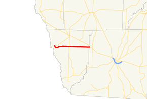
State Route 285 (SR 285) is a west-east state highway located in the southwestern part of the U.S. state of Georgia.
Route description
SR 285 begins at an intersection with SR 91 southwest of Donalsonville, in Seminole County, where the roadway continues as Butler Ferry Road. The route heads southeast along River Road for a short distance before turning and running nearly due east through rural portions of Seminole County. On its way through Seminole County, it intersects SR 39. Almost immediately after entering Decatur County, the route meets its eastern terminus, an intersection with US 84/SR 38 in Brinson.
Major intersections
| County | Location | mi[1] | km | Destinations | Notes |
|---|---|---|---|---|---|
| Seminole | | 0.0 | 0.0 | Western terminus | |
| | 6.1 | 9.8 | |||
| Decatur | | 13.0 | 20.9 | Eastern terminus | |
| 1.000 mi = 1.609 km; 1.000 km = 0.621 mi | |||||
See also
.svg.png)

References
- 1 2 Google (February 11, 2013). "Route of SR 285" (Map). Google Maps. Google. Retrieved February 11, 2013.
External links
Route map:
This article is issued from
Wikipedia.
The text is licensed under Creative Commons - Attribution - Sharealike.
Additional terms may apply for the media files.