Geography of San Marino
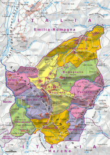
A map of San Marino
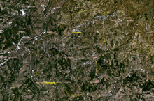
Satellite image
San Marino is located in Southern Europe, an enclave (landlocked) in central Italy, which it borders for 39 km. The third smallest independent state by area in Europe after the Vatican City and Monaco, San Marino is dominated by the Apennines. Located at 43°56′N 12°28′E / 43.94°N 12.46°E, it covers an area of 61.2 km2 (23.6 sq mi). It has a Mediterranean climate with mild to cool winters and warm, sunny summers. Completely mountainous, only 17% of its territory is arable. Several rivers flow through the country, the largest being the Ausa, the Marano, and the San Marino River.
Political geography
San Marino is divided into 9 castelli, or municipalities. They are:
- Acquaviva
- Borgo Maggiore
- Chiesanuova
- Domagnano
- Faetano
- Fiorentino
- Montegiardino
- City of San Marino (Città di San Marino), capital town
- Serravalle

This article is issued from
Wikipedia.
The text is licensed under Creative Commons - Attribution - Sharealike.
Additional terms may apply for the media files.