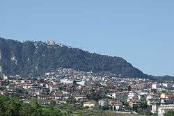
Domagnano
| Domagnano | |||
|---|---|---|---|
| castello | |||
 | |||
| |||
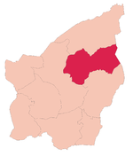 Domagnano's location in San Marino | |||
 Domagnano Domagnano's location in San Marino | |||
| Coordinates: 43°57′N 12°28′E / 43.950°N 12.467°ECoordinates: 43°57′N 12°28′E / 43.950°N 12.467°E | |||
| Country |
| ||
| Government | |||
| • Capitano | Gabriel Guidi (since 2014) | ||
| Area | |||
| • Total | 6.62 km2 (2.56 sq mi) | ||
| Elevation | 357 m (1,171 ft) | ||
| Population (May 2018) | |||
| • Total | 3,565[1] | ||
| Time zone | UTC+1 (CET) | ||
| • Summer (DST) | CEST | ||
| Postal code | 47895 | ||
| Climate | Cfa | ||
Domagnano is a municipality in San Marino. It has 3,565 inhabitants (May 2018)[1] in an area of 6.62 km².
Geography
It borders the San Marino municipalities Faetano, Borgo Maggiore, Serravalle and the Italian municipality Coriano.
History
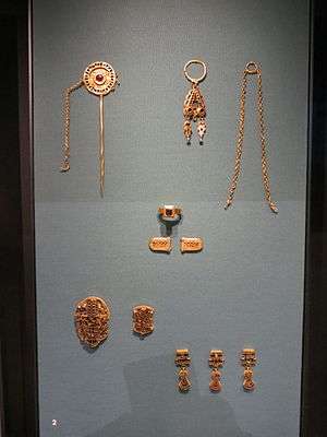
Domagnano, previously known as Montelupo (mountain of wolves) after its coat of arms, was already colonized by Roman times and was first mentioned in c. 1300. It is located on Monte Titano and you can see the Adriatic Sea from here. The so-called Domagnano Treasure was found in the castle here in the late nineteenth century. It is now split between a number of museums, but the largest portions of the treasure are kept at the Germanisches Nationalmuseum in Nuremberg and the British Museum.[2]
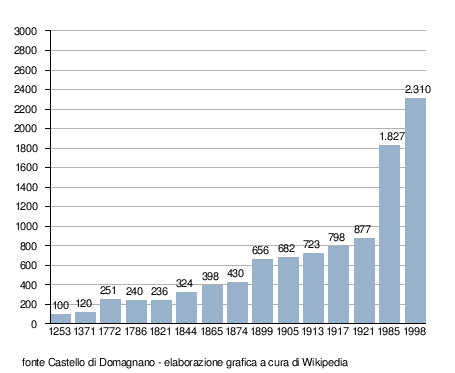
Demographic evolution
Parishes
Domagnano has got 5 parishes (curazie):
References
![]()
| Authority control |
|---|