Garceno, Texas
| Garceno, Texas | |
|---|---|
| CDP | |
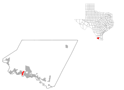
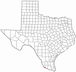 Location of Garceno, Texas | |
 | |
| Coordinates: 26°24′44″N 98°56′25.5″W / 26.41222°N 98.940417°WCoordinates: 26°24′44″N 98°56′25.5″W / 26.41222°N 98.940417°W | |
| Country | United States |
| State | Texas |
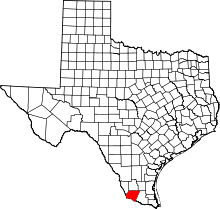
| County | Starr |
| Area | |
| • Total | 0.2 sq mi (0.5 km2) |
| • Land | 0.2 sq mi (0.5 km2) |
| • Water | 0.0 sq mi (0 km2) |
| Elevation | 194 ft (59 m) |
| Population (2010) | |
| • Total | 420 |
| • Density | 2,100/sq mi (810/km2) |
| Time zone | UTC-6 (Central (CST)) |
| • Summer (DST) | UTC-5 (CDT) |
| ZIP code | 78584 |
| Area code(s) | 956 |
| FIPS code | 48-28128[1] |
| GNIS feature ID | 1336371[2] |
Garceno is a census-designated place (CDP) in Starr County, Texas, United States. The population was 420 at the 2010 census down from 1,438 at the 2000 census.[3]
Geography
Garceno is located at 26°24′44″N 98°56′25.5″W / 26.41222°N 98.940417°W (26.412177, -98.940428).
Prior to the 2010 census, Garceno CDP had part incorporated into Escobares city, part taken to form San Juan CDP, and lost additional area. As a result, the total area was reduced to 0.2 square miles (0.5 km²), all land.[4]>[5]
Demographics
As of the census[1] of 2000, there were 1,438 people, 354 households, and 312 families residing in the CDP. The population density was 440.6 people per square mile (170.3/km²). There were 420 housing units at an average density of 128.7/sq mi (49.7/km²). The racial makeup of the CDP was 82.41% White, 0.21% African American, 1.46% Native American, 14.81% from other races, and 1.11% from two or more races. Hispanic or Latino of any race were 97.71% of the population.
There were 354 households out of which 57.9% had children under the age of 18 living with them, 63.6% were married couples living together, 18.6% had a female householder with no husband present, and 11.6% were non-families. 10.5% of all households were made up of individuals and 4.8% had someone living alone who was 65 years of age or older. The average household size was 4.06 and the average family size was 4.35.
In the CDP, the population was spread out with 39.2% under the age of 18, 12.6% from 18 to 24, 25.9% from 25 to 44, 16.1% from 45 to 64, and 6.2% who were 65 years of age or older. The median age was 24 years. For every 100 females, there were 99.4 males. For every 100 females age 18 and over, there were 92.1 males.
The median income for a household in the CDP was $9,750, and the median income for a family was $10,833. Males had a median income of $12,670 versus $7,132 for females. The per capita income for the CDP was $5,922. About 68.8% of families and 71.1% of the population were below the poverty line, including 76.1% of those under age 18 and 77.3% of those age 65 or over.
Education
Public education in the community of Garceno is provided by the Roma Independent School District. Zoned campuses include Anna S. Canavan Elementary School (pre-kindergarten), R.T. Barrera Elementary School (grades K-5), Ramiro Barrera Middle School (grades 6-8), and Roma High School (grades 9-12).[6][7]
References
- 1 2 "American FactFinder". United States Census Bureau. Archived from the original on 2013-09-11. Retrieved 2008-01-31.
- ↑ "US Board on Geographic Names". United States Geological Survey. 2007-10-25. Retrieved 2008-01-31.
- ↑ "2010 Census: Population of Texas Cities Arranged in Alphabetical Order - TSLAC".
- ↑ "Population and Housing Unit Counts, 2010 Census of Population and Housing" (PDF). Texas: 2010.
- ↑ "Garceno, Texas :: Boundary Map of Garceno, Texas".
- ↑ "2009-2010 Roma ISD Elementary Boundaries" (PDF). Roma Independent School District. Archived from the original (PDF) on 2011-07-15. Retrieved 2009-10-13.
- ↑ "2009-2010 Roma ISD Middle School Boundaries" (PDF). Roma Independent School District. Archived from the original (PDF) on 2011-07-15. Retrieved 2009-10-13.