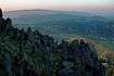
Franconian Forest

View to Döbraberg

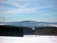
The Franconian Forest[1] (German: Frankenwald ,  German pronunciation ), is a mid-altitude mountain range in Northern Bavaria, Germany. It is located in the district of Upper Franconia (Oberfranken) and forms the geological connection between the Fichtelgebirge and the Thuringian Forest. It is a broad well-wooded plateau, running for about 45 kilometres (28 mi) in a northwesterly direction, descending gently on the north and eastern sides towards the Saale river, but more precipitously to the Bavarian plain in the west, and attaining its highest elevation in the Döbraberg near Schwarzenbach am Wald (794 metres). Along the centre lies the watershed between the basins of the Main and the Saale, belonging to the systems of the Rhine and Elbe respectively.

References

  1. Franconian Forest at www.britannica.com. Accessed on 1 Apr 11.
  •  This article incorporates text from a publication now in the public domain: Chisholm, Hugh, ed. (1911). "Frankenwald". Encyclopædia Britannica (11th ed.). Cambridge University Press.


Coordinates: 50°18′N 11°36′E / 50.300°N 11.600°E / 50.300; 11.600

This article is issued from Wikipedia. The text is licensed under Creative Commons - Attribution - Sharealike. Additional terms may apply for the media files.