Fort Pierre Chouteau
|
Fort Pierre Chouteau Site | |
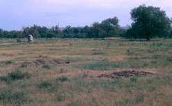 Fields at the site | |
  | |
| Nearest city | Fort Pierre, South Dakota |
|---|---|
| Coordinates | 44°23′21″N 100°23′28″W / 44.38917°N 100.39111°WCoordinates: 44°23′21″N 100°23′28″W / 44.38917°N 100.39111°W |
| NRHP reference # | 76001756[1] |
| Significant dates | |
| Added to NRHP | April 3, 1976[2] |
| Designated NHL | July 17, 1991[1] |
Fort Pierre Chouteau, also just Fort Pierre, was a major trading post and military outpost in what is now central South Dakota during mid-19th century. Established in 1832 and operational through the 1850s, it was the largest trading post in the northern plains, and a major transshipment point for buffalo furs. The archaeological remains of the fort, located in Stanley County just north of Fort Pierre, was declared a National Historic Landmark in 1991.[1][3]
Setting


Fort Pierre Chouteau was located just north of the confluence of the Missouri and Bad Rivers, on a low terrace above the west bank of the Missouri River. This site was of strategic importance for several reasons. It served as a midpoint among the outposts of the American Fur Company (AFC), which monopolized trade on the upper Missouri, and as an endpoint for a major overland shipment route to Fort Laramie in present-day eastern Wyoming. The fort was built as a replacement for Fort Tecumseh, located nearer the river confluence, which had been built by the AFC's predecessor in the regional fur trade, the Columbia Fur Company. That fort, built about 1822, was poorly sited and subject to flooding. Some of its timber elements were reused in the construction of Fort Pierre Chouteau.[3]
History
The Fort Pierre area was first encountered by French explorers the La Vérendrye brothers in their 1743-44 expedition. They buried a lead plate near the confluence of the Missouri and Bad Rivers, on which they claimed the territory as part of New France. The next major non-Native visitors were the American Lewis and Clark Expedition, which camped in the same area in 1806. A French trading post was established in 1817 by Joseph LaFramboise, marking the start of permanent white settlement of the area.[4]
In 1822, former fur traders for the Hudson's Bay Company established the Columbia Fur Company, and built Fort Tecumseh, as well as other outposts on the Upper Missouri. The Columbia Fur Company's assets were purchased in 1827 by the AFC, which turned management of the Upper Missouri Operation (UMO) to Bernard Pratte and Pierre Chouteau, Jr. Chouteau, who purchased the operation when John Jacob Astor, head of the AFC, retired from the fur business in 1834. Chouteau would eventually buy Pratte out, and became the principal operator of the fur trading operation. When he ascended the Missouri River in 1832 on the maiden voyage of the steamship Yellowstone, he ordered the construction of what was formally dubbed Fort Pierre in his honor.
Fort Pierre rapidly became a major center for Chouteau's trading business. In addition to its central location for company logistics, it was also generally surrounded by a settlement of Sioux and other Plains tribes, who traded buffalo furs American and European goods. At its height in the 1850s, the company was shipping 100,000 fur robes through Fort Pierre, and was part of a complex shipment network extending from the Rocky Mountains to the American east coast and Europe.[3]
The buffalo was subjected to extreme overharvesting in the 1850s, caused in part by the trade, but also spurred by the advance of the railroads and an increase in hunting the animals for sport. The trade in buffalo fur was effectively over by the early 1860s, when the United States Army established a presence in the region. Pierre Chouteau sold the fort to the United States government in 1854. The government found the facilities inadequate, and abandoned them in 1857, in favor of Fort Randall to the south. Salvageable buildings and materials were transported to Fort Randall, and any surviving timbers were used to fuel steamboats on the river.[3]
After closure
The fort became part of reservation lands assigned to the Sioux in the 1868 Treaty of Fort Laramie. When the Dakota Territory was partitioned in 1889 and the Sioux reservation was reduced in size, the fort's land became available for homesteading. It was used as pasture land until 1930, when it was acquired by the state. The state property was further enlarged by a land gift in 1970. Archaeological activity in the 1980s identified a number of elements of the fort's structure, confirming its location.[3]
The site is now an open meadow just north of the city limits of Fort Pierre, on the north side of Fort Chouteau Road. A stone marker is located near the center of the site, accessible by a gravel path. There are no visible remains of the fort's buildings and infrastructure. The state is developing plans for improved access and interpretation at the site.[4]
See also
References
- 1 2 3 "Fort Pierre Chouteau Site". National Historic Landmark summary listing. National Park Service. Retrieved 2008-06-14.
- ↑ National Park Service (2008-04-15). "National Register Information System". National Register of Historic Places. National Park Service.
- 1 2 3 4 5 "National Register of Historic Places Inventory-Nomination". National Park Service. December 1990.
- 1 2 "Management Plan for Fort Pierre Chouteau Historic Site" (PDF). State of South Dakota. Retrieved 2017-05-15.
External links
![]()
| Topics | |
|---|---|
| Lists by states |
|
| Lists by insular areas | |
| Lists by associated states | |
| Other areas | |
| |