Fort Hamer, Florida
| Fort Hamer, Florida | |
|---|---|
| Unincorporated community | |
| Fort Hamer | |
 Fort Hamer, Florida Location within the state of Florida | |
| Coordinates: 27°31′31″N 82°25′48″W / 27.52528°N 82.43000°WCoordinates: 27°31′31″N 82°25′48″W / 27.52528°N 82.43000°W[1] | |
| Country | United States |
| State | Florida |
| County | Manatee |
| Established | November 28, 1849 |
| Elevation | 7 ft (2 m) |
| Time zone | UTC-5 (EST) |
| • Summer (DST) | UTC-4 (EDT) |
| Area code(s) | 941 |
| FIPS code | 12-23895[1] |
| GNIS feature ID | 295293[1] |
Fort Hamer is an unincorporated area in Manatee County, Florida, United States, and was the name of a short-lived U.S. Army fort in eastern Manatee County.
History
Fort Hamer was established on November 28, 1849 as part of an order by Major General David E. Twiggs to remove Seminole people from Florida after various pioneer outposts in the state were attacked by Seminole outsiders. The order established a 200-mile-span (320 km) of forts from Manatee River to the Indian River.[2]
References
- 1 2 3 "US Board on Geographic Names". United States Geological Survey. Retrieved June 20, 2018.
- ↑ Donahue-Farrell, Bridget (August 20, 2017). "The Crisis of 1849 and the establishment of Fort Hamer". Bradenton Herald. Retrieved June 1, 2018.
Municipalities and communities of Manatee County, Florida, United States | ||
|---|---|---|
| Cities | 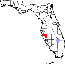 | |
| Town | ||
| CDPs | ||
| Unincorporated communities | ||
| Ghost towns | ||
| Footnotes | ‡This populated place also has portions in an adjacent county or counties | |
This article is issued from
Wikipedia.
The text is licensed under Creative Commons - Attribution - Sharealike.
Additional terms may apply for the media files.