Flores, Pernambuco
| Flores | |
|---|---|
| Municipality | |
.png) Location in Pernambuco state | |
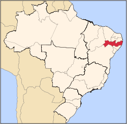
 Flores Location in Brazil | |
| Coordinates: 7°51′57″S 37°58′30″W / 7.86583°S 37.97500°WCoordinates: 7°51′57″S 37°58′30″W / 7.86583°S 37.97500°W | |
| Country |
|
| Region | Northeast Region |
| State | Pernambuco |
| Mesoregion | Sertão Pernambucano |
| Area | |
| • Total | 996 km2 (385 sq mi) |
| Population (2015) | |
| • Total | 22,588 |
| • Density | 23/km2 (59/sq mi) |
| Time zone | BRT (UTC-3) |
Flores (Portuguese for "Flowers") is a municipality (município) in the state of Pernambuco in Brazil. The population is 22,588 (2015 est.) in an area of 996 km².[1]
Geography
Economy
The main economic activities in Flores are based in agribusiness, especially creation of cattle and their milk, goats, sheeps and plantations with beans, corn and guava (goiaba).
Economic Indicators
| Population | GDP x(1000 R$).[2] | GDP pc (R$) | PE |
|---|---|---|---|
| 23.034 | 59.354 | 2.703 | 0.097% |
Economy by Sector
| Primary sector | Secondary sector | Service sector |
|---|---|---|
| 20.39% | 9.10% | 70.51% |
Health Indicators
| HDI (2000) | Hospitals (2007) | Hospitals beds (2007) | Children's mortality every 1000 (2005) |
|---|---|---|---|
| 0.613 | 1 | 22 | 27.5 |
References
Capital: Recife | ||||||||||||||
| Mesoregion Agreste Pernambucano |
|  | ||||||||||||
| Mesoregion Mata Pernambucana |
| |||||||||||||
| Mesoregion Metropolitana de Recife |
| |||||||||||||
| Mesoregion Sao Francisco Pernambucano |
| |||||||||||||
| Mesoregion Sertao Pernambucano |
| |||||||||||||
This article is issued from
Wikipedia.
The text is licensed under Creative Commons - Attribution - Sharealike.
Additional terms may apply for the media files.