Santa Cruz do Capibaribe
| Santa Cruz do Capibaribe Município de Santa Cruz do Capibaribe | |||
|---|---|---|---|
| Municipality | |||
| Municipality of Santa Cruz do Capibaribe | |||
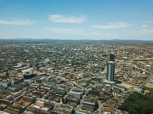 Santa Cruz do Capibaribe in 2017 | |||
| |||
.png) | |||
 Santa Cruz do Capibaribe | |||
| Coordinates: 07°57′25″S 36°12′18″W / 7.95694°S 36.20500°WCoordinates: 07°57′25″S 36°12′18″W / 7.95694°S 36.20500°W | |||
| Country |
| ||
| Region | Northeast | ||
| State |
| ||
| Founded | December 29, 1953 | ||
| Government | |||
| • Mayor | Edson de Souza Vieira (PSDB) | ||
| Area | |||
| • Total | 335.55 km2 (129.56 sq mi) | ||
| Elevation | 438 m (1,410 ft) | ||
| Population (2017) | |||
| • Total | 105,761 | ||
| • Density | 261,20/km2 (67,700/sq mi) | ||
| Time zone | UTC-3 (UTC−3) | ||
| • Summer (DST) | UTC-3 (UTC−3) | ||
| Postal code | 55190-000 | ||
| Area code(s) | +55 81 | ||
| HDI (2010) | 0.648 – medium[1] | ||
| Website |
www | ||


Santa Cruz do Capibaribe is a Brazilian municipality in the State of Pernambuco. It is the third largest city in the mesoregion of Agreste of Pernambuco with a population of 105,761 inhabitants in 2017. It has 335.55 km² (208.5 square miles) of total area and it is located about 185.7 km (115.4 miles) from the capital Recife.
The city is famous for its textile industry together with Caruaru and Toritama.
Geography
- State - Pernambuco
- Region - Agreste of Pernambuco
- Boundaries - Brejo da Madre de Deus and Jataúba (S), Taquaritinga do Norte (E), Paraiba (N and W).
- Area - 335.5 km2
- Elevation - 438 m
- Hidrography - Capibaribe River
- Vegetation - Caatinga hipoxerofila.
- Clima - Semi desertic
- Annual average temperature - 23.4 c
- Main road - BR 203, BR 104 and PE 130
- Distance to Recife - 185 km
Economy
The main economic activities in Santa Cruz do Capibaribe are related with the textile industry (employs 41%) and general commerce.
Economic Indicators
| Population [2] | GDP x(1000 R$).[3] | GDP pc (R$) [4] | PE |
|---|---|---|---|
| 105.761 | 332.112 | 12.286 | 0.55% |
Economy by Sector 2006
| Primary sector | Secondary sector | Service sector |
|---|---|---|
| 1.14% | 14.44% | 84.42% |
Health Indicators
| HDI (2010) | Hospitals (2007) | Hospitals beds (2007) | Children's Mortality every 1000 (2005) |
|---|---|---|---|
| 0.648 | 3 | 115 | 22.5 |
References
- ↑ - UNDP
- ↑ https://cidades.ibge.gov.br/brasil/pe/santa-cruz-do-capibaribe/panorama IBGE 2017 Santa Cruz do Capibaribe
- ↑ Santa Cruz do Capibaribe 2007 GDP IBGE page 31 Archived 2016-03-04 at the Wayback Machine.
- ↑ https://cidades.ibge.gov.br/brasil/pe/santa-cruz-do-capibaribe/panorama IBGE 2017 Santa Cruz do Capibaribe
- ↑ PE State site - City by city profile
This article is issued from
Wikipedia.
The text is licensed under Creative Commons - Attribution - Sharealike.
Additional terms may apply for the media files.