Estate Judith's Fancy
|
Estate Judith's Fancy | |
 | |
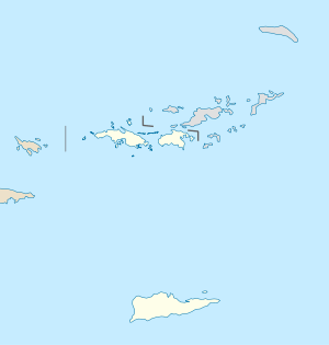 | |
| Location | 4 miles (6.4 km) northwest of Christiansted |
|---|---|
| Coordinates | 17°46′41″N 64°44′44″W / 17.778194°N 64.745694°WCoordinates: 17°46′41″N 64°44′44″W / 17.778194°N 64.745694°W |
| Area | 3.6 acres (1.5 ha) |
| Built | 1733 |
| NRHP reference # | 78002717[1] |
| Added to NRHP | July 17, 1978 |
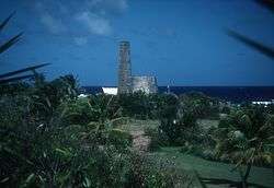
Estate Judith's Fancy, subdistrict of Saint Croix, U.S. Virgin Islands, 4 miles (6.4 km) northwest of Christiansted is a former sugarcane plantation whose great house was built in 1733.[2] Its surviving 3.6 acres (1.5 ha) property was listed on the National Register of Historic Places in 1978. The listing included six contributing sites.[1]
The site is significant for being the location of government headquarters during the French occupation of St. Croix during 1651-65, under the Knights of Malta's ownership, as well as for preserving remnants of typical buildings of a sugar plantation. The property includes stonework ruins from a sugar factory, from a windmill which drew water, from a chimney of a later steam mill, and a small house. The factory building is T-shaped, with a two-story section being 22 by 96 feet (6.7 m × 29.3 m) in plan. An 18.5 by 36 feet (5.6 m × 11.0 m) wing was the boiling room. A one-story 10.67 by 15 feet (3.25 m × 4.57 m) cookhouse with a charcoal stove is also attached.[2]
References
- 1 2 National Park Service (2010-07-09). "National Register Information System". National Register of Historic Places. National Park Service.
- 1 2 Annie Hillary and Russell Wright (June 9, 1977). "National Register of Historic Places Inventory/Nomination: Estate Judith's Fancy". National Park Service. Retrieved May 31, 2017. With three photos from 1977.
| Wikimedia Commons has media related to Plantations in the United States Virgin Islands. |
| Topics | |
|---|---|
| Lists by states |
|
| Lists by insular areas | |
| Lists by associated states | |
| Other areas | |
| |
Charlotte Amalie (capital) | |
| Topics |
|
| Government | |
| Cities | |
| Islands | |
| Parks | |