Engle, New Mexico
| Engle | |
|---|---|
| Unincorporated community | |
 Engle Location within the state of New Mexico  Engle Engle (the US) | |
| Coordinates: 33°10′37″N 107°01′53″W / 33.17694°N 107.03139°WCoordinates: 33°10′37″N 107°01′53″W / 33.17694°N 107.03139°W | |
| Country | United States |
| State | New Mexico |
| County | Sierra |
| Elevation | 4,777 ft (1,456 m) |
| Time zone | UTC-7 (Mountain (MST)) |
| • Summer (DST) | UTC-6 (MDT) |
| Area code(s) | 575 |
| GNIS feature ID | 888887[1] |
Engle is an unincorporated community in Sierra County, New Mexico, United States.[1]
Engle was a station on the Atchison, Topeka and Santa Fe Railway and New Mexico State Road 51 passes through the community. Elephant Butte Reservoir and Truth or Consequences lie to the west and the San Andres Mountains are to the east.[2]
El Camino Real de Tierra Adentro
El Camino Real de Tierra Adentro passed through the vicinity of Engle; two former segments of the road near Engle are listed on the National Register of Historic Places.[3]
Notable people
- Rudd Weatherwax, actor, was born in Engle.[4]
Notes
- 1 2 "Engle, New Mexico". Geographic Names Information System. United States Geological Survey.
- ↑ Engle, NM and Sowell, NM 15 Minute Topographic Quadrangles, USGS, 1959
- ↑ "Weekly List of Actions Taken On Properties: 2/13/12 Through 2/17/12". National Park Service. Retrieved December 9, 2014.
- ↑ IMBD-Rudd Weatherwax
Municipalities and communities of Sierra County, New Mexico, United States | ||
|---|---|---|
| Cities | 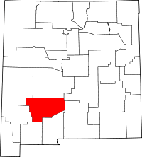 | |
| Villages | ||
| CDPs | ||
| Other communities | ||
| Ghost towns | ||
This article is issued from
Wikipedia.
The text is licensed under Creative Commons - Attribution - Sharealike.
Additional terms may apply for the media files.