Elephant Butte, New Mexico
| Elephant Butte, New Mexico | |
|---|---|
| City | |
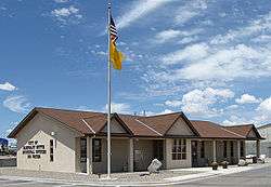 Elephant Butte Municipal Offices | |
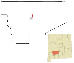 Location of Elephant Butte, New Mexico | |
 Elephant Butte, New Mexico Location in the United States | |
| Coordinates: 33°11′23″N 107°13′22″W / 33.18972°N 107.22278°WCoordinates: 33°11′23″N 107°13′22″W / 33.18972°N 107.22278°W | |
| Country | United States |
| State | New Mexico |
| County | Sierra |
| Area | |
| • Total | 3.0 sq mi (7.7 km2) |
| • Land | 3.0 sq mi (7.7 km2) |
| • Water | 0.0 sq mi (0.0 km2) |
| Elevation | 4,465 ft (1,361 m) |
| Population (2010) | |
| • Total | 1,431 |
| • Estimate (2016)[1] | 1,341 |
| • Density | 480/sq mi (190/km2) |
| Time zone | UTC-7 (Mountain (MST)) |
| • Summer (DST) | UTC-6 (MDT) |
| ZIP code | 87935 |
| Area code(s) | 575 |
| FIPS code | 35-22720 |
| GNIS feature ID | 0898770 |
| Website | http://cityofelephantbutte.com/ |
Elephant Butte is a city in Sierra County, New Mexico, United States, near Elephant Butte Reservoir and State Park. The population was 1,390 at the 2000 census.
History
Elephant Butte was named from Elephant Butte, a butte nearby thought to resemble an elephant.[2] Elephant Butte was the home of the Toy-Box Killer David Parker Ray.[3] Ray is suspected by police to have murdered as many as 60 people while living in Elephant Butte.
Geography
Elephant Butte is located at 33°11′23″N 107°13′22″W / 33.18972°N 107.22278°W (33.189809, -107.222873).[4]
According to the United States Census Bureau, the city has a total area of 3.0 square miles (7.8 km2), all of it land.
Demographics
| Historical population | |||
|---|---|---|---|
| Census | Pop. | %± | |
| 2000 | 1,390 | — | |
| 2010 | 1,431 | 2.9% | |
| Est. 2016 | 1,341 | [1] | −6.3% |
| U.S. Decennial Census[5] | |||
As of the census[6] of 2010, there were 1,431 people, 772 households, and 464 families residing in the city. The population density was 477.0 people per square mile. There were 1,316 housing units at an average density of 438.7 per square mile. The racial makeup of the city was 92.2% White, 0.3% African American, 0.9% Native American, 0.5% Asian, 2.9% from other races, and 3.2% from two or more races. Hispanic or Latino of any race were 13.6% of the population.
There were 772 households out of which 7.8% had children under the age of 18 living with them, 53.4% were married couples living together, 4.3% had a female householder with no husband present, and 39.9% were non-families. 9.3% of all households had individuals under 18 years and 56.0% had individuals age 65 years of age or older. The average household size was 1.85 and the average family size was 2.31.
In the city, the population was spread out with 8.7% under the age of 18 and 43% who were 65 years of age or older. The median age was 62.8 years. For every 100 females, there were 102.2 males.
As of the 2000 census, the median income for a household in the city was $31,705, and the median income for a family was $37,344. Males had a median income of $30,809 versus $22,125 for females. The per capita income for the city was $21,345. About 7.4% of families and 10.6% of the population were below the poverty line, including 26.4% of those under age 18 and 5.2% of those age 65 or over.
See also
References
- 1 2 "Population and Housing Unit Estimates". Retrieved June 9, 2017.
- ↑ Julyan, Robert Hixson (1 January 1996). The Place Names of New Mexico. UNM Press. p. 121. ISBN 978-0-8263-1689-9.
- ↑ Toy-Box Killer David Parker Ray
- ↑ "US Gazetteer files: 2010, 2000, and 1990". United States Census Bureau. 2011-02-12. Retrieved 2011-04-23.
- ↑ "Census of Population and Housing". Census.gov. Archived from the original on May 12, 2015. Retrieved June 4, 2015.
- ↑ "American FactFinder". United States Census Bureau. Archived from the original on 2013-09-11. Retrieved 2008-01-31.
External links
| Wikimedia Commons has media related to Elephant Butte, New Mexico. |
Municipalities and communities of Sierra County, New Mexico, United States | ||
|---|---|---|
| Cities | 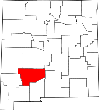 | |
| Villages | ||
| CDPs | ||
| Other communities | ||
| Ghost towns | ||