Els Guiamets
| Els Guiamets | ||
|---|---|---|
| Municipality | ||
 | ||
| ||
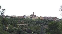
 Els Guiamets Location in Catalonia | ||
| Coordinates: 41°06′13″N 0°45′14″E / 41.10361°N 0.75389°ECoordinates: 41°06′13″N 0°45′14″E / 41.10361°N 0.75389°E | ||
| Country |
| |
| Community |
| |
| Province | Tarragona | |
| Comarca | Priorat | |
| Government | ||
| • Mayor | Miquel Perelló Segura (2015)[1] | |
| Area[2] | ||
| • Total | 12.1 km2 (4.7 sq mi) | |
| Elevation | 220 m (720 ft) | |
| Population (2014)[1] | ||
| • Total | 292 | |
| • Density | 24/km2 (63/sq mi) | |
| Demonym(s) | Guiametà, guiametana | |
| Website |
www | |

Els Guiamets is a municipality in the comarca of the Priorat in Catalonia, Spain. It is situated in the south of the comarca. A local road links the village to the N-420 road between Falset and Móra la Nova. The Guiamets reservoir is on an affluent of the Siurana (Tarragona), but is mostly on the territory of the municipality of Tivissa.
History
In medieval times the town was part of the Barony of Entença.
Notable people
- Neus Català, member of the Unified Socialist Party of Catalonia (PSUC) during Spanish Civil War. She is the only Spanish survivor of the concentration camp of Ravensbrück.
Demography
| 1900 | 1930 | 1950 | 1970 | 1986 | 2007 |
|---|---|---|---|---|---|
| 413 | 416 | 332 | 339 | 305 | 332 |
References
- 1 2 "Ajuntament dels Guiamets". Generalitat of Catalonia. Retrieved 2015-11-13.
- ↑ "El municipi en xifres: Els Guiamets". Statistical Institute of Catalonia. Retrieved 2015-11-23.
External links
- Els Guiamets website
- Government data pages (in Catalan)
Places adjacent to Els Guiamets | ||||||||||
|---|---|---|---|---|---|---|---|---|---|---|
| ||||||||||

This article is issued from
Wikipedia.
The text is licensed under Creative Commons - Attribution - Sharealike.
Additional terms may apply for the media files.