Elizabeth North, South Australia
| Elizabeth North Adelaide, South Australia | |||||||||||||||
|---|---|---|---|---|---|---|---|---|---|---|---|---|---|---|---|
 Elizabeth North | |||||||||||||||
| Coordinates | 34°42′03″S 138°40′33″E / 34.70079°S 138.67578°ECoordinates: 34°42′03″S 138°40′33″E / 34.70079°S 138.67578°E | ||||||||||||||
| Postcode(s) | 5113 | ||||||||||||||
| LGA(s) | City of Playford | ||||||||||||||
| State electorate(s) | Taylor | ||||||||||||||
| Federal Division(s) | Wakefield | ||||||||||||||
| |||||||||||||||
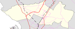
Elizabeth North is a northern suburb of Adelaide, South Australia in the City of Playford.[1] It is sandwiched between Main North Road to the east and the Gawler railway line to its west immediately north of Elizabeth and south of Smithfield. It is served by the Womma and Broadmeadows railway stations.
It was established in the late 1950s as a residential suburb of the planned City of Elizabeth. As for its neighbours including Elizabeth and Elizabeth South, it was configured as a local community around a small shopping centre containing a supermarket, bank, hotel and service station along with other shops.
References
- ↑ "ELIZABETH NORTH Street Map, SA". elizabeth-north-sa.street-map.net.au. Retrieved 2018-09-08.
This article is issued from
Wikipedia.
The text is licensed under Creative Commons - Attribution - Sharealike.
Additional terms may apply for the media files.