Eliot, Maine
| Eliot, Maine | |
|---|---|
| Town | |
 Welcome to Historic Eliot sign on ME Rt. 103 in South Eliot | |
 Eliot | |
| Coordinates: 43°8′8″N 70°47′37″W / 43.13556°N 70.79361°WCoordinates: 43°8′8″N 70°47′37″W / 43.13556°N 70.79361°W | |
| Country | United States |
| State | Maine |
| County | York |
| Incorporated | 1810 |
| Government | |
| • Type | Town Meeting |
| • Board of Selectmen |
Robert Pomerleau(2018) Rebecca Davis(2017) Stephen Beckert (2018) John Murphy(2016) Roland Fernald(2017) |
| Area[1] | |
| • Total | 21.32 sq mi (55.22 km2) |
| • Land | 19.78 sq mi (51.23 km2) |
| • Water | 1.54 sq mi (3.99 km2) |
| Elevation | 20 ft (6 m) |
| Population (2010)[2] | |
| • Total | 6,204 |
| • Estimate (2012[3]) | 6,243 |
| • Density | 313.7/sq mi (121.1/km2) |
| Time zone | UTC-5 (Eastern (EST)) |
| • Summer (DST) | UTC-4 (EDT) |
| ZIP code | 03903 |
| Area code(s) | 207 |
| FIPS code | 23-22955 |
| GNIS feature ID | 0582464 |
| Website |
www |
Eliot is a town in York County, Maine, United States. Originally settled in 1623, it was formerly a part of Kittery, Maine to its east. After Kittery it is the next most southern town in the state of Maine, lying on the Piscataqua River across from Portsmouth and Newington, New Hampshire. The population was 6,204 at the 2010 census. It is part of the Portland–South Portland–Biddeford, Maine metropolitan statistical area.
Eliot is home to Ambush Rock, Green Acre and the Raitt Homestead Farm Museum.
History
Founding
Today's town of Eliot was formerly the Middle Parish of the town Kittery, Maine,[4] originally part of the royal grant to Sir Ferdinando Gorges known as the Piscataqua Plantation. Kittery was incorporated in 1647, today distinguishing itself as "the oldest incorporated town in Maine."
While this may be so, settlements upriver on the north side of the Piscataqua River in today's Eliot were established considerably earlier, owing to more favorable conditions for harborage, timber, and shipbuilding. This is the basis for Eliot maintaining it was "settled" almost a quarter century earlier in 1623.
In 1659 the local court degreed that there should be two meeting houses in Kittery. The town's inhabitants disagreed, and held a town meeting on July 17, 1660, where it was:
...Agreed and fully consented unto that this town of Kittery is by free consent divided into three parts for settling of three ministers, one in the east part as followeth, one at Nichewancick [today's Berwick] which bound ae to come doown unto Thompson point brook formerly called the black Brook and from that Brook the second division is to go downward to the great cove below Thos. Spinney's Point and the third division to go down from the great cove unto Brave Boat Harbor with Capt. Champernown Island, all of which three divisions according as they are divided each division to bear their own charges for the maintenance of their own minister.[4]
The Upper Parish, then known as the Parish of Unity, later became the town of Berwick (incorporated in 1713),[5] with the uppermost part of Kittery along the Piscataqua becoming the Upper Parish. Left without a meeting house or minister, the residents of a newly created Middle Parish between the Upper and Lower along the river between it and Spinney's Cove [Great Cove] were permitted by order of the court to attend church across the Piscataqua in either the towns of Dover, New Hampshire or Portsmouth for one-half their going rates.[4]
Prior to Eliot's incorporation as a town on March 1, 1810, the Upper Parish had been in conflict with Kittery's other parishes since at least 1791. In 1791, the parish's minister died. His successor, according to a large faction of the parish's inhabitants, was a man of "unfair character" imposed by "a small party" of people. He was rejected by "a large majority", and a new minister was installed in 1792. The internal strife between inhabitants didn't stop there.
The minority faction, angered by the removal of their minister, petitioned the Legislature in 1796 to be set off to the Upper Parish, which was accordingly done. The inhabitants of the second Parish, which was left without a meetinghouse and left to worship across the river at half rate in the town of Portsmouth, New Hampshire, accused the members of the other two of conspiring against them.
The town was likely named for Reverend John Eliot of Boston, a friend of General Andrew P. Fernald, the town agent largely responsible for its separation.[6]
Scotland Bridge
A section of northern Eliot bordering on York came to be known as Scotland Bridge[7] after Scots prisoners of war from the English civil war Battle of Dunbar were resettled there in 1650. These Scots had been force-marched to Durham Cathedral in Durham, England, then tried for treason for supporting Charles II rather than Oliver Cromwell, Lord Protector.[8] The name remains today.
Geography
According to the United States Census Bureau, the town has a total area of 21.32 square miles (55.22 km2), of which, 19.78 square miles (51.23 km2) of it is land and 1.54 square miles (3.99 km2) is water.[1] Eliot is drained by Sturgeon Creek and the Piscataqua River.
Eliot is served by state routes 91, 101, 103 and 236. The town is northwest of Interstate 95 and near the New Hampshire border.
Demographics
| Historical population | |||
|---|---|---|---|
| Census | Pop. | %± | |
| 1810 | 1,650 | — | |
| 1820 | 1,679 | 1.8% | |
| 1830 | 1,845 | 9.9% | |
| 1840 | 1,889 | 2.4% | |
| 1850 | 1,803 | −4.6% | |
| 1860 | 1,767 | −2.0% | |
| 1870 | 1,769 | 0.1% | |
| 1880 | 1,640 | −7.3% | |
| 1890 | 1,463 | −10.8% | |
| 1900 | 1,458 | −0.3% | |
| 1910 | 1,530 | 4.9% | |
| 1920 | 1,530 | 0.0% | |
| 1930 | 1,462 | −4.4% | |
| 1940 | 1,932 | 32.1% | |
| 1950 | 2,509 | 29.9% | |
| 1960 | 3,133 | 24.9% | |
| 1970 | 3,497 | 11.6% | |
| 1980 | 4,948 | 41.5% | |
| 1990 | 5,329 | 7.7% | |
| 2000 | 5,954 | 11.7% | |
| 2010 | 6,204 | 4.2% | |
| Est. 2014 | 6,298 | [9] | 1.5% |
| U.S. Decennial Census[10] | |||
See also: South Eliot, Maine As of 2000 the median income for a household in the town was $52,606, and the median income for a family was $63,598. Males had a median income of $44,205 versus $30,530 for females. The per capita income for the town was $24,403. About 5.2% of families and 5.8% of the population were below the poverty line, including 7.1% of those under age 18 and 3.5% of those age 65 or over.
2010 census
As of the census[2] of 2010, there were 6,204 people, 2,509 households, and 1,783 families residing in the town. The population density was 313.7 inhabitants per square mile (121.1/km2). There were 2,669 housing units at an average density of 134.9 per square mile (52.1/km2). The racial makeup of the town was 96.8% White, 0.7% African American, 0.1% Native American, 0.5% Asian, 0.3% from other races, and 1.5% from two or more races. Hispanic or Latino of any race were 1.2% of the population.
There were 2,509 households of which 31.7% had children under the age of 18 living with them, 59.0% were married couples living together, 8.3% had a female householder with no husband present, 3.7% had a male householder with no wife present, and 28.9% were non-families. 23.4% of all households were made up of individuals and 10.1% had someone living alone who was 65 years of age or older. The average household size was 2.47 and the average family size was 2.89.
The median age in the town was 45.4 years. 22.1% of residents were under the age of 18; 5.9% were between the ages of 18 and 24; 21.3% were from 25 to 44; 36.1% were from 45 to 64; and 14.6% were 65 years of age or older. The gender makeup of the town was 48.8% male and 51.2% female.
Sites of interest
- Green Acre
- Raitt Homestead Farm Museum
- Ambush Rock
- Frost Garrison and House, Frost’s Hill
- Paul Family Farm, 106 Depot Road
- Fogg House
- Punkintown
Gallery
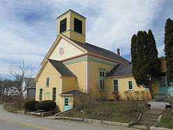
 William Fogg Library
 Sanctuary Arts studio
 Frost House
 Eliot Elementary School
 Eliot Town Hall
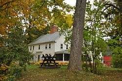 Paul Family Farm
.jpg) Sunset over the Piscataqua River on the Long Reach, Eliot on right, September 2014
Sunset over the Piscataqua River on the Long Reach, Eliot on right, September 2014
Politics
Voter Registration: 29.72% Republican. 27.27% Democrat. 2.01% Green Independent. 41.00% Un-enrolled.[11]
State Representative: Roberta Beavers (2016) (D) State Senator: Dawn Hill (2016) (D) US Representative: Chellie Pingree (2016) (D)
Eliot's form of government provided by its charter is Town Meeting, Select Board, and Town Manager.[12]
Education SAD35 (Eliot and South Berwick)
- Eliot Elementary School
- Central School
- Great Works School
- Marshwood Middle School
- Marshwood High School
- Seacoast Waldorf School (private)
Notable people
- Shem Drowne, coppersmith, America's first documented weathervane maker
- Moses Gerrish Farmer, inventor
- John Fremont Hill, state congressmen and US senator, 45th governor of Maine (1901–1905)
- Major Charles Frost
References
- 1 2 "US Gazetteer files 2010". United States Census Bureau. Retrieved 2012-12-16.
- 1 2 "American FactFinder". United States Census Bureau. Retrieved 2012-12-16.
- ↑ "Population Estimates". United States Census Bureau. Archived from the original on 2013-06-17. Retrieved 2013-07-06.
- 1 2 3 Old Kittery and Her Families", Everett Stackpole, 1903
- ↑ Coolidge, Austin J.; John B. Mansfield (1859). A History and Description of New England. Boston, Massachusetts. pp. 117–118.
- ↑ Varney, George J. (1886), Gazetteer of the state of Maine. Eliot, Boston: Russell
- ↑ Scottish Prisoners of 1650 - Old Berwick Historical Society
- ↑ Coolidge, Austin J.; John B. Mansfield (1859). A History and Description of New England, General and Local. Boston: Austin J. Coolidge. pp. 53–54.
- ↑ "Annual Estimates of the Resident Population for Incorporated Places: April 1, 2010 to July 1, 2014". Retrieved June 4, 2015.
- ↑ "Census of Population and Housing". Census.gov. Archived from the original on May 12, 2015. Retrieved June 4, 2015.
- ↑ http://www.eliotmaine.org/index.asp?Type=B_BASIC&SEC={F653F339-166D-4080-AE27-301C73E98A88}
- ↑ https://www.eliotmaine.org/sites/eliotme/files/uploads/charter_of_the_town_of_eliot_maine_-_certified_by_town_clerk.pdf
External links
- Town of Eliot official website
- William Fogg Library
- Littlebrook Air Park
- Eliot at Maine.gov
- City Data Profile
- Notables in Eliot History
- Maine Genealogy: Eliot, York County, Maine
Places adjacent to Eliot, Maine | |
|---|---|
Municipalities and communities of York County, Maine, United States | ||
|---|---|---|
| Cities | 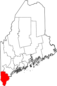 | |
| Towns | ||
| CDPs | ||
| Other villages | ||