Elek
| Elek | ||
|---|---|---|
| Town | ||
| ||
 Elek | ||
| Coordinates: 46°31′41″N 21°14′49″E / 46.528°N 21.247°E | ||
| Country |
| |
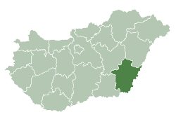
| County | Békés | |
| District | Gyula | |
| Area | ||
| • Total | 54.94 km2 (21.21 sq mi) | |
| Population (2012) | ||
| • Total | 4,816 | |
| • Density | 101/km2 (260/sq mi) | |
| Time zone | UTC+1 (CET) | |
| • Summer (DST) | UTC+2 (CEST) | |
| Postal code | 5742 | |
| Area code | (+36) 66 | |
| Website |
www | |

Elek (Romanian: Aletea) is a town in Békés county, in the Southern Great Plain region of south-east Hungary.[1]
Geography
It covers an area of 54.94 km² and had a population of 5,567 in 2002.
History
- 1232 : First mentioned
- 1566-1696 : Ottoman rule (Ottoman wars in Europe)
- 1724 : settling of German colonists (predominantly from Franconia)
- 1739 : Plague
- 1894 : Artesian aquifer
- 1920 : Elek becomes border town Treaty of Trianon
- 1946 : Expulsion of German settlers
|
Twin towns
Elek is twinned with:
- Alerheim, Germany (1992)
- Gerolzhofen, Germany (1990)
- Grăniceri, Romania (1997)
- Laudenbach, Germany (1994)
- Leimen, Germany (1992)
- Sebiş, Romania (1992)
- Veľké Kapušany, Slovakia (1996)
References
- ↑ "City (town) Elek: map, population, location". www.tiptopglobe.com. Retrieved 8 May 2017.
External links
| Wikimedia Commons has media related to Elek. |
- Official website in Hungarian
| Towns (2) | ||
|---|---|---|
| Large village (1) | ||
| Village (1) | ||
| City with county rights |
|   |
|---|---|---|
| Towns | ||
| Large villages | ||
| Villages |
| |
| Other topics |
| |
This article is issued from
Wikipedia.
The text is licensed under Creative Commons - Attribution - Sharealike.
Additional terms may apply for the media files.