El Rito, Rio Arriba County, New Mexico
El Rito, (Spanish for Little River),[1] is an unincorporated community in Rio Arriba County, New Mexico, USA.[2] Its elevation is 6,875 feet (2,096 m).
El Rito is located on NM 554; 18 miles (29 km) Northwest of Española and 15 miles (24 km) Northwest of Ojo Caliente.
El Rito was one of the first Spanish settlements in northern New Mexico. The oldest church in New Mexico is here. It was restored in the 1980s.
It is the home of the Carson National Forest Service – El Rito Ranger District, the El Rito Public Library, the Las Clinicas del Norte, and a campus of Northern New Mexico College.
Originally named El Rito Colorado, the red creek, it took its name from the creek that passes through the village. Tewas call the El Rito region "pink below place" for the El Rito Mountains, known to them as the pink mountains.[3]
El Rito is surrounded by the Carson National Forest.
Sources
- ↑ Pearce, TM, ed. (1965). New Mexico Place Names: A Geographical Dictionary. University of New Mexico Press, Albuquerque. ISBN 0826300820.
- ↑ "El Rito, Rio Arriba County, New Mexico". Geographic Names Information System. United States Geological Survey.
- ↑ Julyan, Robert (1998). The Place Names of New Mexico. University of New Mexico Press, Albuquerque. p. 120. ISBN 0826316891.
Municipalities and communities of Rio Arriba County, New Mexico, United States | ||
|---|---|---|
| City | 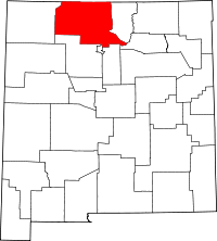 | |
| Village | ||
| CDPs |
| |
| Other unincorporated communities | ||
| Ghost towns and former settlements | ||
| Indian reservations | ||
| Footnotes | ‡This populated place also has portions in an adjacent county or counties | |
Coordinates: 36°20′44″N 106°11′14″W / 36.34542°N 106.1873299°W