Chamita, New Mexico
| Chamita, New Mexico | |
|---|---|
| Census-designated place | |
 Chamita | |
| Coordinates: 36°04′13″N 106°05′49″W / 36.07028°N 106.09694°WCoordinates: 36°04′13″N 106°05′49″W / 36.07028°N 106.09694°W | |
| Country | United States |
| State | New Mexico |
| County | Rio Arriba |
| Area[1] | |
| • Total | 3.902 sq mi (10.11 km2) |
| • Land | 3.851 sq mi (9.97 km2) |
| • Water | 0.051 sq mi (0.13 km2) |
| Elevation | 5,725 ft (1,745 m) |
| Population (2010)[1] | |
| • Total | 870 |
| • Density | 220/sq mi (86/km2) |
| Time zone | UTC-7 (Mountain (MST)) |
| • Summer (DST) | UTC-6 (MDT) |
| Area code(s) | 505 |
| GNIS feature ID | 899579[2] |
Chamita is an unincorporated community and census-designated place in Rio Arriba County, New Mexico, United States. Its population was 870 as of the 2010 census.[1] New Mexico State Road 74 passes through the community. During its earlier years, the community was known as San Pedro De Chamita and served as the first County Seat for Rio Arriba county.
Geography
Chamita is located at 36°04′13″N 106°05′49″W / 36.0703003°N 106.0969681°W.[2] According to the U.S. Census Bureau, the community has an area of 3.902 square miles (10.11 km2); 3.851 square miles (9.97 km2) of its area is land, and 0.051 square miles (0.13 km2) is water.[1] Both the Rio Grande and the Rio Chama flow through the community. The two rivers converge south of the area.
References
- 1 2 3 4 "2010 Census Gazetteer Files - Places: New Mexico". U.S. Census Bureau. Retrieved December 31, 2016.
- 1 2 "Chamita". Geographic Names Information System. United States Geological Survey.
Municipalities and communities of Rio Arriba County, New Mexico, United States | ||
|---|---|---|
| City | 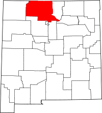 | |
| Village | ||
| CDPs |
| |
| Other unincorporated communities | ||
| Ghost towns and former settlements | ||
| Indian reservations | ||
| Footnotes | ‡This populated place also has portions in an adjacent county or counties | |
This article is issued from
Wikipedia.
The text is licensed under Creative Commons - Attribution - Sharealike.
Additional terms may apply for the media files.