El Platanar Airport
| El Platanar Airport | |||||||||||
|---|---|---|---|---|---|---|---|---|---|---|---|
| Summary | |||||||||||
| Airport type | Public | ||||||||||
| Serves | El Platanar, El Salvador | ||||||||||
| Elevation AMSL | 819 ft / 250 m | ||||||||||
| Coordinates | 13°35′13″N 88°17′50″W / 13.58694°N 88.29722°WCoordinates: 13°35′13″N 88°17′50″W / 13.58694°N 88.29722°W | ||||||||||
| Map | |||||||||||
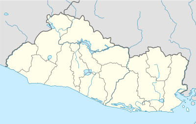 MSPT Location of the airport in El Salvador | |||||||||||
| Runways | |||||||||||
| |||||||||||
|
Source: Google Maps[1] | |||||||||||
El Platanar Airport (ICAO: MSPT) is an airport serving the town of El Platanar in San Miguel Department, El Salvador. The runway is 1 kilometre (0.6 mi) northwest of the city.
El Platanar town is 16 kilometres (10 mi) northwest of San Miguel, the department capital.
See also

- Transport in El Salvador
- List of airports in El Salvador
References
External links
This article is issued from
Wikipedia.
The text is licensed under Creative Commons - Attribution - Sharealike.
Additional terms may apply for the media files.