El Cenizo, Texas
| El Cenizo | |
|---|---|
| City | |
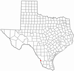 Location of El Cenizo, Texas | |
 | |
| Coordinates: 27°19′42″N 99°29′48″W / 27.32833°N 99.49667°WCoordinates: 27°19′42″N 99°29′48″W / 27.32833°N 99.49667°W | |
| Country | United States |
| State | Texas |
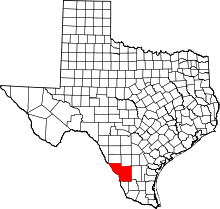
| County | Webb |
| Government | |
| • Type | Mayor/city manager |
| • Mayor | Miriam Angelica Rodríguez Ávalos |
| Area | |
| • City | 0.5 sq mi (1.3 km2) |
| • Land | 0.5 sq mi (1.2 km2) |
| • Water | 0.0 sq mi (.1 km2) 1.4% |
| • Metro | 161.76 sq mi (418.96 km2) |
| Elevation | 450 ft (137.2 m) |
| Population (2010) | |
| • City | 3,273 |
| • Density | 6,500/sq mi (2,500/km2) |
| • Metro | 636,516 |
| • Metro density | 3,900/sq mi (1,500/km2) |
| metro area includes Laredo, Texas, Nuevo Laredo, Tamaulipas, Rio Bravo, Texas, El Cenizo, Texas, Laredo Ranchettes, Texas. Larga Vista, Texas, Ranchos Penitas West, Texas, & La Presa, Texas | |
| Time zone | UTC-6 (CST) |
| • Summer (DST) | UTC-5 (CST) |
| Zip Code | 78043 |
| Area code(s) | +1-956 |
| FIPS code | 48-22905[1] |
| GNIS feature ID | 1377764[2] |
| Website | http://www.cityofelcenizo.com/ |
|
Nearby airports: Laredo: Laredo International Airport KLRD LRD Nuevo Laredo: Quetzalcoatl International Airport MMNL NLD | |
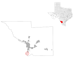
El Cenizo is a city in Webb County, Texas, United States. The population was 3,273 at the 2010 census.[3] El Cenizo is the third-largest city in Webb County. It is located about 20 miles south of the county seat of Laredo.
History
For many years, El Cenizo existed only informally as an impoverished colonia. The city was incorporated in 1989.[4]
In 1999[5] and again in May 2006,[6] El Cenizo gained national attention when it was widely reported that the city had Spanish as its official language. In an interview on a national cable news network held on May 23, 2006, its mayor defended the decision, but said that official business was now conducted in both English and Spanish. He also said that while he supported English as the common and unifying language of the United States, he believed that any attempt to make English that "official" national language would have a discriminatory effect against bilingual programs.
On May 12, 2017, following the passage of SB4, a bill in the Texas Legislature intended to crack down on sanctuary cities, El Cenizo filed a lawsuit claiming that the bill illegally commandeers local officials to enforce federal immigration law.[4] On June 7, 2017, El Cenizo's lawsuit was consolidated with lawsuits filed by much larger cities including San Antonio, Austin, and Dallas, with El Cenizo as the lead plaintiff.[7]
Geography
El Cenizo is located at 27°19′42″N 99°29′48″W / 27.32833°N 99.49667°W (27.328442, -99.496658).[8]
According to the United States Census Bureau, the city has a total area of 0.5 square mile (1.4 km²), of which 0.5 square mile (1.3 km²) is land and 1.89% is covered by water.
Demographics
| Historical population | |||
|---|---|---|---|
| Census | Pop. | %± | |
| 1990 | 1,399 | — | |
| 2000 | 3,545 | 153.4% | |
| 2010 | 3,273 | −7.7% | |
| Est. 2016 | 3,206 | [9] | −2.0% |
| U.S. Decennial Census[10] | |||
As of the census[1] of 2000, 3,545 people, 730 households, and 680 families resided in the city. The population density was 6,919.6 people per square mile (2,683.8/km²). The 811 housing units averaged 1,583.0/sq mi (614.0/km²). The racial makeup of the city was 80.73% White, 0.28% African American, 1.07% Native American, 0.06% Asian, 14.67% from other races, and 3.19% from two or more races. Hispanics or Latinos of any race were 98.90% of the population.
Of the 730 households, 72.6% had children under the age of 18 living with them, 67.8% were married couples living together, 19.0% had a female householder with no husband present, and 6.8% were not families; 6.0% of all households were made up of individuals and 3.3% had someone living alone who was 65 years of age or older. The average household size was 4.86 and the average family size was 5.04.
In the city, the population was distributed as 48.9% under the age of 18, 11.2% from 18 to 24, 25.2% from 25 to 44, 10.9% from 45 to 64, and 3.8% who were 65 years of age or older. The median age was 18 years. For every 100 females, there were 102.2 males. For every 100 females age 18 and over, there were 96.4 males.
The median income for a household in the city was $13,333, and for a family was $13,438. Males had a median income of $14,200 versus $10,625 for females. The per capita income for the city was $3,610. About 66.3% of families and 68.1% of the population were below the poverty line, including 74.3% of those under age 18 and 60.0% of those age 65 or over.
Education
El Cenizo is served by the United Independent School District.
El Cenizo is zoned to Kennedy-Zapata Elementary School (unincorporated Webb County), Salvador Garcia Middle School (Rio Bravo), and Lyndon B. Johnson High School (Laredo).
Government
El Cenizo is a Type C General Law city. It has a city commission form of government, which includes a mayor and two city commissioners elected at large. The city is currently home to the state's youngest mayor. Raul Reyes was elected in 2004 at the age of 21. As of 2017, Reyes, at the age of 33, is serving his seventh term.[4]
References
- 1 2 "American FactFinder". United States Census Bureau. Archived from the original on 2013-09-11. Retrieved 2008-01-31.
- ↑ "US Board on Geographic Names". United States Geological Survey. 2007-10-25. Retrieved 2008-01-31.
- ↑ Census 2010: El Cenizo, Texas Archived March 5, 2014, at the Wayback Machine.
- 1 2 3 Burnett, John (2017-05-12). "Tiny And Defiant, Texas Town Launches Headfirst Into 'Show Me Your Papers' Debate". NPR. Retrieved 2017-06-21.
- ↑ "Texas town makes Spanish official". Reuters. 1999-08-14. Retrieved 2016-06-21.
- ↑ "Consensus in Spanish-only Texas town says English-only national anthem". Associated Press. 2006-05-19. Retrieved 2017-06-21.
- ↑ Limón, Elvia; Wilonsky, Robert (2017-06-08). "Dallas Joins Lawsuit Over Sanctuary Cities Bill". Governing. Retrieved 2017-06-21.
- ↑ "US Gazetteer files: 2010, 2000, and 1990". United States Census Bureau. 2011-02-12. Retrieved 2011-04-23.
- ↑ "Population and Housing Unit Estimates". Retrieved June 9, 2017.
- ↑ "Census of Population and Housing". Census.gov. Archived from the original on May 12, 2015. Retrieved June 4, 2015.