Los Altos, Texas
| Los Altos, Texas | |
|---|---|
| CDP | |
| Coordinates: 27°29′26″N 99°23′9″W / 27.49056°N 99.38583°W | |
| Country | United States |
| State | Texas |
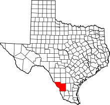
| County | Webb |
| Population (2010) | |
| • Total | 140 |
| Time zone | UTC-6 (Central (CST)) |
| • Summer (DST) | UTC-5 (CDT) |
| Zip Code | 78043 |
Los Altos is a census-designated place (CDP) in Webb County, Texas, United States. This was a new CDP formed from parts of the Laredo Ranchettes CDP prior to the 2010 census with a population of 140.[1]
Geography
Los Altos is located at 27°29′26″N 99°23′9″W / 27.49056°N 99.38583°W (27.490491, -99.385823).[2]
References
- ↑ "Population and Housing Unit Counts, 2010 Census of Population and Housing" (PDF). Texas: 2010. Retrieved 2017-01-03.
- ↑ "Boundary Map of Los Altos, Texas". MapTechnica. Retrieved 2017-01-03.
This article is issued from
Wikipedia.
The text is licensed under Creative Commons - Attribution - Sharealike.
Additional terms may apply for the media files.