El Ain, Beqaa, Lebanon
| El Ain العين | |
|---|---|
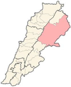
 El Ain Location in Lebanon | |
| Coordinates: 34°13′41″N 36°22′19″E / 34.228°N 36.372°E | |
| Country |
|
| Governorate | Baalbek-Hermel |
| District | Baalbek |
| Elevation | 3,000 ft (1,000 m) |
| Population | |
| • Total | 30,000 |
| Time zone | UTC+2 (EET) |
| • Summer (DST) | +3 |
El Ain (Arabic: العين), Al Ain, or Ain is a village at an elevation of 1,000 metres (3,300 ft) on a foothill of the Anti-Lebanon mountains in Baalbek District of Baalbek-Hermel Governorate, Lebanon. Special place for comfort and eco-tourism and is famous with its agriculture and trade where it's located on the highway that connects Syrian borders and Hermel area with Chtaura and Beirut.
Called Ain referring to the old water source in it.
Geography and Agriculture
The altitude of this village ranges from 900 to 1300 meters above sea level. The village is 125 km away from Beirut situated between the towns of Labwe and Fakiha. Its economy is restricted to agriculture (figs, olives, apples, pomegranate, apricots, peach and grapes). Many source of water are distributed all around the village.
Weather Conditions
Winters in ElAin are cold and dry, with temperatures seldom reaching freezing point (-7° to -10°). On average, it snows three to five times per season. Summers are very hot and dry, with temperatures seldom reaching 40 °C. The average annual rainfall is 230 mm (9 in).
Sources
External links
- Ain, Localiban
Capital: Baalbek | ||
| Towns and villages |
|  |
| Other | ||