Ainata
| Ainata عيناتا | |
|---|---|
| Village | |
 Ainata Location within Lebanon | |
| Coordinates: 34°11′13″N 36°04′52″E / 34.187°N 36.081°ECoordinates: 34°11′13″N 36°04′52″E / 34.187°N 36.081°E | |
| Country |
|
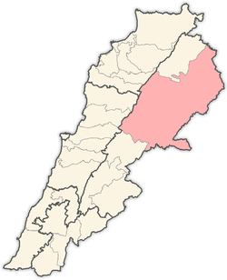
| Governorate | Baalbek-Hermel |
| District | Baalbek |
| Elevation | 1,620 m (5,310 ft) |
| Highest elevation | 1,640 m (5,380 ft) |
| Lowest elevation | 1,600 m (5,200 ft) |
| Population | |
| • Total | 3,000+ |
| Time zone | UTC+2 (EET) |
| • Summer (DST) | UTC+3 (EEST) |
| Dialing code | +961 |
Ainata, or sometimes known as Ainata-Al Ariz (Arabic:عيناتا الأرز) is a Lebanese village, 108 km from Beirut, located in Northern Lebanon, between the Bsharri District and the Baalbek District. Officially, Ainata is considered a village of the Baalbek District, but its inhabitants consider and prefer the village to be of the Bsharri District, mostly because its name "Ainata-Al Ariz" means "Ainata-The Cedars", in reference to the Cedars of God near Bsharri since most of the descendents are originally from Bsharri. Ainata rises 1620 meters above sea level and is sometimes considered as the highest Lebanese populated village (Although some books state that Bekaa Kafra is the highest).
Etymology
The origin of the word Ainata is Syriac and means "The eyes of water". The most notable mamily in Ainata is Rahme, where basically 99% of the inhabitants carry the same surname, having some exceptions that came and settled in the village decades ago such as : Taok and Lahoud. It is also known for its strong rough accent
Religion
Christianity is the only religion in Ainata. The village's church is named after the Saints Sarkis and Bakhos. Apart from having the biggest church in the Baalbek District, Ainata also has several capella around the village. People there practice their religion rather seriously, where you could see hundreds of people travelling to Ainata to take part in the Christmas and Easter Celebrations.
Lands
Due to harsh winters, ninety percent of the population descend to the coast during that time. People from Ainata maintain a great deal pride of their roots, as lands and family homes are descended from generations to generations. Some Lands have been divided in a way that is known as 3EREF in Lebanon , where no official papers were signed or made but rather just a gentlemen's agreement. These agreements are probably hundreds of years old, and are passed by to the younger generations and are always respected and held. The lands are mostly kept in the Rahme family where usually the women waiving their right of inheritance to the men, if possible, in order to keep the lands in the family as women might marry someone with another surname. Ainata is well known to produce one of the best qualities in the region when it comes to apples and grapes. During the civil war, Ainata was also known to grow weed but has since shifted to apples, grapes, cherries and many other means.
Location
Ainata is located at the bottom of Mount Makmel, to the Eastern side, facing the Baalbek District, and it is almost exactly between the Bsharri district and the Baalbek District, but officially it belongs to the Baalbek District. Ainata has an altitude of ca. 1620 meters and is considered as the highest Lebanese village although some references consider Bekaa Kafra the highest. The nearest village would be Deir el Ahmar where both residents have a special bond due to having mostly the same political views and being Christians surrounded by mostly muslim villages
Climate
Ainata has a cold climate in winter, with temperatures averaging around 0°C in January and February but some winters have seen temperatures drop to as low as -15°C. Snow can reach up to 3 meters high. In summer temperatures average around 22°C but can reach 35°C, however, temperature may drop after sunset to as low as 10°C during the summer.
References
- Aaynata, Localiban
Capital: Baalbek | ||
| Towns and villages |
|  |
| Other | ||