Eilean Mhic Chrion
| Meaning of name | MacNiven's island |
|---|---|
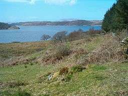 Eilean Mhic Chrion from near Ormaig | |
| Location | |
 Eilean Mhic Chrion Eilean Mhic Chrion shown within Scotland | |
| OS grid reference | NM803034 |
| Coordinates | 56°10′23″N 5°32′24″W / 56.173°N 5.540°W |
| Physical geography | |
| Island group | Loch Craignish |
| Area | 40 hectares (99 acres)[1] |
| Area rank | 220= [2] |
| Highest elevation | 63 m |
| Administration | |
| Sovereign state | United Kingdom |
| Country | Scotland |
| Council area | Argyll and Bute |
| Demographics | |
| Population | 0 |
| References | [3][4] |
Eilean Mhic Chrion is a tidal island sheltering Ardfern in Loch Craignish, Scotland.
Eilean Mhic Chrion is one of 43 tidal islands that can be walked to from the mainland of Great Britain and one of 17 that can be walked to from the Scottish mainland.[5]
Footnotes
- ↑ "Rick Livingstone’s Tables of the Islands of Scotland" (pdf) Argyll Yacht Charters. Retrieved 23 September 2013.
- ↑ Area and population ranks: there are c. 300 islands over 20 ha in extent and 93 permanently inhabited islands were listed in the 2011 census.
- ↑ Haswell-Smith, Hamish (2004). The Scottish Islands. Edinburgh: Canongate. ISBN 978-1-84195-454-7.
- ↑ Ordnance Survey. OS Maps Online (Map). 1:25,000. Leisure.
- ↑ Peter Caton (2011) No Boat Required - Exploring Tidal Islands. Matador.
| Wikimedia Commons has media related to Eilean Mhic Chrion. |
Coordinates: 56°10′22″N 5°32′24″W / 56.17278°N 5.54000°W
This article is issued from
Wikipedia.
The text is licensed under Creative Commons - Attribution - Sharealike.
Additional terms may apply for the media files.