Eden, New York
| Eden, New York | |
|---|---|
| Town | |
| Nickname(s): Garden Spot of New York State | |
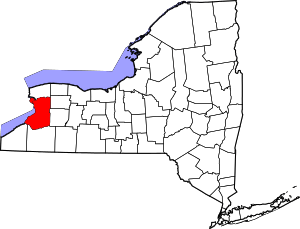
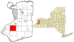 Location in Erie County and the state of New York. | |
.svg.png) Location of New York in the United States | |
| Coordinates: 42°39′09″N 78°53′41″W / 42.65250°N 78.89472°WCoordinates: 42°39′09″N 78°53′41″W / 42.65250°N 78.89472°W | |
| Country | United States |
| State | New York |
| County | Erie County |
| Incorporated | 1812 |
| Government | |
| • Mayor |
Melissa Hartman (D) |
| Area[1] | |
| • Total | 39.86 sq mi (103.23 km2) |
| • Land | 39.79 sq mi (103.05 km2) |
| • Water | 0.07 sq mi (0.18 km2) |
| Elevation | 984 ft (300 m) |
| Population (2010) | |
| • Total | 7,688 |
| • Estimate (2017)[2] | 7,670 |
| • Density | 192.29/sq mi (74.25/km2) |
| Time zone | UTC-5 (EST) |
| • Summer (DST) | UTC-4 (EDT) |
| ZIP code | 14057 |
| Area code(s) | 716 |
| FIPS code | 36-029-23415 |
| Website |
www |
Eden is a town located south of Buffalo, in Erie County, New York, United States. The population was 7,688 at the 2010 census.[3] The basis for choosing the town's name is unknown.
Eden is one of the interior "Southtowns" of Erie County, lying in the south-central part of the county and south of Buffalo.
History
The first settler, Samual Tubbs, arrived around the 1800s. The town of Eden was established in 1812 by partition of the (now defunct) town of Willink. Later, Eden gave up territory to form the towns of Evans and Hamburg. The town was called "Hill's Corners" until 1822.
Geography
According to the U.S. Census Bureau, the town of Eden has a total area of 39.86 square miles (103.24 km2), of which 39.79 square miles (103.06 km2) is land and 0.07 square miles (0.18 km2), or 0.17%, is water.[3]
Adjacent cities and towns
- Evans: west
- Hamburg: north
- Boston: east
- North Collins: south
- Brant: southwest
Major highways


Demographics
| Historical population | |||
|---|---|---|---|
| Census | Pop. | %± | |
| 1820 | 1,065 | — | |
| 1830 | 1,066 | 0.1% | |
| 1840 | 2,174 | 103.9% | |
| 1850 | 2,494 | 14.7% | |
| 1860 | 2,439 | −2.2% | |
| 1870 | 2,270 | −6.9% | |
| 1880 | 2,363 | 4.1% | |
| 1890 | 2,288 | −3.2% | |
| 1900 | 2,368 | 3.5% | |
| 1910 | 2,526 | 6.7% | |
| 1920 | 2,352 | −6.9% | |
| 1930 | 2,773 | 17.9% | |
| 1940 | 3,295 | 18.8% | |
| 1950 | 4,201 | 27.5% | |
| 1960 | 6,630 | 57.8% | |
| 1970 | 7,644 | 15.3% | |
| 1980 | 7,327 | −4.1% | |
| 1990 | 7,416 | 1.2% | |
| 2000 | 8,076 | 8.9% | |
| 2010 | 7,688 | −4.8% | |
| Est. 2017 | 7,670 | [2] | −0.2% |
| U.S. Decennial Census[4] | |||
As of the census of 2000, there were 8,076 people, 2,855 households, and 2,235 families residing in the town. The population density was 202.8 inhabitants per square mile (78.3/km²). There were 2,995 housing units at an average density of 29.0 persons/km² (75.2 persons/sq mi). The racial makeup of the town was 98.33% White, .41% African American, 0.25% Native American, 0.20% Asian, 0.01% Pacific Islander, 0.31% from other races, and 0.50% from two or more races. Of the population 1.03% were Hispanic or Latino of any race.
There were 2,855 households out of which 37.2% had children under the age of 18 living with them, 67.3% were married couples living together, 7.9% have a woman whose husband does not live with her, and 21.7% were non-families. Of all households 18.6% were made up of individuals and 8.4% had someone living alone who was 65 years of age or older. The average household size was 2.76 and the average family size was 3.17.
In the town, the population was spread out with 26.9% under the age of 18, 6.1% from 18 to 24, 28.3% from 25 to 44, 24.6% from 45 to 64, and 14.2% who were 65 years of age or older. The median age was 39 years. For every 100 females, there were 98.8 males. For every 100 females age 18 and over, there were 95.6 males.
The median income for a household in the town was $54,940, and the median income for a family was $60,640. Males had a median income of $41,405 versus $28,582 for females. The per capita income for the town was $23,060. 2.4% of the population and 1.2% of families were below the poverty line. Out of the total people living in poverty, 1.1% are under the age of 18 and 4.5% are 65 or older.
Communities and locations in Eden
- Clarksburg: A community on NY-75 in the southeast corner of the town.
- Eden: The hamlet of Eden (formerly, "Hills Corners" and "Eden Center"), located on US-62 in the western half of the town. .
- East Eden: A location near the eastern town line.
- Eden Valley: A hamlet, formerly called "Tubbs Hollow," located on US-62 near the northern town line.
- Eighteen Mile Creek: A stream with forks near Eden Valley.
Abandoned Trains Of Eden
Located in Eden there are several abandoned trains, including an Alco RS3, which has been abandoned along with several train cars behind it. This train was carrying an anonymous load from Southern Pennsylvania to Eden when it de-railed. Witnesses said a car drove in front of it. After it was derailed, the location was heavily guarded for several months while mysterious people and unidentified construction crew "Fixed" the situation. When all was said and done, the train was left with all of its cargo gone. No one knows the truth behind the train.
Additional facts
The Eden Corn Festival is a small annual festival held in Eden. Festivities usually include a craft show, an auto show, a small assortment of rides, a small parade, and lots of great local foods (most of which include some form of corn). There are also baseball and softball tournaments and a tractor pull.
During summer months, usually around the Eden Corn Festival, a summer concert series is held in front of the Eden Elementary School. Here, local musicians play music for the townsfolk.
A factory in Eden, the Original American Kazoo Company, was established in 1916 and currently remains the only metal kazoo factory in North America. Located along Route 62, the factory contains a gift shop, as well as a museum that shows its history, and step by step kazoo assembly.[5]
Notable people
- Thomas L. Bunting, former US congressman
- Lewis P. Dayton, former mayor of Buffalo, New York
- Charles S. Desmond, former Chief Judge of the New York Court of Appeals
- Alex Iafallo, Los Angeles Kings forward
- Bert Weidner, retired NFL player
- William Wurtenburg, former college football coach, born in Clarksburg
References
- ↑ "2016 U.S. Gazetteer Files". United States Census Bureau. Retrieved Jul 4, 2017.
- 1 2 "Population and Housing Unit Estimates". Retrieved June 9, 2017.
- 1 2 "Geographic Identifiers: 2010 Demographic Profile Data (G001): Eden town, Erie County, New York". U.S. Census Bureau, American Factfinder. Retrieved February 29, 2016.
- ↑ "Census of Population and Housing". Census.gov. Archived from the original on May 12, 2015. Retrieved June 4, 2015.
- ↑ http://www.edenkazoo.com/history.php