Ebenthal, Lower Austria
| Ebenthal | ||
|---|---|---|
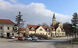 Main square with parish church | ||
| ||
 Ebenthal Location within Austria | ||
| Coordinates: 48°26′N 16°47′E / 48.433°N 16.783°ECoordinates: 48°26′N 16°47′E / 48.433°N 16.783°E | ||
| Country | Austria | |
| State | Lower Austria | |
| District | Gänserndorf | |
| Government | ||
| • Mayor | Raimund Kolm | |
| Area | ||
| • Total | 18.14 km2 (7.00 sq mi) | |
| Elevation | 176 m (577 ft) | |
| Population (1 January 2016)[1] | ||
| • Total | 865 | |
| • Density | 48/km2 (120/sq mi) | |
| Time zone | UTC+1 (CET) | |
| • Summer (DST) | UTC+2 (CEST) | |
| Postal code | 2251 | |
| Area code | 02538 | |
| Website | www.ebenthal.at | |

Ebenthal is a town in the district of Gänserndorf in the Austrian state of Lower Austria.
Geography
Ebenthal lies near Vienna in Lower Austria. About 40.22 percent of the municipality is forested.
References
This article is issued from
Wikipedia.
The text is licensed under Creative Commons - Attribution - Sharealike.
Additional terms may apply for the media files.