Auersthal
| Auersthal | ||
|---|---|---|
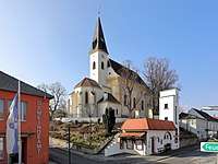 Center of Auersthal | ||
| ||
 Auersthal Location within Austria | ||
| Coordinates: 48°22′27″N 16°38′10″E / 48.37417°N 16.63611°ECoordinates: 48°22′27″N 16°38′10″E / 48.37417°N 16.63611°E | ||
| Country | Austria | |
| State | Lower Austria | |
| District | Gänserndorf | |
| Government | ||
| • Mayor | Erich Hofer | |
| Area | ||
| • Total | 15.18 km2 (5.86 sq mi) | |
| Elevation | 178 m (584 ft) | |
| Population (1 January 2016)[1] | ||
| • Total | 1,924 | |
| • Density | 130/km2 (330/sq mi) | |
| Time zone | UTC+1 (CET) | |
| • Summer (DST) | UTC+2 (CEST) | |
| Postal code | 2214 | |
| Area code | 02288 | |
| Website | www.auersthal.at | |

Auersthal is a town in the district of Gänserndorf in Lower Austria in Austria.
Geography
Auersthal lies about 10 km east of Wolkersdorf. About 2.47 percent of the municipality is forested.
References
This article is issued from
Wikipedia.
The text is licensed under Creative Commons - Attribution - Sharealike.
Additional terms may apply for the media files.