Eastfield, South Lanarkshire

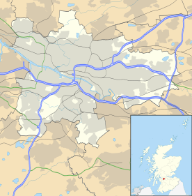
Eastfield is a mainly residential district sandwiched between the South Lanarkshire industrial towns of Rutherglen and Cambuslang in the south-east of the Greater Glasgow urban area. It is situated south of the River Clyde and to the east of the Stonelaw and Burnside districts.
History
Formerly a country estate with a burn running through it,[1] Eastfield was developed with housing between the 1930s and 1960s. A mix of council and private homes, the wider area is also home to two large modern high schools (Stonelaw and Trinity) and the associated public sports facilities of the latter, including 5-a-side football fields and modern swimming pool known as South Lanarkshire Lifestyle Eastfield.[2]
During the 20th century, a prominent feature in the district was Richmond Park Laundry, at one time one of the largest such operations in the country.[3] The facility opened around 1907, closed in 2004, and the premises were demolished in 2007 and replaced by a supermarket. The location's name was also familiar to Glasgow bus users as the terminus for the First Glasgow No 12 service (there is also another Richmond Park a few miles to the west; this is an urban park bordering the Glasgow neighbourhood of Oatlands).[4]
Parcels of land in Eastfield were found to have been contaminated by chromium waste from the Whites Chemical Works, the most conspicuous of which was a large play area made from a filled-in quarry at the end of Dukes Road; this stood empty and fenced-off for a number of years before the waste was eradicated, and now modern apartments and a new landscaped park (Quarryfield) occupies the site.[5]
Part of the territory which is generally considered to be part of Eastfield, including the local community centre, is within the postcode zone of Cambuslang (G72) while the remainder is within Rutherglen (G73). The entire district is currently administered as part of the Cambuslang West ward of the South Lanarkshire Council area, which is also the extent of the neighbourhood community policing zone, however it also encompasses several other streets which have always been considered to be in Rutherglen, such as Ettrick Crescent.[6][7]
The area is likely to be boosted economically in the 21st century by the expansion of the nearby M74 motorway which brings nationwide businesses to Eastfield's doorstep. Nearby to the north is one of Scotland's last steelworks at Clydebridge, previously a major employer in the area but operating in a greatly reduced capacity than in its heyday.
Pearse Park
Pearse Park was the playing field that was the adopted home of Gaelic games in Scotland, situated on Cambuslang Road in Eastfield.
It was purchased by Scotland GAA in 1953 and is named after the Irish revolutionary Patrick Pearse. It was also home to Tír Conaill Harps. As of 2016 the park had been lying unused and overgrown for several years.
Gallery
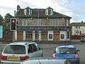 Langfield Inn (public house, demolished 2006)
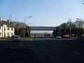 Bogleshole Road
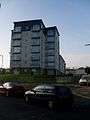 modern flats on Dukes Road
 Whinfield Avenue
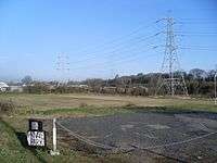 Pearse Park, GAA field, in 2009
.jpg) The ground lying neglected in 2013
The ground lying neglected in 2013
References
- ↑ "Eastfield House". The Glasgow Story.
- ↑ "SLC – Eastfield Lifestyle". South Lanarkshire Leisure & Culture. Retrieved 11 February 2018.
- ↑ "Richmond Park Laundry". Canmore.
- ↑ "Richmond Park". Clyde Waterfront. Retrieved 7 February 2018.
- ↑ "King's Gait, Dukes Road". CRGP Architects.
- ↑ "Ward map 13 - Cambuslang West" (PDF). South Lanarkshire Council. 4 May 2017. Retrieved 23 July 2018.
- ↑ "Cambuslang West". Police Service of Scotland. Retrieved 7 February 2018.
External links
| Wikimedia Commons has media related to Eastfield, South Lanarkshire. |
- Eastfield at Gazetteer for Scotland
- Pearse Park Redevelopment website
- History of Cambuslang Industries (C. Findlay) - Richmond Park Laundry