Retford
| Retford | |
|---|---|
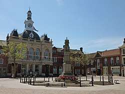 Retford Town Hall | |
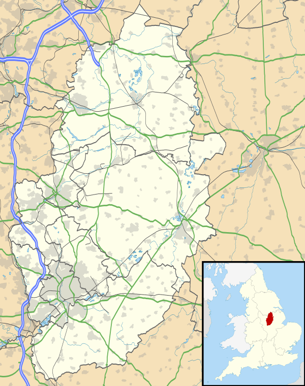 Retford Retford shown within Nottinghamshire | |
| Population | 22,013 (2011) |
| Demonym | Retfordian |
| OS grid reference | SK 70393 81201 |
| District | |
| Shire county | |
| Region | |
| Country | England |
| Sovereign state | United Kingdom |
| Post town | RETFORD |
| Postcode district | DN22 |
| Dialling code | 01777 |
| Police | Nottinghamshire |
| Fire | Nottinghamshire |
| Ambulance | East Midlands |
| EU Parliament | East Midlands |
| UK Parliament | |
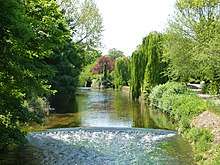
Retford (pronounced rɛt-fʌd, RET-fud) is a market town in Nottinghamshire in the East Midlands of England, 31 miles (50 km) from Nottingham, and 23 miles (37 km) west of Lincoln. The population at the 2011 census was 22,013.[1] The town is in the valley of the River Idle and the Chesterfield Canal passes through the centre. The village of Ordsall, west of the River Idle and the East Coast Main Line railway, and the former hamlet of Thrumpton are suburbs. Retford is administered by Bassetlaw District Council, which itself is now a non-constituent partner member of the Sheffield City Region Combined Authority. Retford is twinned with Pfungstadt, Germany.
History

Retford is one of the oldest boroughs in England and was mentioned in the Domesday Book of 1086 as 'Redeforde'. Henry I established the borough in 1105, and it gained a Royal Charter in 1246, when Henry III granted the right to a fair. This was later extended to holding a Saturday Market by Edward I in 1275. The granting of Royal Charters was important because it enabled Retford to self-govern and become independent of interference from the Sheriff of Nottingham. A total of 17 charters (including the Letters Patent of 1225) are believed to have been granted to East Retford up to 1607.
Retford was reformed by the Municipal Corporations Act 1835, and then remained a municipal borough until 1974. Since 1974, Retford has been part of the District of Bassetlaw which was formed by the merger of the boroughs of Worksop and East Retford, as well as most of Worksop Rural District and East Retford Rural District. Bassetlaw is named after the historic Anglo-Saxon Bassetlaw Wapentake of Nottinghamshire. Retford's civic traditions are maintained by Charter Trustees.
The coat of arms for the town consists of two rampant choughs, which were taken from an old seal of the Borough. The crest is based on the design on a Mace presented to the Borough in 1679 by Sir Edward Neville, with few changes. A small shield replaces the original rose, upon which the lion rests its paw. The shield features a deed which references the Boroughs ancient Royal Charters. The unicorns are from the heraldry of Lord Galway, whose ancestors were High Stewards of the Borough. The shells are from the arms of Rt Hon FJ Savile Foljambe, appointed High Steward 1880.
Origins of the name

The origins of the town's name are unknown and have been subject to much debate, but consensus seems to conclude that it gets its name from an ancient ford crossing the River Idle. There is considerable variation in how its name has been spelt historically, although in early usage it is usually styled as 'Redeforde' or 'Redforde'. A common explanation of the name is that the river water was tinged red due to the frequent crossing of people and livestock disturbing the clay river bed.[2] Other traditions include that it refers to the reeds that are plentiful in the river, or that the name references the Battle of the River Idle which was said to tinge the Idle red with blood.
Wilmshurst proposes another theory as to the origin of the name:
"In the days of the Roman occupation of Britain, a great Roman Road, or "Strada"— Street— ran from Southampton to Derby, Little Chester, Chesterfield, Castleford, Pontefract, to Eboracum, or York: and from it, at Chesterfield, branched out a "Street" to the Roman Station of Lindum, or Lincoln, which crossed the River Trent at Agelocum, now Littleborough, and the River Idle by a Ford, still used as a watering place for horses, near West Retford Bridge; hence the place would be known as the Street-Ford, or Streteford."
— Wilmshurst, Edwin, "The History of the Old Hall of the Manor of West Retford"
One of the main streets in the town is 'Bridgegate', which underlines the historical importance of the town as a river crossing.
Settlement
The first land settled was on the western side of the ford, this area being less liable to flooding. However, as the community grew it spread to occupy land on the other bank of the river, and it was this eastern part of the town that eventually became more important; hence Retford's alternative (and, for administrative purposes, still official) name of East Retford. The centre of Retford is characterised by a large Market Square surrounded by Georgian period architecture. The Retford Conservation Area contains the historic cores of both West and East Retford, which sit either side of the River Idle. The Conservation Area also extends southwards up to and including the 18th century Chesterfield Canal. The town also includes the small villages and hamlets that are adjacent to it, which have effectively become suburbs of the town. These include Ordsall.
Early human history
Evidence of early human activity around Retford stretches back to the Mesolithic period, with archaeological evidence of human activity in the area including a Mesolithic flint tool found in Ordsall, an axe from the Neolithic era (New Stone Age) from Little Morton and a Neolithic polished flint axe discovered near the River Idle at Tiln. [3] A Bronze Age spearhead was found near Whinney Moor Lane and Romano-British crop marks are visible around Babworth.
Roman-era artefacts are rare in Retford, although 1st/2nd century items were found at a site on Carolgate in 1922. The remains of a group of 1st-3rd century buildings were found at Babworth in 1981. A coin hoard was found at Little Morton that was dated to the 3rd century, and Roman artefacts and pottery fragments have been found at Tiln (Stroud, 2001). Evidence of Roman field patterns were identified by Derrick Riley of Sheffield University in the 1970s and 80s. Large amounts of Roman pottery has also been found over the years by farmers working the land around North Leverton Windmill.
Anglo-Saxon period
Timber piles were found in Retford in 1995 on the Western bank of the Idle at Bridgegate, which were dated to 947-1030 AD. At that time, Retford was within the Anglo-Saxon kingdom of Mercia. The first reference to Retford is in relation to the Battle of The River Idle in 617. According to Bede:
"In the year 617 Aethelfrith, the powerful King of pagan Northumbria, demanded from Rædwald, the half-Christian and half-pagan King of East Anglia, the surrender of Edwin, the representative of the kingly stock of Daere, or Deira, the southern half of Northumbria, who had found asylum at Rædwald’s Court. Raedwald refused to surrender the fugitive, and, fully appreciating the consequences of this refusal, gathered his forces in haste, and set out to meet the terrible Northumbrian King. Rædwald was so expeditious that he surprised Aethelfrith on the borders of Mercia before the body of his army had come up. Here, on the eastern bank of the river Idle, near Retford, was fought a battle in which the Northumbrian King was defeated and slain."
According to Hunt (Dictionary of National Biography) this led to a saying: "The River Idle was foul with the blood of Englishmen", which a variant local tradition says was the origin of the name 'Redforde'. The battle of the River Idle was significant in establishing Rædwald's power, such that Bede called him Rex Anglorum (King of the Angles). There are no accurate records as to where the battlesite was, and various local sites have been proposed.
The Norman Period and Middle Ages
Retford was next mentioned in the Domesday Book as Redforde, and joined to Odesthorpe (now unknown). It appears to have been the property or fee of Roger de Busli.
The first town hall or 'moot hall' was built in 1388 and demolished in 1754. It is believed that this may have been situated in what is now known as Cannon Square. The hall was built of timber and faced east. On the ground floor of this building was the Shambles. At that time, the present Market Square was possibly used for cattle/horses, with Marcombe suggesting this was the site of the ‘beast market’ in the Tudor period. [4]
At this time, the majority of buildings in Retford would have been of timber and thatch construction. However, three major fires destroyed the majority of these. The 1528 fire destroyed over three-quarters of buildings in the East Retford borough), followed by fires in 1585 and 1631. The 1585 was so profound that the people of Worksop raised money for 'the poor men of the late burned town of Retford'. By 1552 Retford only had a population of 700. In 1558 there was an outbreak of Plague which caused 300 deaths in East Retford and killed half the people of West Retford. Yet another fire struck in 1631 and caused £1,300 worth of damage [5] .
Modern Period
The Civil War seems to have largely bypassed Retford, although Charles I was said to have stayed in the house of Mr Lane, a lawyer, on 20 August 1645. He was on his way from Doncaster and set off the following day to Lord Danecourt's in Newark. In 1657 there was a Great Storm, which destroyed the steeple and Chantries of St Swithun's Church. This was restored in 1658 at a cost of £3,648.
The town prospered after the Great North Road was diverted to run through the town in 1766. Then in 1777 the Chesterfield Canal was built through the town, with the direct London to York railway (1849) later routed via the borough. In 1801 there were 5,999 people, which rose to 12,340 by 1901.
The Great North Road was diverted around the town in 1961 and part of the route through the town is now pedestrianised. By 2001 the population had grown to 22,000 (Nicholson, 2008), with a large proportion living on housing estates in Ordsall, Hallcroft and Spital Hill.
Political history

Since 1316 Retford had been entitled to two sitting MPs. Although by 1330 it was begging to be excused the privilege, on the grounds of poverty, and the inability to pay the burgesses the heavy expenses of their long journeys to and from the capital. The petition was granted and it was to be several generations (1571) before Retford was represented in the Lower Chamber again.
Robert de Retford, son of Richard de Retford, rose to become an influential judge, and was summoned in that capacity to Parliament in 1295. ‘He continued to be called upon to assist at the deliberations of the senate until 1318, and, having left on one occasion without royal permission, he was peremptorily summoned to return, and not to absent himself without the King’s licence’. He was present at Edward II’s coronation in 1308, and records show he acted in his judicial capacity in Retford, Durham and Leicester. His son, William de Retford, was appointed Keeper of the Great Wardrobe, and in 1354 was made a Baron of the Exchequer [6] .
East Retford (UK Parliament constituency) was one of the most notorious Rotten and pocket boroughs in the country and was considered to be in the gift of the Duke of Newcastle. There were therefore vigorous debates in Parliament over whether to transfer Retford's franchise to one of the larger unrepresented towns such as Manchester or Birmingham. Hansard records that during the House of Lords debates on the Disfranchisement Bill, the town had an active committee, led by a couple of attorneys and meeting at the Turk's Head Inn, who were trying to make the borough seem even more corrupt than it was and ensure its extinction. One of its members was later seen wearing a handsome gold watch, apparently presented in gratitude by well-wishers in Birmingham. Viscount Howick objected to the disenfranchisement of Retford not on the basis that the accusations of corruption were not true, but that it punished the innocent as well as the guilty and ignored the fact that many boroughs were equally corrupt.
They thought that East Retford ought to be partially sacrificed, in order to prevent the whole system of corruption from being overturned. Just as in a bullfight a cloak is dropped to turn aside the rage of the mad animal, while his assailant prepares more securely to destroy him. If the public were ignorant of the undue means by which a large majority of the Members of that House obtained their seats in it, they might declaim against the venality of the voters of East Retford; but, notorious as these circumstances were, he thought it better to pass over the present case in silence till they were prepared to deal with others equally flagitious.
— Hansard record of Viscount Howick's speech in the House, 1830, HC Deb 11 February 1830 vol 22 cc334-63
The 1830 Act extended the borough's boundaries to encompass the Wapentake of Bassetlaw (which included the whole of the northern end of Nottinghamshire, including the town of Worksop). All those within this area who were qualified to vote in the county elections were given votes for East Retford. Within a year, Parliament was debating the Great Reform Bill, but the extended boundaries meant Retford could retain its seats until 1885, when the constituency was replaced by an identically delineated single-member county constituency, Bassetlaw. The current MP (since 2001) is John Mann.
Historians
James Shadrach Piercy was born in Rillington, near Malton and moved to Retford in 1822 to teach at the National School (a school that traditionally had strong links with St Swithun's church) on Grove Street. While living in Retford, Piercy wrote 'The History of Retford in the County of Nottingham (1828)'. This is an important work because it contains references to material that has subsequently been lost. Jones & Co Solicitors hold the Piercy Manuscript.
Robert Thoroton was a physician and country gentleman who published a history of Nottinghamshire in 1667 entitled 'The Antiquities of Nottinghamshire'. In 1796 a new edition was published by John Throsby (1740–1803), who added an additional volume. Retford is mentioned in Volume 3. pp. 274-280.
B.J. Biggs was the Principal Lecturer in History at Eaton Hall College and a keen local historian. He wrote a number of histories of Retford including 'Looking at Old Retford', Published by Eaton Hall College (1968), with drawings by CT Boothby; 'Living in Old Retford', Published by Eaton Hall College (1973); The Lost Windmills of Retford, Published by Eaton Hall College (1978).
Geography and climate
Retford lies in a shallow, fertile river valley which has a wide flood plain on either side of the River Idle. This makes the low-lying land next to the river prone to flooding. The underlying geology is Primo-Triassic rocks which lie over coal measures. This district therefore forms part of the Nottinghamshire-Yorkshire Coalfield. To the West are Pebble Beds and Sandstone outcrops. To the east are heavy claylands of Keuper Marl.
Nature and biodiversity
The area in and around Retford has a varied geology and habitat. Bassetlaw has 19 Sites of Special Scientific Interest that cover broadleaved woodland, wetlands and grasslands comprising 1361 hectares. The area also has 290 Local Wildlife Sites. Retford Cemetery is designated as a Local Nature Reserve. There are 30 known Ancient woodlands of more than 2 hectares in Bassetlaw.
The Retford area has a rich and diverse ecosystem including rare and endangered animals and birds. A wide range of birds can be spotted. Nottinghamshire wildlife trust commonly records Sparrowhawk, Moorhen, Stock dove, Woodpigeon, Collared dove, Swift, Green woodpecker, Great spotted woodpecker, House martin, Pied wagtail, Wren, Dunnock, Robin, Blackbird, Song thrush, Redwing, Mistle thrush, Blackcap, Chiffchaff, Goldcrest, Long-tailed tit, Coal tit, Blue tit, Great tit, Treecreeper, Nuthatch, Jay, Magpie, Jackdaw, Carrion crow, Starling, House sparrow, Chaffinch, Greenfinch, Goldfinch, Bullfinch, Siskin.
The River Idle is a critical habitat for eels - with an eel pass being installed in 2018 to help silver eels get upstream[7]. 9 species of bats have been recorded in and around the town including Daubenton’s bat, Whiskered bat, Brandt’s bat, Natterer’s bat, Noctule, Leisler’s bat, Common pipistrelle, Soprano pipistrelle, Brown long-eared bat. And a range of mammals and amphibians can be seen such as Hedgehogs, frogs, rabbit, hare, squirrel, toad, newts, moles, badgers, foxes.

Development in Retford is somewhat constrained by its environment. To the North of Retford the Sutton and Lound Gravel Pits SSI (part of the Idle Wetlands), as well as the influence of the river Idle, mean that housing development is unlikely. To the West of Retford, the estate of Babworth Hall (a Registered Park) constrains expansion. The East Retford Pastures meanwhile are susceptible to flooding. This means new housing development has tended to be concentrated in certain areas (Ordsall and North Road) or as in-fill to replace former industrial buildings or waste ground.
SSI's around Retford, including the reason for their importance:
- 'Ashton's Meadow' - A Hay meadow with a valuable flora. 3.6Ha
- 'Barrow Hills Sandpits' - An excellent area of grassland and scrub on glacial sands - of both invertebrate zoological and botanical importance. 2.9Ha
- 'Castle Hill Woods' - A unit of fine deciduous woodlands with a characteristic structure and species composition - of botanical and zoological interest. 33Ha
- 'Chesterfield Canal' - A representative stretch of canal supporting a nationally notable aquatic plant community characteristic of brackish waters, and a rich invertebrate habitat. 20Ha
- 'Clarborough Tunnel' - A fine example of species-rich calcareous grassland and scrub developed around the tunnel top and cuttings on an active railway line - a site of botanical interest. 7.9Ha
- 'Clumber Park' - A diverse area of mixed habitats of considerable botanical and zoological importance. 562Ha
- 'Eaton Wood' - An excellent deciduous woodland of botanical and invertebrate zoological interest. 24Ha
- 'Gamston Wood' - An excellent ancient woodland site of botanical and zoological importance. 41Ha
- 'Gamston and Eaton Verges' - species-rich roadside verges. 1.5Ha
- 'Mattersey Hill Marsh' - One of the best examples of mixed marsh in Nottinghamshire and representative of marsh communities in Central and Eastern England. 6Ha
- 'Misson Line Bank' - An excellent mosaic of open water, marsh, grassland and scrub communities developed around several old borrow pits. 20Ha
- 'Misson Carr' - Nationally rare wet woodlands, marsh, and old grazing pastures. One of the county’s largest remaining fragments of a fenland system that once covered much of the local landscape, but which has been progressively lost to drainage and agriculture over the last three hundred years. 85Ha
- 'Mother Drain, Misterton' - Ditch and banks of considerable zoological interest and of some botanical importance 4Ha
- 'River Idle Washlands' - An extensive area of open water, marsh, grassland, scrub and wet woodland which support a rich assemblage of plants, invertebrates and birds. 575Ha
- Treswell Woods - One of the best remaining examples of ancient semi-natural broad-leaved (ash, oak, maple) woodland on clay soils in the county. Of botanical and zoological interest. 50ha. 3 miles East of Retford[8]
Flooding
Retford lies in the Idle River Valley and low-lying areas are prone to flooding. Flooding is confined to the well-defined and wide flood plain of the Idle, and areas above the flood plain or on sandstone (to the West) do not flood. To the North and East the land is clay and the area was historically marshy (see Isle of Axholm), but was drained by Dutch engineers under Cornelius Vermuyden in the 17th century.
In 1947 an article in The Retford Times notes that Moorgate (one of the principal streets) derives from the Anglo-Saxon 'mor' meaning a marsh. The author notes that across Moorgate there runs a brook commonly called 'The Beck', which floods annually. He notes: "The soil here is largely clay, and Moorgate was well called the 'morgata' - the miry street".
Hardmoors, which is adjacent to the Idle at Ordsall, was so called because it floods and freezes in winter.
Many floods are recorded in the historical record including
- A Great Flood in 1775.
- February 1795 the town flooded.
- 1872 there were serious floods in April.
- There was a Great Flood in 1886 which caused considerable damage. The council demolished the bridge and built a new bridge in West Retford to facilitate the flow of water under the bridge.
- In 27 June 2007, a few low-lying parts of the town were affected by the 2007 United Kingdom floods. The majority of Kings Park was flooded under three feet of water.[9] The Asda and Morrisons supermarkets adjacent to the river were also flooded.[10]
"The flood came on so sudden at Retford on Tuesday night, that great numbers of the inhabitants had no time to remove their effects, and several of them have received very considerable losses by it. It was three feet high in the Market-place, and the torrent ran so strong as to tear up the pavement in different parts of the town, which was nearly all under water. At West-Retford a grocer's shop, and part of Miss Hurst's house were washed down, and four other houses were nearly destroyed, and their inhabitants preserved with the greatest difficulty."
— Nottingham Journal (1795)
Landmarks
Market Square
The Square is in the centre of Retford and features an ornate French-inspired Victorian Town Hall (Grade II listed), in front of which is the Grade II listed Broad Stone.
Broad Stone
Legend says that the Broad Stone had a hollow in it that used to be filled with vinegar during plague times to disinfect coins. However, it is thought to be the upturned base of a boundary marker - perhaps the 'Dominie Cross'.
A 1908 guidebook to the town[11] says the following:
"Immediately in front of the Town Hall, in the Market Square, is the historic Broad Stone. It formerly occupied a slight eminence known by the name of Est-croc-sic, now called Dominie Cross. It is believed to have been the base of a cross, and to have formed one of four: a second is still preserved in the West Retford churchyard, a third was in the churchyard at Ordsall, the fourth is lost...likely these crosses marked the boundary beyond which inhabitants smitten with the plague were prohibited to pass. Certain it is that at times the plague devastated Retford (especially West Retford in 1558)...From Dominie Cross the Broad Stone was removed into the Market-place. It became the hustings where candidates for the two parliamentary seats allotted to this borough addressed their constituents, the freemen. Here, at various times, they were heckled, threatened, even assaulted. Woe betide the candidate who was not "all right". When 40 guineas were at stake it was serious to a freeman to "lose his election". Apprentices assembled here at the close of their "servitude" after a night's carousal and sang a ditty which is still preserved."
— East Retford and the Dukeries, A Handbook for Visitors and Residents
Stapleton suggested in his study of Nottinghamshire crosses that the crosses mentioned in the 1908 guide were market crosses.[12].
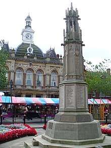
War memorial
The Grade II* listed war memorial is in the form of an Eleanor Cross, an octagonal strruucture of late Gothic design. It was unveiled by Sir Frederick Milner, the town's MP, in 1921. The memorial features an eternal flame, with the names of the men killed in World War I on the lower eight panels[13], with bronze plaques containing the names of those killed in World War II. The monument was designed by architect Leonard W. Barnard FRIBA of Cheltenham, and built of Stancliffe stone from Darley Dale, Derbyshire by RL Boulton & Sons.[14] A plaque for the Korean War was unveiled and dedicated on 17th August 2008.
In addition to the main memorial in The Square, there are other war memorials in the town. For example, the Sevastopol Cannon in neighbouring Cannon Square is a memorial to those killed in the Crimean War. A window in the south aisle of St Swithun's church (by Charles Eamer Kempe) was erected in memory of the Sherwood Rangers who fell in the Second Boer War, being unveiled in December 1903. The tablet below contains the following inscription: "To the glory of God, and to the Memory of those of the Sherwood Rangers Imperial Yeomanry who died for their Sovereign and Country in South Africa, 1900-1902" and after the names: "This Window was dedicated by their friends". In St Swithun's is also a set of oak boards, naming the 205 fallen members of the Parish from the First World War[15].
In St Saviour's Church there is a memorial to the 65 men of the parish killed in the First World War[16]. In the churchyard of All Hallows Church in Ordsall is a carved granite cross based on St Columb’s Cross in Cornwall. The inscription is in lead letters and reads: "1914-1918/ 1939-1945/ In Proud Remembrance Of Those Who Did Not Return." No names are given. This is a replacement (1951) for an earlier wooden cross, and is Grade II listed. There is also a memorial window in All Hallows’ church. Five Courts is a Grade II listed monument of the Rugby Fives type and was built at the former King Edward VI school site by the mother of William Eyre, a former pupil who died in the First World War. The plaque reads: "In Memory Of Capt. William Eyre; Who Died Of Wounds; August 19th 1916; Their Name Liveth Forever More." Bassetlaw Council notes that the year of death is incorrect (it should read 1915).[17]
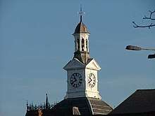
Town hall
Retford built its first town hall - a moot hall - in 1388. The building was between The Square and St Swithun's church, on a different site to the present building. Like many early buildings the Moot Hall was built of timber and was destroyed in the 1528 fire. It was replaced by a similar building. According to Piercy's History of Retford, the roof of this building had "a small cupola, of a very antiquated appearance, containing a bell, but no clock. This bell was rung at the commencement of the markets, and was also used for summoning the inhabitants to attend the courts, and the Council sessions, etc". The hall seems to have fallen into a poor state of repair, since Piercy notes it was necessary to demolish it before it fell down. The Moot Hall was replaced in 1755 on the same site. This time a clock, weathercock and bell were added. This hall was demolished in 1868 because it had become an obstruction to traffic.
In 1866 the Town Hall was resited to the south of The Square, with the current Grade II listed building replacing an existing townhouse (the land alone cost £2,000). The Corporation held a design competition which had 18 entrants and was won by Bellamy and Hardy of Lincoln. The design is Italianate with the roofs of French mansard design. The clock tower was designed to resemble the previous Town Hall clock tower. The building is brick with a facing of limestone (Bath Stone) and the plinths and columns are in Mansfield Red Stone. Building started in 1866 and the project was completed by January 1868. The building consisted of a Court held in the main hall, a Council Room, a committee and retiring room, Town Clerk's office and Muniment Room, a hall-keeper's residence, kitchens, Corn Exchange and a Butter, Poultry Market and Shambles or meat market. This was one of a group of new civic buildings, with the total cost of the Town Hall, Shambles and Corn Exchange being £7,110. A clock and two chandeliers were reused from the previous building.
Pevsner is critical of the resulting building, saying it is "without any of the Victorian qualities we appreciate today: a bad mansard roof and a bad lantern".[18] The Builder (October 1867) uses the building as an example of an unsatisfactory result of a building competition, much preferring the Gothic revival design that had been submitted by the Bristol architects Godwin and Crisp.
The Court-house was replaced in the 1930s and the Shambles and Corn Exchange were demolished about 1980.[19]
Cannon Square
Just across from the Market Square is Cannon Square which has St Swithun's Church and a cannon captured from the Russians during the Siege of Sevastopol at the end of the Crimean War in 1856.
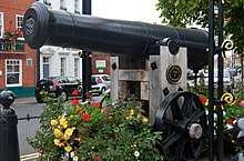
The cannon, supporting plinth, lamp arch and iron posts with chains are all listed (Grade II). The cannon arrived in Retford in April 1858 by rail. It was given the name ‘The Earl of Aberdeen’ and was officially unveiled on 17 February 1859 by Gunner Cole (of the Royal Artillery). It was removed during the scrap drive of the Second World War, but was rescued by Mr R.G. Bradshaw (Alderman of Retford). The cannon was reinstated after the Second World War, set on a new wooden gun carriage, being officially unveiled on 29 March 1950 by the Mayor of Retford, Councillor T. Richmond.
King's Park
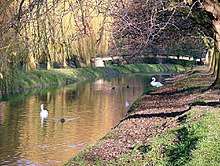
Kings' Park was opened on 29 June 1938, to commemorate not only the reign of King George V, but also the Coronation year of King George VI. The site for the original park occupies the land from Chancery Lane to the River Idle and was donated by Mrs M Huntsman of West Retford Hall in 1937. A public appeal by the Borough of East Retford at the time raised £2,000 towards the estimated cost of £8,000 (equivalent to £485,000 today) to develop the park.[20]
In 1960 a further donation of the land by R H Williamson to the west of the River Idle allowed for an extension to the park within the former grounds of the historic West Retford Hall, which dates from 1699 and still stands outside the north-west boundary of the park.[20]
Kings Park has received many awards including winning the prestigious Britain's Best Park competition in the Midlands region (2007). It also received the Green Flag Award in both 2008 and 2009. It is described as a 'jewel in the crown' by Bassetlaw council.
The Park now covers some 10 hectares on either side of the Idle River, just off the town centre. In addition to formal gardens, it contains large areas of grassland suitable for ball games and picnics, a children's water play area, bowling greens, tennis courts, skate park, children's play ground, a performance stage, rose gardens, wildlife gardens and public conveniences.
Sloswicke’s Hospital
Sloswicke's Hospital is a Grade II* listed building founded in 1657 from money left in Richard Sloswicke’s will to found almshouses "for the maintenance of six poore old men of good carriage and behaviour to the end of the world." The present building dates from 1806; an additional pair of houses being added in 1819.
Trinity Hospital
Trinity Hospital is a Grade II listed building, set in gardens off Hospital Road. It was established over 340 years ago, and has been a prominent Alms House in Retford since the 17th Century. It was set up from the Will of John Darrel in 1671, to provide ‘hospitality’ to 15 ‘Poor Bachelors or Widowers of good Character, who are not less than 50 years of age’. He endowed the charity with a significant portfolio of property and land, and a Bailiff was to be appointed to manage this estate. The rental income from the properties was intended to cover any repairs of the buildings, including the Hospital itself, and be sufficient to sustain the Charity in providing benefits to the residents (known as the "Brethren").
The building on Hospital Road was designed by Edward Blore with the chapel and the two projecting L-shaped wings of cottages dating from 1833, and the central section, dominated by the tower, added in 1872. The clock in the Clock Tower was made by William Thomas, Lincoln, and is dated 1858. The clock is of bird-cage wrought iron construction, having two trains, a recoil escapement and shows the time externally on a single adjacent dial. It strikes the hours only on a single bell above.
It is thought Blore's link to Retford was because his wife was from Mattersey. His creation cost £4,000 to build.
A painting of Queen Anne belonging to the hospital was cleaned and restored in 1999. An appraisal of the painting was made by an art expert from Phillips, who attributed it to Sir Godfrey Kneller, a well-known royal portrait painter during Queen Anne's reign.
The Audit Room features a striking stained glass window made by Edwin Wilmshurst. In his scrapbook he notes how in 1860 he happened to be in York and enquired if he could obtain historic stained glass. He was shown a box of waste glass and bought it. When he retired in 1908, he finally cleaned and sorted it, discovering some came from church windows, some from nobile town houses in medieval York and some from secular public buildings. It ranged in date from early Gothic to Nineteenth Century. He assembled from this collection a window which became known as the 'Trinity window'. It was installed by William Spurr, Plumber and Glazier of Churchgate, Retford at a cost of £20 – 6s – 7½d. When the window was restored in 2000, it was discovered that it contained rare medieval glass, which necessitated recording the window in the European and British Register.
Another stained glass widow on the south-east side dates from 1876 and was added at the expense of brother Edward Beckett, who had been a gardener who laid out the ground of the King Edward VI Grammar School. He is said to have saved his beer money for three years to pay for the window and have challenged his Brethren: "Now then you, there's t'other winder, and there be 15 o'yah; I dares ye to put him in." His Brethern took up the challenge and within a year had saved enough for the Four Evangelists window.
The Hospital features an outstanding pair of gates, commissioned in January 1995 by the Master Governor from Chris Topp, Blacksmith, of Carlton Husthwaite, Thirsk, North Yorkshire. The gates were finished and hung on the Epiphany Feast 1996.
Corporation Almshouses, Union Street
Consisting of a terrace of nine almshouses, which were built for £1,100 in 1823 for women of the town.
Other buildings of note
A large number of buildings in the Retford Conservation area are listed buildings. These include:
- Amcott House is a Grade II* listed 18th century townhouse on Grove Street that is now the site of the Bassetlaw Museum
- Grade II listed buildings on Grove Street include numbers 4-8, 5, 7, 10, 12, 13-17, 14-18, 20, 22, 25, 24-28, 27, 35
- 25 Grove Street is a Grade II* listed 18th century house
- Grade II listed buildings on Bridgegate includes numbers 2, 4, 6, 6A, 8, 10, 11, 13, 16, 22, 43, 66-72
- West Retford Hall - a Grade II listed house on Rectory Road, adjacent to King's Park. It's stables are also listed
- Grade II listed buildings on Carolgate include numbers 2, 4, 5, 6, 17, 19, 28-32, 31, 41, 77, 79, 81, 83
- Grade II listed buildings on Churchgate include numbers 1, 2, 3, 4, 4a, 5, 6-10, 7, 9, 11, 15, 17-19, 23, 33, 45
- Grade II listed buildings on Chapelgate include numbers 2, 4, 6-12, 24, 40, Church House (26 and 28) and Chapelgate House (Number 42)
- Grade II listed building on Coronation Street - number 2
- The former Newcastle Arms Public House - Grade II listed (now redeveloped as housing)
- Grade II listed buildings in The Square including numbers 1, 3, 4, 7, 8, 9, 10, 10a, 11, 13, 18, 18a, 19, 21, 23, 24, 25, 26, 27, 29, 30, 31, 31a
- Protestant Place, Queen Street - Grade II listed cottages (dated 1826)
- Grade II listed buildings on London Road - 19-23, Storcroft House, Holly Mount and Ordsall House
- Grade II listed buildings in Moorgate including numbers 35, 37, 39, 41, 43, 53, as well as Moorgate House
- Bolham Hall, Tiln Lane - Grade II listed
- 43-47, 96, 98 All Hallows Street, Ordsall - Grade II listed
- Swiss Cottages, Babworth Park - Grade II listed
Spa Common
Spa common sits behind Carolgate, lying adjacent to the Chesterfield Canal. The common gets its name because there used to be a spa in this area.
Retford sits on Artesian aquifer - with rain water filtering through the Bunter sandstone. Before mains water was established, most houses had their own wells or used communal wells. One of these wells was located on what is now called Spa Common. The water from this well developed a reputation for being able to cure various ailments whether drunk or used to wash in.
According to an article in The Retford Times newspaper (5th July 1957), John Piercy the historian and schoolmaster tried the water and said it was red in colour and tasted of ink.
The Mineral Spas of England, published by J.C. Short MD (1734) says that at that time the water on Spa Common bubbled to the surface inside a handsome freestone basin which itself was enclosed in a pleasant, decorated building shaped like a pyramid. He says that the colour of the water was probably the result of iron oxide, and that it would develop a white scum on the surface when left standing, due to the presence of gypsum.
This building was later demolished and replaced by Robert Hudson, before being demolished again. Today there is no trace of the spa on the Common.
Opinions on Retford
Nikolaus Pevsner, architectural historian, was fairly scathing about Retford and its lack of distinguished buildings. "A singularly unattractive town," he wrote.[21]
However, William White in his Directory of Nottinghamshire (1853) is more complimentary about Retford: "The approach to the town, from every side, is by a beautiful and gradual descent, and its open and spacious Market-place, surrounded by good regular buildings, and having several commodious streets of neat houses branching from it gives the whole an air of importance, comfort, and wealth, possessed but by few country towns of the same size.”[22] Retford and its environs were thought to be sufficiently attractive for the Great Northern Railway Company to organise trips based in Retford (1908). Visitors stayed at the White Hart Hotel, with a fare inclusive of the railway journey, the drive (by four in-hand, landau, citoria or dogcart), and a couple of meals. C Moss, author of the 1908 handbook, notes: "Attention, almost at the very outset of the journey, is directed to the beauties of the drive. By a gentle incline we pass into the fair demesne of Babworth. At the foot of the declivity, Babworth Hall, the church, the rectory and the lake, wherein shrub and tree are shadowed, naturally catch the eye."[23]
In 1896, Cornelius Brown wrote that Retford was "discernible from the [Great Northern Railway] line as a mass of red-brick houses and smoking chimneys, with the tower of an old parish church rising in their midst’.
C Moss wrote: "Not only does the proximity of Retford to the Dukeries make the town attractive to visitors, but it is also sought after as a place of residence...One of the charms of Retford is undoubtedly its antiquity." [24]
Bill Bryson, the American author and former president of the Campaign to Protect Rural England, praised the town. In his bestselling book Notes from a Small Island, he writes, 'Retford, I am pleased to report, is a delightful and charming place even under the sort of oppressive grey clouds that make far more celebrated towns seem dreary and tired. Its centrepiece is an exceptionally large and handsome market square lined with a picturesque jumble of noble Georgian buildings. Beside the main church stood a weighty black cannon with a plaque saying 'Captured at Sevastopol 1855', which I thought was a remarkable piece of initiative on the part of the locals - it's not every day, after all, that you find a Nottinghamshire market town storming a Crimean redoubt and bringing home booty - and the shops seemed prosperous and well ordered.'[25]
Religion and Places of Worship
Pilgrim Fathers
Retford and its rural district contain a large number of historic churches. The area has a strong non-conformist tradition. The Pilgrim Fathers, a name commonly applied to early settlers of the Plymouth Colony in present-day Massachusetts originated from villages of Babworth and Scrooby on the outskirts of East Retford between 1586 and 1605.53°19′20.45″N 0°56′20.57″W / 53.3223472°N 0.9390472°W
Methodism
Retford was involved in the early history of Methodism, with John Wesley preaching in the town square in 1779. His visit had a warm reception from some Retfordians - led by a certain John Willey - who conspired to disrupt his preaching. In the end this was limited to the throwing of a bad egg, which missed Wesley but hit his sister. She was said to retaliate with a torrent of abuse that made the crowd laugh even if somewhat out of place at an evangelistic rally. Retford's first Methodist chapel opened the same year. This chapel was deemed too small for the crowd expected for John Wesley's second visit to Retford, who was by then 83 years old. According to his journal he preached first at the New Inn, afterwards at Newark, and in the evening at Retford where he saw "the dead, small and great, stand before God". According to a tablet in the wall of a house in Bridgegate, Wesley preached under a pear tree in an orchard just over the Idle in the parish of West Retford. (Barry J Biggs 1967)
"From whichever direction it is approached this building dominates the skyline".
— BJ Biggs, Looking at Old Retford
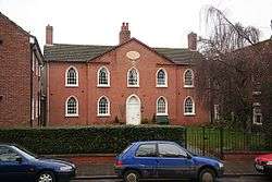
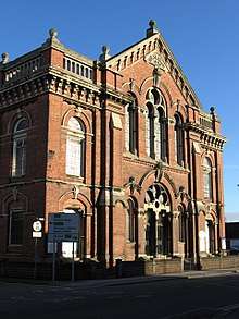
The current Grade II listed Methodist chapel in Grove Street dates from 1880 and was built by Bellamy and Hardy, who were also the architects of Retford Town Hall. Its listing states that the chapel retains a high quality of architectural and artistic embellishment in both the external and internal detail. The oval galleries are an architectural expression of distinctive worshipping practice and there has been minimal alteration to the original fabric or fittings. The chapel contains flooring laid in the early 20th century, an example of the terrazzo and mosaic craft of Italian immigrant craftsmen.
In addition to the chapel on Grove Street there are other non-conformist chapels around the town. Some are in use as places of worship and others are now used for other purposes.
St Michael the Archangel
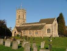
The limestone built, Grade II* listed St Michael the Archangel church, West Retford was dedicated in 1227 and sits on an elevation on Rectory Road. The oldest part of the church is the south aisle and the chapel dedicated to Oswald of Northumbria. Its outstanding feature is the octagonal spire on a square tower. The spire is said to be an exact, early 14th century replica of the spire of St Michael At Rouen in Normandy. At that time, Lincoln cathedral was served by Norman priests from Rouen, and as the Manor of West Retford was among the Manors granted to Roger-de-Buesli, it is almost certain that this and other churches in Nottinghamshire were designed and built by Norman architects from Rouen.
Originally the spire was surmounted by an iron cross, but in 1855 a severe gale damaged the tip of the spire and the cross was replaced by the current weather vane. It is the crocketted spire and tower that was referred to by Pugin as "a poem in stone" and by Pevsner (1979) as "remarkable". There are six bells in the tower, the largest tenor bell weighing 9cwt in A Flat is dated to 1619 and is inscribed "Jesus be our speed", the 5th bell was originally cast in 1620 and recast in 1884 by Mr Taylor of Loughborough at the cost of £200 raised by public subscription. There is an inscription on this bell that reads "Fili Dei Misere Mei" – "Son of God have Mercy on me". The other 4 bells were cast in the 19th century.
St Oswalds chapel is the oldest part of the church. There is a carved statue of St Oswald in a niche on one of the pillars in the south aisle, which was placed there in the 19th century. The window above the altar depicts St Michael and was designed by the architect William Butterfield in memory of his brother the Rev Charles Butterfield, rector of West Retford parish from 1857-1866. In the small chapel at the end of the north aisle, also known as the 'Mary chapel', there is a handsome reredos by Sir Ninian Comper.
St Swithun's

A Grade II* listed church in East Retford that is dedicated to St Swithun and founded in 1258. The church is located in the centre of town between Churchgate and Chapelgate.
The current building is of cruciform shape, now mainly of perpendicular architecture, but still preserving in its south and west doorways, and in the tracery of some of its windows, marks of earlier styles. In 1528 there was a great fire in Retford which damaged the church. In 1535, we learn that: "Where sumtyme were iiii chauntries which now er in decaye by reason they er consumed wt. fyer." The tower and chancel collapsed in 1651 and were rebuilt in 1658. The current building is therefore largely the work of restorers of 1658, 1854-5 and 1905.
The church has a square, battlemented tower, containing a clock and 10 bells. The oldest, virtually untouched, part is the north transept, although it has now been transformed into a chapel as a war memorial. The tower is supported by four massive arches and the nave and aisles are separated by arcades of five bays. There is a stone pulpit, an eagle lectern in oak, and a large organ erected in 1841. In the north transept is an incised slab to Henry Smyth (d 1496) and Sir Whatton Amcotts (d 1807) by William Kinnard, architect. The Victorian stained glass includes work by Clayton and Bell, Charles Eamer Kempe, Michael O’Connor, Hardman & Co, William Wailes and George Shaw[26] .
The figure over the southern door is locally said to be of St Swithun, but according to Kidson is of a bishop. He says the figure was brought from a dissolved monastery in Portugal and was given to the Church, and placed in its present position, about the year 1895.[27]
The British Museum contains several architectural drawings of East Retford Church by Samuel Hieronymous Grimm. These include a general view of the exterior, and a drawing of the tracery of the east window. There are also drawings by Thomas Kerrich (1748-1828) including a drawing of a window which used to be in the Chancel, but which no longer exists. John Buckler (1770-1851) made several drawings of the church, including one of the figure in the vesica piscis, at the beginning of the nineteenth century.
St Joseph

Catholics mainly worshipped in homes following the reformation and up until the 20th century, although demand for a Catholic church rose with an increase in Irish workers and Italian immigrants in the 19th and early 20th centuries. In 1895 a piece of land was purchased on the corner of Queen Street and Pelham Road and what came to be known locally as the "tin chapel" was constructed. A nearby house on Pelham Road was used by the priest.
As the Catholic community continued to expand it was decided to build a bigger church and land was purchased on the Babworth Road. The present Catholic church - St Joseph's - opened in 1959 and was designed by E Bower Norris in modern Romanesque design, incorporating Art Deco elements. The church was later reordered in 1968 by renowned Modernist architect Gerard Goalen, at which time a large sculpture by Steven Sykes was introduced. St Joseph’s is prominently located on Babworth Road and its campanile serves as a local landmark. Next to the church is St Joseph's Catholic Primary School.
All Hallows, Ordsall
Ordsall is a village that is now a suburb of Retford. Its church All Hallows is a Grade II* listed building. The first recorded rector is in 1277. The current building dates from that period but was rebuilt in the 19th century by TC Hine of Nottingham. The church has a short, square tower with diagonal buttresses that is thought to date from the 15th century. The upper parts of the tower had to be repaired in 1823 after it was struck by lightning.
The church's east window is by Camm Brothers of Smethwick and dates from 1877, as is the window in the north aisle east (1881). In the chancel there is a window by James Powell and Sons (Flint memorial, 1923) and another by Charles Eamer Kempe (Hall memorial, 1905). There are a number of unusual brass plates in the south aisle, dating from the 17th and 18th centuries. In the north aisle is a memorial made of Nottinghamshire alabaster with kneeling figure between Corinthian columns (c 1600-20).
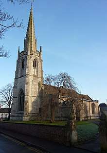
St Saviour's, Retford

St Saviour's is a Grade II listed church in Retford which is located on the top of Moorgate Hill. It was designed by the Lincoln architect Edward James Willson, FSA and was completed in 1829. It was the first major project by Willson and cost £4,000.
At the West End of the building are a pair of octagonal towers which have ogee shaped, lead covered, caps. The church is built in yellow brick, which has weathered to dark grey. There is a brass plaque at the church which says the following: "This first stone of the new chapel dedicated to the Saviour, and containing silver and copper coins of the reign of George the Fourth, was laid on the second day of June, AD 1828, by Henry Clark Hutchinson Esq., of Welham." The church was restored and repewed in 1877-8. In 1936 there was a reduction in seats and the removal of the side galleries. A major reordering of the inside of the church was carried out in 2001, removing the oak pews and replacing them with individual seats.
The building seems to be far bigger than was required. BJ Biggs in 'Looking at Old Retford' notes: "There were 1,040 sittings and it is interesting to speculate whether they were ever fully occupied. At the time of the census of 1851 there was an average morning congregation of 300 adults and 123 children, and an average evening attendance of 400." p14
Other places of worship in Retford
- The Bridge Church, Bridgegate, Retford
- The Well, Hospital Road, Reford - a Baptist Church
- St Alban's Church, London Road - a Grade II listed, stone-built Edwardian church that fell into disuse and was gutted by fire in 2008
- Salvation Army, Exchange Street, Retford
- Hallcroft Methodist Church, Retford
- All Saints, Babworth - a Grade I listed church on the outskirts of Retford in the hamlet of Babworth
Economy
Retford has a strong economy mainly consisting of services with some light industry. The town itself is an important commercial centre for the local area, with large supermarkets, many independent shops and a market every Thursday, Friday and Saturday. As of 2013, Retford's town centre has an empty shop rate of only 9%, 5% less than the national average.[28] Bassetlaw Council recently invested £1.5 million in Retford market square and £2.5 million in Retford Enterprise Centre. Bassetlaw has a very low unemployment rate of 3.3%. The council continues to work with Retford Business Forum to find ways to help the local economy.
Historically, Retford traded agricultural produce, but has also been a producer of hats, sail-cloth, rope, sack bags, paper and leather. In 1788 Major John Cartwright, the older brother of Edmund Cartwright inventor of the power loom, built The Revolution Mill on Spital Hill, near the Chesterfield Canal. The mill was a steam-powered wool spinning and weaving mill employing around 600 people. The ambitious enterprise, however, failed a few years later and the site and machinery were eventually sold at great loss in 1805. Only one building survives.
Hezekiah Clark of Derby came to work in Cartwright's mill in the 1780s as a dyer. After the Mill failed he set up as a dyer in Retford in 1798, resulting in the business Clarks of Retford. This business gave its name to Dyers Court in Retford. The company eventually became known for its dry cleaning and laundry services, and had 138 shops before it ceased trading in the 1980s.
The Bolham Paper Making Company made glazed papers, shop papers, boards, boxboards; other new paper mills were built in the mid-19th century, including a mill on Albert Road (1867). Foundries and iron works were also established. The Beehive Works was built in Thrumpton in 1873 and William Bradshaw set up his Carr Foundry in Albert Road which specialised in heating and rainwater pipes, gutters, stoves, fireplaces and general engineering castings. The late nineteenth century also saw the introduction of new technologies when the Northern Rubber Company was created by Alfred Pegler in 1871. The factory’s proximity to the junction of two important railways helped it prosper.
However, Retford did not experience the large-scale industrial growth of nearby towns and remained primarily a rural market town. Since the 1980s many of these long-established companies such as Jenkins Newell Dunford (engineering) and Bridon Ropes (wire) have closed, with the economy becoming more services-based. Strong transport links mean that many Retford workers commute to neighbouring towns and cities; some commute to London.
Transport
Road
Retford was historically on the Great North Road. It is now bypassed by the A1 trunk road and the A57 which links Retford to a number of major towns and cities, with London just over two hours away. The East Retford bypass was built in three stages mostly along what was previously the A57. In 1957, the West Drayton diversion opened up to the B6387 near Elkesley. Also near Elkesley and Gamston is the Retford Gamston Airport. The section from Elkesley bypass to Five Lane Ends (A614 junction) at Apleyhead Wood opened in 1958, and the third section was from Five Lane Ends to north of Checker House at Ranby (A620 junction). Recent investment led to a renovation of junctions at Blyth, Great Whin Covert and Markham Moor.
The town is also served by a number of buses operated by Stagecoach in Bassetlaw, Stagecoach in Lincolnshire, TM Travel as well as smaller local bus operators, to destinations including Worksop, Newark, Nottingham and Doncaster. Retford bus station is also the terminus of the 450 National Express coach service between Victoria Coach Station in London and Retford.
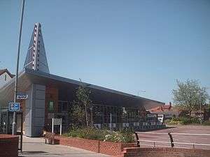
The current bus station was built and opened on 30 July 2007 at a cost of £1.4 million,[29] and was given a highly commended accolade in the infrastructure category of the UK Bus Awards 2008.[30] The previous bus station on the same site was a collection of bus shelters, but also allowed vehicles to drive illegally through the bus station. The new bus station has new traffic controls in to prevent this.[31]
Rail
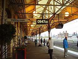
Retford is served by two railway lines, the East Coast Main Line which runs between London and Scotland, with trains taking from 1hr 20 minutes to London Kings Cross, and the Sheffield to Lincoln Line which has links to Sheffield, Lincoln, Gainsborough, Worksop, Grimsby and Cleethorpes. These two lines meet at Retford railway station which acts as an important interchange in the British rail network.
Canal

Retford is connected to the UK Inland Waterways network by the Chesterfield Canal. Indeed, up to Retford the canal was built to be accessible by broad-beam boats rather than the more usual narrowboats, Retford Town Lock being the first narrow lock on the canal from its junction with the River Trent at West Stockwith. However, narrow sections now prevent such craft reaching Retford.[32] The canal starts at Chesterfield in Derbyshire.
Although the canal was built to export coal, limestone, and lead from Derbyshire, iron from Chesterfield, and corn, deals, timber, groceries and general merchandise into Derbyshire, today it is used for leisure purposes. Based in Retford on the lower side of the Town Lock is a boat club called Retford Mariners Boat Club[33] (R.M.B.C), it was formed in November 1978 by a group of canal enthusiasts.
Air
Doncaster Sheffield Airport (formerly RAF Finningley) is approximately 14 miles (23 km) away on the A638 towards Doncaster. A regular bus service is available from Retford bus station to the airport, which offers regular flights to other European countries. Due to its military past, Doncaster Sheffield Airport| has a long 2,580 metres (8,460 ft) runway, and so is capable of landing wide body jets such as Boeing 747s, and has plans of extending its destinations to include the US. The popular discount airline easyjet, commenced flying to many European destinations in March 2010, but withdrew by the end of the year citing commercial factors as a reason. The Hungarian airline WizzAir continues to serve several Eastern-European cities, and Thomson Holidays regularly runs charter services from there as part of their package holiday business.
Retford (Gamston) Airport is a private airport located a few miles south of Retford in the village of Gamston, operated by Gamston Aviation Ltd.
Leisure and entertainment
Retford is home to the Bassetlaw Museum, which was created in 1983 and has a number of collections donated by people in the local area. It was voted the Nottinghamshire Museum of the Year in 2009, following extensive renovation, and is based in the II* listed Amcott House.
.jpg)
Retford has two theatres in the town: the Majestic Theatre,[34] a former cinema, which hosts famous entertainers, music concerts from local performers and plays, and Retford Little Theatre,[35] a smaller theatre which hosts the Retford Little Theatre amateur drama group.
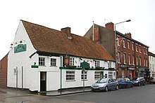
Retford also has a wide range of restaurants and pubs, plus an antiques and collectables market every Friday and a farmers' market on the third Saturday of every month. Many of the historic public houses are listed buildings, including The White Hart, an historic 18th Century Coaching Inn which has a cobbled yard and stabling for horses and at its peak saw 19 stages a day pass through. The Vine Inn (Grade II listed), an 18th century public house. Whitehouse Inn (Grade II listed) an 18th century Inn on the South edge of town. The Olde Sun on Chapelgate is a Grade II listed timber-framed building that dates from the 16th century and is one of the oldest buildings remaining in the town. The Litten Tree which was originally called The Crown Inn and dates from 1754 was once the principal place of conducting business in the town. The Queen's Head, a Grade II listed Public House on Moorgate. New Inn Public House, a Grade II listed pub on Whinney Moor Lane. The Black Boy, a Grade II listed 19th century public house on Moorgate. The Elms Hotel, an early 19th century detached stucco house on London Road. Galway Arms, an early 19th century public house on Bridgegate. The Anchor, a Grade II listed early 19th century public house on Carolgate. Retford's pubs have played an important part in its social, cultural and political history. For example, The Duke of Newcastle's True Blue Club, met in The Turk's Head[36]. Retford historically had a large number of pubs, with 56 Inns and 3 beer houses being recorded in Retford in 1896[37].
Youth groups
Retford is served by many youth groups including The Scout Association, Girlguiding UK, St. John Ambulance and Young Farmers, meeting within the town. Retford is also home to 1403 ATC Retford Squadron and Army Cadets. In addition Retford is served by an excellent youth musical theatre group known as The MOB (mini operatic bunch) the junior section of Retford Amateur Operatic Society.
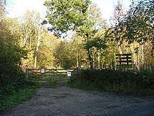
Idle Valley Nature Reserve
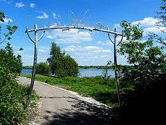
The Idle Valley nature reserve is managed by Nottinghamshire Wildlife Trust (NWT) and is the largest of the trust's reserves in Nottinghamshire. The eastern boundary is created by the natural path of the River Idle; redundant gravel quarries to the west of the river have created wetland areas which comprise the majority of the site. The reserve is a mosaic of different habitats over an area of 450 hectares, over 300 of which are designated with SSSI status. It is the largest wetland area in Nottinghamshire and over 250 species of birds have been recorded there making it one of the top birding sites in the UK. NWT has a program of activities and events for the benefit of schools, community groups and individuals and is becoming increasingly popular with established walking groups in the area and also neighbouring counties.
Charter Day
To celebrate the granting of Retford's Royal Charter in 1246, the town holds a celebration known as Charter Day on the first Bank Holiday in May. The event celebrated its 25th Anniversary in 2018 and now enjoys tens of thousands of visitors who take part in the many events held around the town. These include musical performances, vintage car rallies, street entertainers, dance performances, dog displays, food stalls, workshops, demonstrations and a charity market. Retford Fire Station perform 'rescues' to demonstrate their job to the public. One of the most popular events is the annual Lions' Duck Race, where locals and visitors sponsor a yellow plastic duck which is then 'raced' between two bridges on the river Idle. The money raised is donated to charity[38].
Sport
Fitness and Health
There are a number of gymnasiums, spas and health, beauty and fitness centres in Retford. The new Retford Leisure Centre offers aquatic activities such as lane swimming, fun swims, and water aerobics; along with a state of the art gym facilities. Retford also features a small skate park within the grounds of Kings Park in the centre of Retford. Walking and cycling are well catered for, with a wide choice of well maintained and sign-posted routes. The 46-mile Cuckoo Way, which runs alongside the Chesterfield Canal also runs through Retford.
Martial Arts
There are well established Karate, Taekwondo and Kung Fu schools, as well as a Judo club which runs in the St. Saviours Church Hall.
Football
Retford has an established football team called Retford United F.C. who play in the premier division of the Baris Northern Counties East League. The club plays football at Cannon Park on the outskirts of the town. Retford is also home to Retford Town F.C., a smaller football club. Babworth Rovers, a well-established junior football team, is on the outskirts of town and includes players from Retford and the surrounding villages.
Rugby
Founded in 1952, East Retford Rugby Union Football Club, competes in the Midlands League Division. The club celebrated its Golden Jubilee in 2002. It initially played on a pitch at Hard Moors, off Goosemoor Lane, then owned by Jenkins of Retford. A pitch at Ranby Camp followed before the club moved to Frank Wood's field on Green Mile, Ranby, complete with cows. In 1966 negotiations with Anglian Water Authority resulted in a long-term rental agreement for the use of land at Ordsall Road with room for three pitches on flat, well-drained land. In 2000 the Club purchased the majority of its Ordsall Road ground from Anglian Water. The Club currently runs two senior teams and a thriving and successful junior section, from minis to under 16s, for both boys and girls.
Cricket
The Retford Town Cricket and Sports Club was established in 1850 and moved to its present ground in 1858. The club was a founding member of the Bassetlaw Cricket league in 1904, their inaugural match was against Whitwell Colliery. However, they had to wait until 1984 before they won the League Division 1A Championship. Retford has developed players that have played at County and International level, including Derek Randall.
Snooker
Retford also has a long running Snooker League consisting of 2 Divisions.
Swimming
Retford Swimming Club represent the town and the surrounding area in the pool. The club, established in 1896, trains swimmers and takes part in competitive swimming galas against other teams in Nottinghamshire, in the Sports Centre League. Retford Swimming Club competes in Division 1 of the Sports Centre League. An annual Open Meet is held at Ponds Forge International Pool in Sheffield, hosted by the club.
Golf
Located at the south eastern edge of the town, Retford Golf Club is a private members club founded in 1921. The course is laid out around the area known locally as Whisker Hill, and it provides a varied mixture of open parkland, oak-lined fairways and changes of level. It is a popular destination for golf societies from across the East Midlands and South Yorkshire areas.
Media
Retford is primarily served by two local radio stations, BBC Radio Sheffield and the local commercial radio station Trax FM. Hallam FM's coverage area also includes Retford. The majority of the town receives its terrestrial television from the Emley Moor transmitting station, which broadcasts local news from BBC Look North and Calendar News. A minority of residents receive programming from Belmont serving Lincolnshire and East Yorkshire (to the east) and Waltham serving the East Midlands (to the south).
Retford also has two newspapers serving the town, the Retford Times which is published in Retford, and the Guardian and Trader newspaper, a free weekly newspaper published in Worksop. The Worksop Guardian, although predominately a newspaper serving Worksop and its area, also covers stories in Retford.
Retford cemetery
Retford cemetery is a Victorian era cemetery, with the site's first burial dating back to 1854 (when it was built). Prior to the cemetery, maps dating back to 1835 confirm that the area was covered by farmland. It is approximately 25 acres (10 ha) in size, situated between Babworth Road and North Road. The Chesterfield canal runs alongside the eastern border and to the west of the cemetery, there is a primary school and a railway line. It is maintained by Bassetlaw District Council (BDC), which has freehold ownership of the site. The cemetery contains 14 Commonwealth war graves from the First World War, and 16 from the Second World War. There is also one Polish soldier buried here.
Education
Primary schools
- St Swithun's C of E Primary & Nursery School[39]
- St Josephs Catholic Primary school
- Bracken Lane Primary School
- Thrumpton Primary School
- Carr Hill Primary School
- Ordsall Primary School
Senior schools
- The Elizabethan Academy
- Retford Oaks Academy
- St. Giles
As part of a major overhaul of secondary schools in the Bassetlaw area, all schools have now been moved to new facilities built around the town as part of the Transform Schools scheme. Retford is home to a Post-16 centre the aim of which was to unite all Sixth Form students in one site (formerly Ordsall Hall School) and provide other courses available through North Nottinghamshire College (based at Worksop). As of spring 2018, the proposal is to devolve A Level students back to the respective secondary schools and use the dedicated Post-16 centre for vocational and technical courses, as well as higher education.
Historic schools
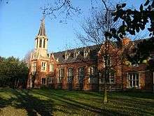
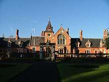
The King Edward VI Grammar School was on London Road, with the oldest part of the school buildings (opened in August 1857) designed by the noted Victorian architect Decimus Burton. The school motto was Ex Pulvere Palma. The school traced its foundation back to Thomas Gunthorpe of Babworth in 1519, although there are references to a still earlier school in the town. It was refounded around 1551 during the reign of King Edward VI. The school accepted boarders from at least the 17th century onwards, with the last boarders leaving in 1938. During the Second World War Retford took in over 6,000 evacuee children, including a number of boys from Great Yarmouth Grammar School who were evacuated to Retford (from 1940–44) and taught in classrooms at King Edward VI Grammar School. The school eventually became part of the Retford Oaks Academy, although the original Grade II listed buildings still exist on London Road.
Retford County High School for Girls has its origins in a meeting convened at the White Hart Hotel, Retford 'to consider the advisability of taking steps to establish a public High School for Girls in the district'. The prime instigator in the new project was the manager of the Westminster Bank, Mr. William Oakden, who in 1891 had moved from Nottingham to Retford. He and other like-minded people wanted to provide their daughters with some form of higher education. The school eventually found a site on the corner of Pelham Road and Queen Street, adjacent to the canal. The school educated around 400 girls in the 1950s to 1970s. In 1979 the secondary schools in Retford were reorganised and the 11+ abolished. Boys were to be admitted for the first time. The result was a comprehensive school called 'The Elizabethan High School' under head teacher Mrs Coxon-Butler. At this time the former Hallcroft Girls' secondary modern school on Hallcroft Road became the new school's Lower Site and the Retford Girls' High School became the school's Upper Site. The former Pelham Road/Queen Street site was demolished when the school moved to new buildings in Hallcroft and was renamed The Elizabethan Academy. The site is now a housing estate.
Notable Retfordians
- Anthony Perrinott Lysberg Barber, Baron Barber, PC (4 July 1920 – 16 December 2005), was a British Conservative politician who served as a member of both the House of Commons and the House of Lords, and Chancellor of the Exchequer 1970-4.
- Frank Bennett, recipient of the Military Medal in World War I
- Max Blagg poet.
- Frank Branston, (9 May 1939 – 14 August 2009), award-winning journalist and newspaper owner, also the first directly-elected mayor of Bedford.
- Ed Bulling (1889-1963), professional footballer
- John Cartwright (political reformer) was born in Marnham in the Retford rural district and later built The Revolution Mill in Retford.
- Thomas Clater painter.
- Doc Cox, went to the King Edward VI School.
- Robert Craufurd. Major General during Peninsular War and Member of Parliament for East Retford between 1802-06.[40]
- Anne Denman of Olde Hall West Retford married Sir Thomas Aylesbury, 1st Baronet and was the grandmother of Anne Hyde and great-grandmother of Queen Mary and Queen Anne.
- Percy Doe, soldier, recipient of the Military Medal in World War I.
- Fred Ede, recipient of the Distinguished Conduct Medal
- John Glasby novelist, chemist, mathematician.
- William Gleaden, recipient of the Military Medal, World War I
- Catherine Grace Frances Gore (Moody), novelist and playwright, was born in Retford, the daughter of a wine merchant, in 1799.
- George F. Hopkinson OBE, MC commanded the First Airborne Division in the World War II
- Philip Jackson, actor best known for his role as Chief Inspector Japp in the television series Agatha Christie's Poirot.
- John Kelsall, (31 July 1947 – 4 November 1986), British composer, conductor and lecturer.
- Liam Lawrence, football player for Sunderland AFC and the Republic of Ireland national football team.
- Ted Linley, footballer
- Arthur James Mason, clergyman, theologian and classical scholar
- Flt Lt Jim McCairns DFC, MM, pilot, grew up on Chapelgate, Retford and completed his education at King Edward VI Grammar School. He is commemorated by a Blue Plaque in Chapelgate.
- Samuel Milner, physicist.
- Derek Randall, cricketer who played first-class cricket for Nottinghamshire County Cricket Club and the English cricket team in the late 1970s and early 1980s. Started his playing career at Retford Cricket Club
- Frank Snowdin, recipient of the Distinguished Conduct Medal, World War I
- Frederick Stockdale, recipient of the Military Medal in World War I.
- John Taylor, English Publisher
- Sam Trickett, poker player.
- Russell Wainscoat, footballer
- John Warham, photographer
- Samuel Wright, nonconformist
Nearby places
Places adjacent to Retford | |
|---|---|
See also
References
- ↑ "Town population 2011". Retrieved 14 April 2016.
- ↑ Piercy, John Shadrach. The History of Retford. 1828. cited at Derivation of the Towns Name Updated 29 May 2003, accessed 17 June 2006.
- ↑ Stroud, J. Retford Extensive Urban Survey (2001 ed.).
- ↑ Marcombe, D. English Small Town Life – Retford 1520-1642 (1993 ed.).
- ↑ Arthur A Kidson. A History of East Retford Church (1905 ed.).
- ↑ Brown, Cornelius. History of Nottinghamshire (1896 ed.).
- ↑ Peck, James (1 May 2018). "'Eel pass' to help critically endangered species survive installed at Retford nature reserve". LincolnshireLive. Retrieved 27 June 2018.
- ↑ "Treswell Woods".
- ↑ "Villagers braced for more floods". BBC News. 28 June 2007. Retrieved 2008-05-04.
- ↑ "Gallery : Flooding in Notts". BBC News. Archived from the original on 30 November 2007. Retrieved 4 May 2008.
- ↑ C Moss (1908). East Retford and the Dukeries, A Handbook for Visitors and Residents.
- ↑ Stapleton, A (1912). A catalogue of Nottinghamshire Crosses.
- ↑ "Names on Retford War Memorial".
- ↑ restorethememorial.co.uk
- ↑ Names on Oak Boards in St Swithun's Church, commemorating dead of World War II
- ↑ title= St Saviour's War Memorial
- ↑ "Bassetlaw Outdoor War Memorials Survey" (PDF). Bassetlaw District Council. November 2015. Retrieved 28 June 2018.
- ↑ Pevner N. (1979), 2nd revised ed by Williamson E. ‘‘The Buildings of England: Nottinghamshire’’ pp. 296–7.
- ↑ Megan Doole Retford Town Hall
- 1 2 "Kings' Park In Retford". Bassetlaw District Council. Retrieved 25 June 2018.

- ↑ Nikolaus Pevsner. The Buildings of England: Nottinghamshire (1951 ed.). Penguin Books. p. 63.
- ↑ "Directory of Nottinghamshire, William White". 1853.
- ↑ C Moss. East Retford and the Dukeries, A Handbook for Visitors and Residents (1908 ed.).
- ↑ C Moss. East Retford and the Dukeries - A guide for visitors and residents (1908 ed.).
- ↑ Bill Bryson. Notes from a Small Island (1996 ed.). Black Swan. p. 188.
- ↑ Arthur A Kidson. A History of East Retford Church (1905 ed.).
- ↑ Arthur A Kidson. A History of East Retford Church (1905 ed.).
- ↑ "New scheme to reduce town's empty shopfronts". Retford Times. 2013-04-18. Retrieved 2016-04-01.
- ↑ "Retford bus station". Nottinghamshire County Council. Retrieved 2009-05-07.
- ↑ "Infrastructure 2008". UK Bus Awards. Retrieved 2009-05-07.
- ↑ "Retford Bus Station" (pdf). Nottinghamshire County Council. July 2007. Retrieved 2009-05-07.
- ↑ Richardson, Christine, Lower John (2010). Chesterfield Canal – A Richlow Guide. Richlow. ISBN 978-0-9552609-4-0
- ↑ retfordmarinersboatclub.co.uk
- ↑ majestictheatre.co.uk
- ↑ rlt.org.uk
- ↑ "Nottinghamshire History - Retford Election Scandal". 26 June 2018.
- ↑ Retford in Times Past, EL Ableson, page 17
- ↑ "25th Anniversary of Charter Day, Retford". 2015.
- ↑ st-swithuns.notts.sch.uk
- ↑ "Mr Charles Crauford". Hansard. Retrieved 2009-03-14.
External links
| Wikimedia Commons has media related to Retford. |
- Retford at Curlie (based on DMOZ)
- Chesterfield Canal History Archive
- List of histories of Retford by Ordsall Parish
| Unitary authorities | |
|---|---|
| Boroughs or districts | |
| Major settlements | |
| Topics | |