West Bridgford
| West Bridgford | |
|---|---|
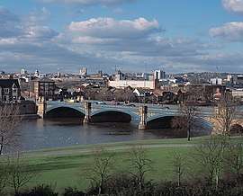 View of Trent Bridge and Nottingham from West Bridgford | |
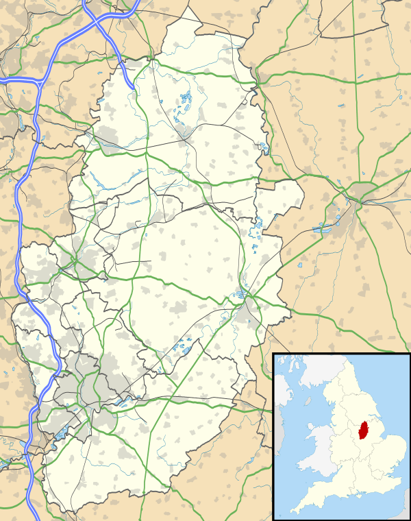 West Bridgford West Bridgford shown within Nottinghamshire | |
| Population | 47,109 (2011) |
| OS grid reference | SK 58733 37502 |
| District | |
| Shire county | |
| Region | |
| Country | England |
| Sovereign state | United Kingdom |
| Post town | NOTTINGHAM |
| Postcode district | NG2 |
| Dialling code | 0115 |
| Police | Nottinghamshire |
| Fire | Nottinghamshire |
| Ambulance | East Midlands |
| EU Parliament | East Midlands |
| UK Parliament | |
West Bridgford is a town in the Rushcliffe borough of Nottinghamshire, England, immediately south of the city of Nottingham, delimited by the River Trent. The population of the town at the 2011 census was 47,109.
It is part of the Rushcliffe constituency which is held by 'The Rt Hon Kenneth Clarke, QC', (Conservative Party). The headquarters of Nottinghamshire County Council has been located here since 1959.
History
Most of the main roads in central West Bridgford are named after wealthy families that dominated the town's early history. There are also, however, new developments that are, in effect, suburbs of the suburb named after different things. For example, the Gamston development has roads named after the Lake District, and Compton Acres has roads named after Dorset and the Purbeck Coast.
There are no 'Streets' in West Bridgford. When the town was being planned in the Victorian period, the roads were originally named as streets: for example, Musters Street and South Street. However, the planners eventually decided that the term 'Street' was too urban, so today the town has Musters Road and South Road.
West Bridgford is notably different from the other suburbs of Nottingham in a variety of ways. During the Victorian period, Nottingham was growing rapidly, but development in West Bridgford was restricted, as much of the land was owned by the Musters family.
At the end of the First World War, the Musters family sold the Trent Bridge Inn and the Trent Bridge Cricket ground to the cricket club. The club only briefly owned the inn as they resold it to a brewery for a sum in excess of the money they had paid to the Musters.[1] After much pressure, the Musters sold land for building, but they applied strict planning regulations to the area then known as the West Bridgford Estate. This estate was planned over a grid of tree-lined streets. The main roads, such as Musters Road, had restrictions on the density of housing and house size. All houses were specified to contain a certain number of bedrooms. Smaller houses were permitted on side streets, and terraces were erected on roads such as Exchange Road for the servants of the wealthy Nottingham merchants who bought property in West Bridgford.
What has resulted from these strict plans is a community that is still very separate from Nottingham. The town has no formal ties with Nottingham. In Nottingham itself, West Bridgford is often called "Bread and Lard Island" in the belief that its inhabitants spend most of their money on big houses and fur coats, so they can only afford to eat bread and lard at home.[2][3] Population:
- 1801 – 235
- 1851 – 258
- 1901 – 7,018
- 2001 – 43,395
- 2011 – 45,509
Public transport
Bus services
■ 1: Nottingham → Railway Station → Trent Bridge → West Bridgford (Wilford Lane) → NTU Clifton Campus → Clifton → Gotham → East Leake → Loughborough[4]
■ 1A: Nottingham → Railway Station → Trent Bridge → West Bridgford (Wilford Lane) → NTU Clifton Campus → Clifton[5]
■ 1B: Nottingham → Railway Station → Trent Bridge → West Bridgford (Wilford Lane) → NTU Clifton Campus → Clifton[6]
■ 3: Nottingham → Railway Station → West Bridgford (Wilford Lane) → Ruddington → Clifton (Farnborough Road, Southchurch Drive, Hartness Road)[7]
■ 4: NTU City Campus → Nottingham → Railway Station → Trent Bridge → West Bridgford (Wilford Lane) → NTU Clifton Campus[8]
■ 5: Nottingham → Railway Station → Trent Bridge → West Bridgford (Central Avenue) → Melton Road → Gamston[9]
■ 6: Nottingham → Railway Station → Trent Bridge → West Bridgford (Central Avenue) → Edwalton[10]
■ 7: Nottingham → Railway Station → Trent Bridge → West Bridgford (Central Avenue) → Abbey Park → Gamston[11]
■ 7B: Gamston → Abbey Park → West Bridgford (Central Avenue) → Trent Bridge[12]
■ 8: Nottingham → Railway Station → Trent Bridge → West Bridgford (Central Avenue) → Wilford Hill → Compton Acres[13]
■ 9: Nottingham → Railway Station → Trent Bridge → West Bridgford (Central Avenue) → Compton Acres → Wilford Hill[14]
■ 9B: Nottingham → Railway Station → Trent Bridge → West Bridgford (Central Avenue) → Compton Acres → Wilford Hill[15]
■ 10: Nottingham → Railway Station → Trent Bridge → West Bridgford (Loughborough Road) → Wilford Hill → Ruddington[16]
■ 10C: Nottingham → Railway Station → Trent Bridge → West Bridgford (Loughborough Road) → Wilford Hill → Ruddington → Rushcliffe Country Park[17]
■ 10X: Nottingham → Railway Station → Trent Bridge → West Bridgford (Loughborough Road) → Wilford Hill → Ruddington (Business Park)[18]
■ 11: Nottingham → Railway Station → Meadows → Trent Bridge → West Bridgford (Radcliffe Road) → Lady Bay[19]
■ 11C: Nottingham → Railway Station → Meadows → Trent Bridge → West Bridgford (Radcliffe Road) → Lady Bay → Water Sports Centre[20]
■ N4: NTU City Campus → Nottingham → Railway Station → Trent Bridge → West Bridgford (Wilford Lane) → NTU Clifton Campus[21]
■ N6: Nottingham → Railway Station → Trent Bridge → West Bridgford (Central Avenue) → Wilford Hill → Compton Acres → Loughborough Road[22]
■ the cotgrave: Nottingham → West Bridgford → Cotgrave[23]
■ the keyworth: Nottingham → West Bridgford (Melton Road) → Keyworth[24]
■ mainline: Nottingham → West Bridgford → Radcliffe → Bingham [25]
■ rushcliffe villager: Nottingham → West Bridgford → Radcliffe → Shelford → Gunthorpe → East Bridgford → Newton → Bingham [26]
- Nottingham Community Transport
■ L1: Nottingham → Railway Station → Trent Bridge → West Bridgford (Wilford Lane) → Wilford Village → Silverdale → Clifton[27]
■ L22: Gamston → West Bridgford → Ruddington → Clifton[28]
■ L23: Gamston → Clifton → Ruddington → West Bridgford[29]
■ 9: Nottingham → Trent Bridge → West Bridgford (Loughborough Road) → Ruddington → Bradmore → Bunny → Costock → Rempstone → Hoton → Cotes → Loughborough[30]
■ 19: Nottingham → West Bridgford (Melton Road) → Tollerton → Stanton-on-the-Wolds → Nether Broughton → Melton Mowbray[31]
- Marshalls
■ 90: Nottingham → Trent BridgeWest Bridgford (Radcliffe Road) → Radcliffe → Farndon → Newark[32]
■ 90A: Nottingham → Trent BridgeWest Bridgford (Radcliffe Road) → Radcliffe → Farndon → Newark → Balderton[33]
- Nottsbus Connect
■ 822: Nottingham → West Bridgford (Central Avenue) → Gamston → Tollerton → Cotgrave → Cropwell Bishop → Langar → Barnstone → Granby → Elton → Orston → Aslockton → Bingham[34]
West Bridgford UDC ran its own fleet of buses with brown and yellow livery, it merged with Nottingham City Transport in 1968.
Bridges
Four bridges across the River Trent allow access to the city of Nottingham. The access to Nottingham has been an aspect of the popularity of West Bridgford as a suburb.
Trent bridge A road bridge with three lanes in both directions. It is highly decorated on the sides with carvings that can be seen from the river. In 2017 the bridge was fitted with permanent steel safety barriers at pavement level for the protection of pedestrians arriving and departing from major sporting events.
A bicycle and pedestrian bridge to the west of Trent Bridge, linking the town with The Meadows, Nottingham.
Since August 2015 this bridge carries part of the tram route (Nottingham Express Transit) connecting Clifton, Nottingham, Ruddington and Compton Acres suburb of West Bridgford to the centre of Nottingham and beyond. The small suburb of Silverdale is served by the adjacent ring road. The tram passes by the Becket school and travels through Compton Acres into Clifton.
A two-lane road bridge, originally the rail crossing for the Midland Railway's "alternative route" from London to Nottingham via Melton Mowbray. Despite passing right through the middle of West Bridgford, mostly on a high embankment, there was never a West Bridgford station: the nearest station on this line was at Edwalton, and even that closed in July 1941, the line itself in May 1967. Today much of the embankment has been removed and its route built over, however part of the line's embankment has been converted into a public footpath. As a result, parts of railway sleepers and stones can still be seen on the path.
Local government
There is no town or parish council.
West Bridgford was created as an urban sanitary district in 1891. It became an urban district with an elected council under the Local Government Act 1894. In 1935, the parishes of Edwalton and South Wilford were added to the urban district. This then became part of the larger borough of Rushcliffe under the Local Government Act 1972.
Geography
The northern boundary of West Bridgford is the River Trent, spanned by two road bridges, Trent Bridge and Lady Bay Bridge, and two pedestrianised bridges consisting of a suspension bridge and a toll bridge near the Ferry Inn linking nearby Wilford village with the Meadows area of Nottingham city. The pedestrianised bridges link particularly well with cycling routes to Nottingham, the railway station and the university areas, making several rapid, safe, car-free routes available.
Two spans of the original mediaeval bridge still remain, surrounded by a traffic island on the south side of the river, adjacent to Trent Bridge.
Architecture and housing
The central West Bridgford area has a rich diversity of buildings, mostly Victorian, although the larger properties are being demolished for development as no protection exists for common housing stock. St. Giles Church is medieval but heavily restored at the end of the nineteenth century.
- Sharphill housing development
Work has started on the development of 1600 houses at Sharphill and Edwalton/Tollerton triangle.
Neighbourhoods
Nearby places
- Nottingham to the north
- Holme Pierrepont to the north‐east
- Gamston to the south‐east
- Edwalton to the south
- Clifton to the south‐west
- Wilford to the north‐west
Sport
Nottingham Forest Football Club play at the City Ground on the banks of the River Trent. The club was founded in 1865 and have played at the City Ground since 1898. Between 1975 and 1993 they were managed by Brian Clough and won a Football League title, two European Cups and four Football League Cups as well as fielding players Peter Shilton, Trevor Francis, Stuart Pearce and Roy Keane.
At local level, West Bridgford also has a number of football teams for all ages. West Bridgford Colts FC are the largest FA approved football organisation in the country, running over 90 teams; the club includes West Bridgford Football Club the Senior section for Colts, which started in 2011 on Saturday afternoons in the Nottinghamshire Senior League.
Trent Bridge cricket ground was first used for cricket in 1838 and hosted its first Test match in 1899, for England playing against Australia. It is the third oldest ground to be used as a Test cricket venue after Lord's in London and Eden Gardens in Calcutta, India.
Trent Bridge is also home to Nottinghamshire County Cricket Club, a first-class English cricket club.
The Holme Pierrepont National Watersports Centre is Britain's centre for water sports and is located in Holme Pierrepont, next to West Bridgford. Its facilities include a regatta lake, a white water slalom and water‐ski jumps. West Bridgford also hosts two rowing clubs, Nottingham Rowing Club and Nottingham and Union Rowing Club, and a rowing shell manufacturers, Raymond Sims Ltd. Several of the town's secondary schools have rowing activities on their curriculum.
West Bridgford is home to a number of Rugby Clubs, Nottingham Moderns R.F.C in Wilford village and West Bridgford Rugby Club. Nottingham R.F.C moved their training base and reserve team ground to Lady Bay following the 2005/6 season in Ireland Road Beeston. They currently play 1st team fixtures at Meadow Lane, just over Trent Bridge from West Bridgford.
West Bridgford Hockey Club is located on Loughborough Road and was the childhood hockey club of Olympic Gold medalist, and former West Bridge resident, Helen Richardson-Walsh
Retail
West Bridgford has a place in British retail history as the location of the UK's first major out-of-town shopping development. In 1964, an American company called GEM opened a store on Loughborough Road. However, despite ambitious expansion plans, GEM's British operations were not a success, with only two other stores (at Cross Gates, Leeds) and Cliff Mill, Dundonald Street, Preston being opened. National concessionaires withdrew from the stores and, in 1966, the fledgeling Asda company (then known as 'Associated Dairies') of Leeds acquired a controlling interest in the GEM operations. The Loughborough Road site still houses a major Asda store, although it was resited and rebuilt some years ago. (For a fuller history of the site and GEM, see Whysall (2005) in The International Review of Retail Distribution and Consumer Research, 15(2), 111–124).
Plans for both a Waitrose and Sainbsury's superstores were abandoned in 2018.
Many high street businesses have closed down in the last five years, like others across the UK.
In 2018 Rushcliffe Borough Council appointed a team of commissioners to recommend improvements and changes to the town, these included better design of roads with landscaping points to improve the movement of people from Gordon Road through to Central Avenue. Both of these roads have independent retailers and national chains.
Other proposals from the reports include moving Bridgford Road car park underground and putting retail space at ground level.
Education
The secondary schools are both academies in West Bridgford, the West Bridgford School and Rushcliffe School respectively. The Becket School is a local Catholic school, although in a separate Local Authority from West Bridgford, as is The Emmanuel School, a local C of E school.
The Becket School is fed by primary schools around Nottingham but only one school in West Bridgford; this school is St. Edmund Campion Catholic Primary School. The feeder schools are; Blessed Robert, St Edmund Campion, Our Lady and St Edward's.
The main primary schools in West Bridgford feed into the West Bridgford School. They are West Bridgford Infants and Junior School, Abbey Road Primary School, Jesse Gray Primary School, Heymann Primary School and Greythorn Primary School.
Local facilities
- Rushcliffe Arena extended in 2017 with swimming pool, gym and now the offices of Rushcliffe Borough Council.
- West Bridgford Young People's Centre - adjacent to the library, houses a music studio, dance studio and other activities
- West Bridgford Library
- Bridgford Park
- The Studio Theatre – home of West Bridgford Dramatic Society. The only registered public theatre in Rushcliffe/West Bridgford.
Notable residents
- Ellie Brazil, England under 19 and Fiorentina association footballer, born in the town
- Stuart Broad, England and Nottinghamshire cricketer.
- The Rt Hon Kenneth Clarke, QC MP was born in and lives in West Bridgford and has represented it as part of the Rushcliffe constituency since 1970, making him Father of the House.
- Leslie Crowther, born 6 February 1933.
- Helen Richardson-Walsh, the hockey Olympic Gold medalist grew up in West Bridgford.
- Harry Wheatcroft, the famous rose grower lived in West Bridgford.
- Beth Sheil, England and Nottinghamshire model.
References
- ↑ Wynne-Thomas, Peter. "A Brief History of Trent Bridge". espncricinfo.com. Retrieved 21 April 2013.
- ↑ http://money.independent.co.uk/property/homes/article354181.ece
- ↑ "Locale West Bridgford - The Open Guide to Nottingham". 14 October 2006. Archived from the original on 14 October 2006.
- ↑ wearebase.com, Base,. "Service 1 on Navy Line". www.nctx.co.uk.
- ↑ wearebase.com, Base,. "Service 1A on Navy Line". www.nctx.co.uk.
- ↑ wearebase.com, Base,. "Service 1B on Navy Line". www.nctx.co.uk.
- ↑ wearebase.com, Base,. "Service 3 on Navy Line". www.nctx.co.uk.
- ↑ wearebase.com, Base,. "Service 4 on Navy Line". www.nctx.co.uk.
- ↑ wearebase.com, Base,. "Service 5 on Green Line". www.nctx.co.uk.
- ↑ wearebase.com, Base,. "Service 6 on Green Line". www.nctx.co.uk.
- ↑ wearebase.com, Base,. "Service 7 on Green Line". www.nctx.co.uk.
- ↑ wearebase.com, Base,. "Service 7B on Green Line". www.nctx.co.uk.
- ↑ wearebase.com, Base,. "Service 8 on Green Line". www.nctx.co.uk.
- ↑ wearebase.com, Base,. "Service 9 on Green Line". www.nctx.co.uk.
- ↑ wearebase.com, Base,. "Service 9B on Green Line". www.nctx.co.uk.
- ↑ wearebase.com, Base,. "Service 10 on Green Line". www.nctx.co.uk.
- ↑ wearebase.com, Base,. "Service 10C on Green Line". www.nctx.co.uk.
- ↑ wearebase.com, Base,. "Service 10C on Green Line". www.nctx.co.uk.
- ↑ wearebase.com, Base,. "Service 11 on Green Line". www.nctx.co.uk.
- ↑ wearebase.com, Base,. "Service 11C on Green Line". www.nctx.co.uk.
- ↑ wearebase.com, Base,. "Service N4 on Navy Line". www.nctx.co.uk.
- ↑ wearebase.com, Base,. "Service N6 on Green Line". www.nctx.co.uk.
- ↑ wearebase.com, Base,. "The cotgrave service ran by Trentbarton". www.trentbarton.co.uk.
- ↑ wearebase.com, Base,. "The keyworth service ran by Trentbarton". www.trentbarton.co.uk.
- ↑ wearebase.com, Base,. "The mainline service ran by Trentbarton". www.trentbarton.co.uk.
- ↑ wearebase.com, Base,. "The rushcliffe villager service ran by Trentbarton". www.trentbarton.co.uk.
- ↑ wearebase.com, Base,. "Locallink service L1 ran by Nottingham Community Transport" (PDF). www.trentbarton.co.uk.
- ↑ wearebase.com, Base,. "Locallink service L22 ran by Nottingham Community Transport" (PDF). www.trentbarton.co.uk.
- ↑ wearebase.com, Base,. "Locallink service L23 ran by Nottingham Community Transport" (PDF). www.trentbarton.co.uk.
- ↑ wearebase.com, Base,. "Service 9 ran by Kinchbus". www.kinchbus.co.uk.
- ↑ wearebase.com, Base,. "Service 19 ran by Centrebus" (PDF). http://www.centrebus.info/Pages/default.aspx. External link in
|website=(help) - ↑ wearebase.com, Base,. "Fosseway Flyer service 90 ran by Marshalls" (PDF). http://www.marshallscoaches.co.uk/. External link in
|website=(help) - ↑ wearebase.com, Base,. "Service 90A ran by Marshalls" (PDF). http://www.marshallscoaches.co.uk/. External link in
|website=(help) - ↑ wearebase.com, Base,. "Service 822 ran by Nottsbus" (PDF). http://www.nottinghamshire.gov.uk/. External link in
|website=(help)
External links
- Rushcliffe Borough Council
- https://westbridgfordwire.com West Bridgford has its own independent online news website, launched in 2012.