Dub, Arkansas
| Dub, Arkansas | |
|---|---|
| Unincorporated community | |
 Dub, Arkansas  Dub, Arkansas | |
| Coordinates: 35°31′20″N 90°21′27″W / 35.52222°N 90.35750°WCoordinates: 35°31′20″N 90°21′27″W / 35.52222°N 90.35750°W | |
| Country | United States |
| State | Arkansas |
| County | Poinsett |
| Elevation | 217 ft (66 m) |
| Time zone | UTC-6 (Central (CST)) |
| • Summer (DST) | UTC-5 (CDT) |
| Area code(s) | 870 |
| GNIS feature ID | 57680[1] |
Dub is an unincorporated community in Poinsett County, Arkansas, United States. Dub is located along gravel roads, 3.6 miles (5.8 km) east of Marked Tree.[2]
References
- ↑ "Dub". Geographic Names Information System. United States Geological Survey.
- ↑ Poinsett County, Arkansas General Highway Map (PDF) (Map). Arkansas State Highway and Transportation Department. 2009. Retrieved September 19, 2012.
Municipalities and communities of Poinsett County, Arkansas, United States | ||
|---|---|---|
| Cities | 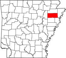 | |
| Town | ||
| Unincorporated communities | ||
This article is issued from
Wikipedia.
The text is licensed under Creative Commons - Attribution - Sharealike.
Additional terms may apply for the media files.