Drysdale River
| Drysdale River | |
|---|---|
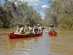 A canoeing expedition on the Drysdale River. | |
| Country | Australia |
| Physical characteristics | |
| Main source |
Caroline Ranges 329 metres (1,079 ft)[1] |
| River mouth |
Napier Broome Bay sea level |
| Length | 432 kilometres (268 mi)[2] |
| Discharge |
|
| Basin features | |
| Basin size | 26,019 square kilometres (10,046 sq mi)[4] |
Drysdale River is a river in the Kimberley region of Western Australia.
The river rises in the Caroline Ranges, flows in a northerly direction and discharges into Napier Broome Bay near Kalumburu. The river contains several permanent pools some of which have several examples of Indigenous Australian art known as Bradshaw paintings that can be found along the cliff faces.[5]
Notable waterfalls on the river are the Eagle Falls - which are regularly visited by Kimberley coastal cruise ships,[6] Solea Falls north of the Johnston Creek fork and Bango Falls on the tributary Bango Creek.
There are 19 tributaries of the Drysdale including; Gibb River, Woodhouse River, Barton River, Tadarida Creek, Wax Creek, Curlew Creek, King David Creek, Ubach Creek and Damper Creek.
15% of the river's catchment area lies within Drysdale River National Park.[7]
The river was named after the Director of a Victorian Squatting Company T.A. Drysdale by explorer Charles Burrowes in 1886.
The traditional owners of the area that the river flows through are the Ngarinjin, Miwa and Wilawila peoples.[8]
References
- ↑ "Bonzle Digital Atlas - Map of Drysdale River, WA". 2008. Retrieved 16 December 2008.
- ↑ Western Australian Land Information Authority. "History of river names". Archived from the original on 16 February 2015. Retrieved 16 December 2008.
- ↑ "Department of Water - Water Resources Data - Streamflow Sites- Drysdale River Solea Falls". 2008. Retrieved 16 December 2008.
- ↑ "Australian Natural Resource Atlas - Landscape - carbon, nutrients, water and productivity - Drysdale River". 2007. Archived from the original on 4 August 2008. Retrieved 16 December 2008.
- ↑ "Bradshaw Foundation - Rock Art Archives". 2010. Retrieved 2 July 2011.
- ↑ http://www.australiaforeveryone.com.au/places_kimberley_falls.htm
- ↑ "National Water commission - Regional Water Resource Assessment - Drysdale River". 2005. Archived from the original on 27 July 2008. Retrieved 16 December 2008.
- ↑ "AusAnthrop Australian Aboriginal tribal database". 2009. Archived from the original on 30 May 2008. Retrieved 30 April 2012.
Coordinates: 13°56′17″S 126°48′55″E / 13.93806°S 126.81528°E
Rivers of Western Australia | |
|---|---|
| Rivers of the Gascoyne region | |
| Rivers of the Goldfields-Esperance region | |
| Rivers of the Great Southern region | |
| Rivers of the Kimberley region |
|
| Rivers of the Mid West region | |
| Rivers of the Peel and Perth regions | |
| Rivers of the Pilbara region | |
| Rivers of the South West region | |
| Rivers of the Wheatbelt region | |
| |