Carson River (Western Australia)
| Carson River | |
|---|---|
| Country | Australia |
| Physical characteristics | |
| Main source |
below Foster Range 300 metres (984 ft)[1] |
| River mouth |
King Edward River 36 metres (118 ft) |
| Length | 155 kilometres (96 mi) |
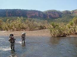
The Carson River is a river in the Kimberley of Western Australia.
The headwaters of the river rise at the base of the Foster Range near the southwestern edge of the Drysdale River National Park. The river flows in a northerly direction along the Carson Escarpment and discharges into the King Edward River near Aragoon, about 12 kilometres (7 mi) south of Kalumburu.
The river has four tributaries, including Morgan River, Swida Creek and Pronga-Marie Creek. The river was named in 1886 by the explorer Charles Burrowes while surveying the area for the Victoria Squatting Company. He named it after a director of the company, David Carson.[2] The river contains several permanent pools where examples of Indigenous Australian art known as Bradshaw paintings can be found along the cliff faces.[3]
The traditional owners of the areas around the river are the Wilawila, Miwa and Wunambal peoples.[4]
References
- ↑ "Bonzle Digital Atlas – Map of Carson River". 2009. Retrieved 12 March 2009.
- ↑ Western Australian Land Information Authority. "History of river names". Archived from the original on 16 February 2015. Retrieved 3 September 2011.
- ↑ "Bradshaw Foundation - Rock Art Archives". 2010. Retrieved 2 July 2011.
- ↑ "Ausanthrop - Australian Aboriginal tribal database". 2012. Archived from the original on 27 September 2015. Retrieved 30 April 2012.
Coordinates: 14°25′59″S 126°38′04″E / 14.43306°S 126.63444°E
Rivers of Western Australia | |
|---|---|
| Rivers of the Gascoyne region | |
| Rivers of the Goldfields-Esperance region | |
| Rivers of the Great Southern region | |
| Rivers of the Kimberley region |
|
| Rivers of the Mid West region | |
| Rivers of the Peel and Perth regions | |
| Rivers of the Pilbara region | |
| Rivers of the South West region | |
| Rivers of the Wheatbelt region | |
| |