Drumballyhagan
| Drumballyhagan | |
|---|---|
| Irish transcription(s) | |
| • Derivation: | Droim Bhaile Uí Ágáin |
| • Meaning: | "Ridge of O'Hagan's townland" |
 | |
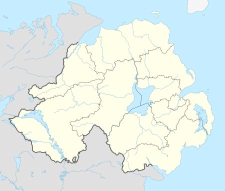 Drumballyhagan Drumballyhagan shown within Northern Ireland | |
| Coordinates: 54°49′26″N 6°42′50″W / 54.824°N 6.714°WCoordinates: 54°49′26″N 6°42′50″W / 54.824°N 6.714°W | |
| Country | Northern Ireland |
| County | County Londonderry |
| Barony | Loughinsholin |
| Civil parish | Kilcronaghan |
| Plantation grant | Vintners Company |
| First recorded | 1609 |
| Government | |
| • Council | Mid Ulster District |
| • Ward | Tobermore |
| Area[1] | |
| • Total | 129.73 ha (320.57 acres) |
| Irish grid ref | H8298 |
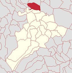
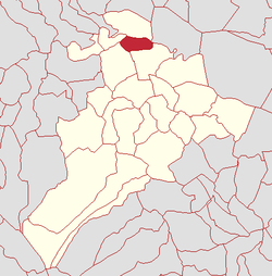
Drumballyhagan and Drumballyhagan Clark (locally [ˌdrӧmˌbaliˈhaɡən], from Irish Droim Bhaile Uí Ágáin, meaning 'ridge of O'Hagans townland'[2]) are two townlands lying within the civil parish of Kilcronaghan, County Londonderry, Northern Ireland. Situated in the north of the parish, the two townlands are separated by the Moyola River, of which the southern portion was held by a person surnamed "Clark".[3] Together they are bounded by the townlands of; Ballynahone Beg, Bracaghreilly, Drumcrow, Fallagloon, Lisnamuck, Moneyshanere, and Tobermore. It was apportioned to the Vintners company.[3]
| Drumballyhagan Clarke | |
|---|---|
 | |
| Area[1] | |
| • Total | 48.94 ha (120.93 acres) |
| Irish grid ref | H8297 |
The townland was part of Tobermore electoral ward of the former Magherafelt District Council, however in 1926 it was part of Tobermore district electoral division as part of the Maghera division of Magherafelt Rural District.[4] It was also part of the historic barony of Loughinsholin.[3]
Etymology
This townland derives its name from the O'Hagan's, one of the principal Irish families in the barony of Loughinsholin. They occupied a castle in the nearby townland of Calmore and the surname was common in the neighbouring parishes of Desertmartin and Ballynascreen.[2]
History
Table legend
- (D) - Drumballyhagan
- (DC) - Drumballyhagan Clarke
|
|
| |||||||||||||||||||||||||||||||||||||||||||||||||||||||||||||||||
See also
References
- 1 2 Northern Ireland Environment Agency. "NIEA Map Viewer". Archived from the original on 24 November 2011. Retrieved 27 January 2012.
- 1 2 3 Toner, Gregory: Place-Names of Northern Ireland, page 120-121. Queen's University of Belfast, 1996, ISBN 0-85389-613-5
- 1 2 3 Notes on the Place Names of the Parishes and Townlands of the County of Londonderry, 1925, Alfred Moore Munn, Clerk of the Crown and Peace of the City and County of Londonderry
- 1 2 3 4 5 6 7 8 HistPop; County and County Borough of Londonderry, 1926, page 27
- 1 2 3 4 5 6 7 8 9 10 11 HistPop; Area, population and number of houses, Vol. III, Ireland, 1881, page 698
- 1 2 3 4 5 6 HistPop; Area, houses, and population, Vol. III [Part 2], Ireland, 1901 Page 35
- 1 2 HistPop; County of Londonderry, 1851, page 241
- ↑ Place Names NI - Drumballyhagan
