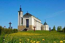
Domeikava
| Domeikava | ||
|---|---|---|
| Village | ||
 | ||
| ||
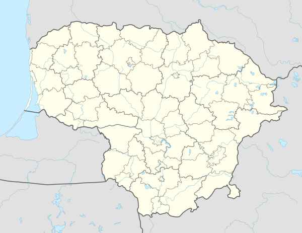 Domeikava Location of Domeikava | ||
| Coordinates: 54°58′0″N 23°55′10″E / 54.96667°N 23.91944°ECoordinates: 54°58′0″N 23°55′10″E / 54.96667°N 23.91944°E | ||
| Country |
| |
| Ethnographic region | Aukštaitija | |
| County |
| |
| Municipality | Kaunas district municipality | |
| Eldership | Domeikava eldership | |
| Capital of | Domeikava eldership | |
| Population (2011) | ||
| • Total | 5,006 | |
| Time zone | UTC+2 (EET) | |
| • Summer (DST) | UTC+3 (EEST) | |

Domeikava is a village in the Kaunas district municipality, located 8 km (5.0 mi) northwest of Kaunas. Area surrounding Domeikava has some of Lithuania's most fertile and productive soil[1]
Domeikavos Gimnazija, established in early 1920s is the primary high school in the local area with students coming from all nearby villages. Another school, Kauno šv. Kazimiero progimnazija (primary and middle-school) is just outside Domeikava village borders.
According to the 2011 census, the village had a population of 5,006 people.[2]. By 2017, Domeikava eldership reached a population of 8820[3], the increase largely driven by construction of new houses and apartments which attract inhabitants from other areas.
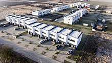 One of the new house complexes in Domeikava
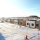 One of the new house complexes in Domeikava
 A family house in Domeikava, designed by architect Natkevičius
| Wikimedia Commons has media related to Domeikava. |
References
- ↑ "Archived ŽUM fertility map". access via ŽUM, Žemės Ūkio Ministerija. Archived from the original on September 8, 2017. Retrieved September 9, 2017.
- ↑ "2011 census". Statistikos Departamentas (Lithuania). Retrieved August 21, 2017.
- ↑ "Domeikava population in 2017". Domeikava eldership. Archived from the original on June 21, 2015. Retrieved September 9, 2017.
This article is issued from
Wikipedia.
The text is licensed under Creative Commons - Attribution - Sharealike.
Additional terms may apply for the media files.