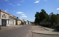
Ariogala
| Ariogala | ||
|---|---|---|
| City | ||
 | ||
| ||
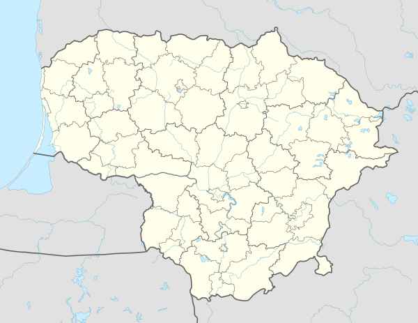 Ariogala Location of Ariogala | ||
| Coordinates: 55°16′0″N 23°28′0″E / 55.26667°N 23.46667°ECoordinates: 55°16′0″N 23°28′0″E / 55.26667°N 23.46667°E | ||
| Country |
| |
| Ethnographic region | Samogitia | |
| County |
| |
| Municipality | Raseiniai district municipality | |
| Eldership | Ariogala eldership | |
| Capital of | Ariogala eldership | |
| First mentioned | 1253 | |
| Granted city rights | 1792 | |
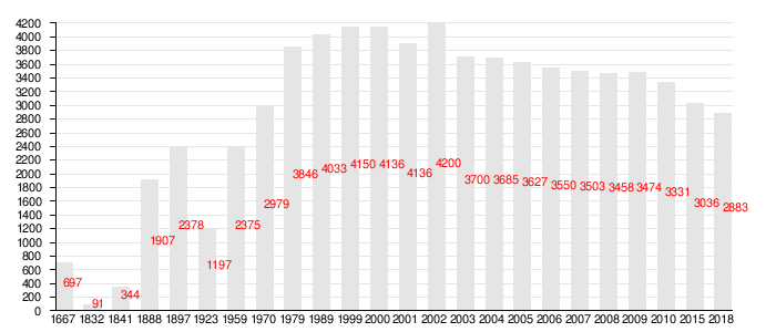
| Population (2009) | ||
| • Total | 3,376 | |
| Time zone | UTC+2 (EET) | |
| • Summer (DST) | UTC+3 (EEST) | |
Ariogala (![]()
Population
Name
Ariogala is the Lithuanian name of the city. Versions of the name in other languages include Samogitian: Ariuogala, Polish: Ejragoła, Russian: Эйрагола Eiragola, Belarusian: Эйрагола Eirahola, Yiddish: אייראַגאָלע Eyragole.
History
In 1941 all the Jews from Ariogala and some nearby villages were gathered in a ghetto.[1] At the end of August/beginning of September 1941, around 700 Jewish men, women and children were shot in a field near the village.
References
Notes
- (in Lithuanian) Gyventojų skaičius metų pradžioje (Population statistics). Lithuanian Department of Statistics.
- Geographical data. administrative territorial division. Lithuanian Department of Statistics.
| Wikimedia Commons has media related to Ariogala. |
| Authority control |
|---|
This article is issued from
Wikipedia.
The text is licensed under Creative Commons - Attribution - Sharealike.
Additional terms may apply for the media files.