Dixon, Missouri
| Dixon, Missouri | |
|---|---|
| City | |
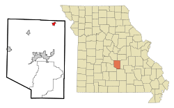 Location of Dixon, Missouri | |
| Coordinates: 37°59′43″N 92°5′46″W / 37.99528°N 92.09611°WCoordinates: 37°59′43″N 92°5′46″W / 37.99528°N 92.09611°W | |
| Country | United States |
| State | Missouri |
| County | Pulaski |
| Area[1] | |
| • Total | 1.01 sq mi (2.62 km2) |
| • Land | 1.01 sq mi (2.62 km2) |
| • Water | 0 sq mi (0 km2) |
| Elevation | 1,168 ft (356 m) |
| Population (2010)[2] | |
| • Total | 1,549 |
| • Estimate (2016)[3] | 1,472 |
| • Density | 1,500/sq mi (590/km2) |
| Time zone | UTC-6 (Central (CST)) |
| • Summer (DST) | UTC-5 (CDT) |
| ZIP code | 65459 |
| Area code(s) | 573 |
| FIPS code | 29-19630[4] |
| GNIS feature ID | 0749667[5] |
Dixon is a city in Pulaski County, Missouri, United States. The population was 1,549 at the 2010 census.
History
Dixon was platted in 1869 at the time the railroad was extended to through the neighborhood.[6] A post office called Dixon has been in operation since 1869.[7] The community takes its name from Dixon, Illinois, the native home of a share of the railway builders.[6]
Geography
Dixon is located at 37°59′43″N 92°5′46″W / 37.99528°N 92.09611°W (37.995273, -92.095979).[8]
According to the United States Census Bureau, the city has a total area of 1.01 square miles (2.62 km2), all of it land.[1]
Demographics
| Historical population | |||
|---|---|---|---|
| Census | Pop. | %± | |
| 1890 | 404 | — | |
| 1900 | 500 | 23.8% | |
| 1910 | 715 | 43.0% | |
| 1920 | 810 | 13.3% | |
| 1930 | 721 | −11.0% | |
| 1940 | 741 | 2.8% | |
| 1950 | 988 | 33.3% | |
| 1960 | 1,473 | 49.1% | |
| 1970 | 1,387 | −5.8% | |
| 1980 | 1,402 | 1.1% | |
| 1990 | 1,585 | 13.1% | |
| 2000 | 1,570 | −0.9% | |
| 2010 | 1,549 | −1.3% | |
| Est. 2016 | 1,472 | [3] | −5.0% |
| U.S. Decennial Census[9] | |||
2010 census
As of the census[2] of 2010, there were 1,549 people, 645 households, and 363 families residing in the city. The population density was 1,533.7 inhabitants per square mile (592.2/km2). There were 738 housing units at an average density of 730.7 per square mile (282.1/km2). The racial makeup of the city was 94.5% White, 0.9% African American, 0.3% Native American, 0.6% Asian, 0.9% Pacific Islander, 0.5% from other races, and 2.3% from two or more races. Hispanic or Latino of any race were 4.7% of the population.
There were 645 households of which 30.9% had children under the age of 18 living with them, 38.9% were married couples living together, 13.2% had a female householder with no husband present, 4.2% had a male householder with no wife present, and 43.7% were non-families. 38.4% of all households were made up of individuals and 17% had someone living alone who was 65 years of age or older. The average household size was 2.33 and the average family size was 3.10.
The median age in the city was 38.3 years. 25.7% of residents were under the age of 18; 8% were between the ages of 18 and 24; 23.8% were from 25 to 44; 25.2% were from 45 to 64; and 17.2% were 65 years of age or older. The gender makeup of the city was 46.8% male and 53.2% female.
2000 census
As of the census[4] of 2000, there were 1,570 people, 667 households, and 414 families residing in the city. The population density was 1,545.8 people per square mile (594.3/km²). There were 751 housing units at an average density of 739.4 per square mile (284.3/km²). The racial makeup of the city was 96.05% White, 0.06% African American, 0.57% Native American, 1.02% Asian, 0.45% Pacific Islander, 1.02% from other races, and 0.83% from two or more races. Hispanic or Latino of any race were 2.04% of the population.
There were 667 households out of which 32.2% had children under the age of 18 living with them, 44.5% were married couples living together, 14.1% had a female householder with no husband present, and 37.8% were non-families. 33.6% of all households were made up of individuals and 18.6% had someone living alone who was 65 years of age or older. The average household size was 2.28 and the average family size was 2.91.
In the city the population was spread out with 25.4% under the age of 18, 8.5% from 18 to 24, 25.5% from 25 to 44, 18.5% from 45 to 64, and 22.2% who were 65 years of age or older. The median age was 38 years. For every 100 females there were 79.0 males. For every 100 females age 18 and over, there were 75.6 males.
The median income for a household in the city was $21,821, and the median income for a family was $28,693. Males had a median income of $21,667 versus $17,115 for females. The per capita income for the city was $12,405. About 21.3% of families and 23.5% of the population were below the poverty line, including 37.6% of those under age 18 and 12.9% of those age 65 or over.
Transportation
Major north-south routes near Dixon include:
- Route 133 runs north from Interstate 44 exit 145 about two miles east of Hazelgreen to Richland, Swedeborg, Crocker, and about two miles west of Dixon, then north out of the county.
- Route 28 begins at Interstate 44 exit 163 at the eastern edge of St. Robert, runs north through Dixon, and then runs north out of the county.
- A secondary road parallels Route 28, beginning as Highway Y at exit 161 of Interstate 44 in St. Robert, running north to the Gasconade River bridge where it becomes the county-maintained Cave Road and turning north as Highway O until it meets Route 28 about a mile south of Dixon.
Notable people
- John Brown, former professional basketball player, attended Dixon High School
- David A. Day, Missouri state legislator, resides in Dixon. Day served in the Missouri House of Representatives from 2005-2012 and served as Chairman of the House Veterans Committee.
References
- 1 2 "US Gazetteer files 2010". United States Census Bureau. Archived from the original on 2012-07-14. Retrieved 2012-07-08.
- 1 2 "American FactFinder". United States Census Bureau. Retrieved 2012-07-08.
- 1 2 "Population and Housing Unit Estimates". Retrieved June 9, 2017.
- 1 2 "American FactFinder". United States Census Bureau. Archived from the original on 2013-09-11. Retrieved 2008-01-31.
- ↑ "US Board on Geographic Names". United States Geological Survey. 2007-10-25. Retrieved 2008-01-31.
- 1 2 "Pulaski County Place Names, 1928–1945". The State Historical Society of Missouri. Archived from the original on June 24, 2016. Retrieved November 27, 2016.
- ↑ "Post Offices". Jim Forte Postal History. Retrieved 10 December 2016.
- ↑ "US Gazetteer files: 2010, 2000, and 1990". United States Census Bureau. 2011-02-12. Retrieved 2011-04-23.
- ↑ "Census of Population and Housing". Census.gov. Archived from the original on May 12, 2015. Retrieved June 4, 2015.
External links
- Historic maps of Dixon in the Sanborn Maps of Missouri Collection at the University of Missouri
Municipalities and communities of Pulaski County, Missouri, United States | ||
|---|---|---|
| Cities | 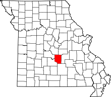 | |
| Townships | ||
| CDP | ||
| Unincorporated communities | ||
| Ghost towns | ||
| Footnotes | ‡This populated place also has portions in an adjacent county or counties | |