Devils Elbow, Missouri
.jpg)
Devils Elbow, Missouri is an unincorporated community in Pulaski County on historic U.S. Highway 66. It is situated on the Big Piney River and is named for a particularly bad place in the river known as a "devil of an elbow". The community is about five miles (8 km) east of St. Robert. The floods of May 2017 destroyed much of the historic area, including the post office, but it is in the process of being rebuilt.
History
A post office called Devils Elbow was in use from 1927 untll the floods in May 2017. The first Postmaster was Dwight Rench, who with his two sons built the Devils Elbow Café, from stone taken from the bluff along the river. It became known as the HideAway in the 1950s. Several cabins were also built for fishermen who would come to fish the river.[1] The community took its name from a nearby meander on the Big Piney River.[2]
Transportation
The major east-west route is Interstate 44; before that, the main highway was U.S. Route 66, which still exists as a scenic route through the area and passes through Devil's Elbow, St. Robert, Waynesville, Buckhorn, and Hazelgreen. Names for U.S. Route 66 vary - at different places, it is called Teardrop Road, Highway Z, Old Route 66, Historic Route 66, and Highway 17. State-posted signs mark most of the alignment of the road.
The original alignment of Route 66, now known as Teardrop Road, runs through Devil's Elbow and is the site of the historic Devil's Elbow Bridge.[3] A later realignment, Highway Z, runs near Devil's Elbow and bypasses the community.
Three bridges cross the Big Piney River at Devils Elbow—the modern Interstate 44 bridge, the later U.S. Route 66 alignment on Highway Z that was made possible by the Hooker Cut through a steep hillside, and the original U.S. Route 66 alignment on Teardrop Road that includes a historic bridge that's in the process of renovation.
References
- ↑ "Post Offices". Jim Forte Postal History. Retrieved 10 December 2016.
- ↑ "Pulaski County Place Names, 1928–1945". The State Historical Society of Missouri. Archived from the original on December 10, 2016. Retrieved November 27, 2016.
- ↑ "Devils Elbow Bridge". Bridgehunter.com.
Municipalities and communities of Pulaski County, Missouri, United States | ||
|---|---|---|
| Cities | 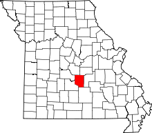 | |
| Townships | ||
| CDP | ||
| Unincorporated communities | ||
| Ghost towns | ||
| Footnotes | ‡This populated place also has portions in an adjacent county or counties | |
Coordinates: 37°50′45″N 92°03′50″W / 37.84583°N 92.06389°W