Braga District
| Braga | |
|---|---|
| District | |
 | |
| Country | Portugal |
| Region | Norte |
| Historical province | Minho |
| No. of municipalities | 14 |
| No. of parishes | 515 |
| Capital | Braga |
| Area | |
| • Total | 2,673 km2 (1,032 sq mi) |
| Population | |
| • Total | 831,368 |
| • Density | 310/km2 (810/sq mi) |
| ISO 3166 code | PT-03 |
| No. of parliamentary representatives | 19 |
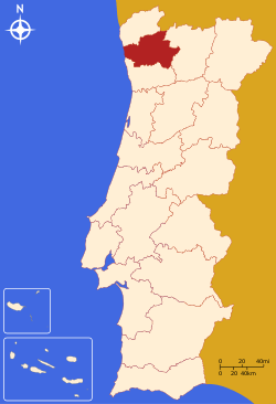
The district of Braga (Portuguese pronunciation: [ˈbɾaɣɐ], Portuguese: Distrito de Braga) is a district in the northwest of Portugal. The district capital is the city of Braga, and it is bordered by the district of Viana do Castelo in the north, Vila Real in the east, Spain (Galicia) in the northeast and Porto in the south. Its area is 2,673 km² and it has a population of 831,368.
Municipalities
The district comprises 14 municipalities:
Summary of votes and seats won 1976-2011
Summary of election results from Braga district, 1976-2011
| Parties | % | S | % | S | % | S | % | S | % | S | % | S | % | S | % | S | % | S | % | S | % | S | % | S | % | S |
|---|---|---|---|---|---|---|---|---|---|---|---|---|---|---|---|---|---|---|---|---|---|---|---|---|---|---|
| 1976 | 1979 | 1980 | 1983 | 1985 | 1987 | 1991 | 1995 | 1999 | 2002 | 2005 | 2009 | 2011 | ||||||||||||||
| PS | 32.3 | 6 | 30.2 | 5 | 29.3 | 5 | 39.7 | 7 | 21.8 | 4 | 25.9 | 5 | 31.5 | 5 | 42.9 | 8 | 44.3 | 8 | 37.4 | 8 | 45.4 | 9 | 41.7 | 9 | 32.9 | 7 |
| PSD | 28.6 | 5 | 27.0 | 5 | 32.8 | 6 | 53.4 | 10 | 53.6 | 10 | 38.2 | 7 | 36.7 | 7 | 44.4 | 9 | 32.9 | 7 | 30.8 | 6 | 40.1 | 9 | ||||
| CDS-PP | 25.2 | 4 | 18.3 | 3 | 14.0 | 2 | 5.9 | 1 | 5.6 | 1 | 10.7 | 1 | 8.9 | 1 | 9.3 | 1 | 7.8 | 1 | 9.7 | 2 | 10.4 | 2 | ||||
| PCP/APU/CDU | 4.2 | 10.0 | 1 | 8.4 | 1 | 8.8 | 1 | 8.5 | 1 | 6.1 | 1 | 4.6 | 4.5 | 5.4 | 1 | 4.4 | 4.8 | 1 | 4.6 | 1 | 4.9 | 1 | ||||
| BE | 1.2 | 1.7 | 4.6 | 7.8 | 1 | 4.2 | ||||||||||||||||||||
| AD | 51.9 | 9 | 54.9 | 9 | ||||||||||||||||||||||
| PRD | 16.8 | 3 | 3.3 | |||||||||||||||||||||||
| Source: Comissão Nacional de Eleições | ||||||||||||||||||||||||||
External links
This article is issued from
Wikipedia.
The text is licensed under Creative Commons - Attribution - Sharealike.
Additional terms may apply for the media files.