Danville Township, Vermilion County, Illinois
| Danville Township | |
|---|---|
| Township | |
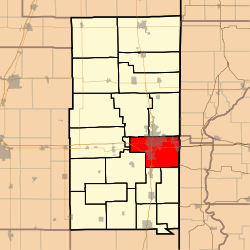 Location in Vermilion County | |
| Coordinates: 40°06′37″N 87°36′38″W / 40.11028°N 87.61056°WCoordinates: 40°06′37″N 87°36′38″W / 40.11028°N 87.61056°W | |
| Country | United States |
| State | Illinois |
| County | Vermilion |
| Created | 1851 |
| Area | |
| • Total | 50.01 sq mi (129.5 km2) |
| • Land | 49.43 sq mi (128.0 km2) |
| • Water | 0.58 sq mi (1.5 km2) 1.16% |
| Elevation | 577 ft (176 m) |
| Population (2010) | |
| • Estimate (2016)[1] | 30,673 |
| • Density | 649.7/sq mi (250.9/km2) |
| Time zone | UTC-6 (CST) |
| • Summer (DST) | UTC-5 (CDT) |
| FIPS code | 17-183-18576 |
Danville Township is a township in Vermilion County, Illinois, USA. As of the 2010 census, its population was 32,113 and it contained 13,913 housing units.[2] Danville Area Community College and the Illinois Department Of Corrections Danville Correctional Facility are in this township.
History
Danville Township was one of the eight townships created in 1851.
Danville Township was named for Dan Beckwith, an Indian trader.[3]
Geography
According to the 2010 census, the township has a total area of 50.01 square miles (129.5 km2), of which 49.43 square miles (128.0 km2) (or 98.84%) is land and 0.58 square miles (1.5 km2) (or 1.16%) is water.[2]
Cities and towns
Unincorporated towns
Extinct towns
- Beeler Terrace
- Brookville
- Grape Creek
- South Danville
- Vandercook
- Vermilion Heights
- Walz
- Wyton
Adjacent townships
- Newell Township (north)
- Highland Township, Vermillion County, Indiana (east)
- Mound Township, Warren County, Indiana (east)
- Georgetown Township (south)
- McKendree Township (south)
- Catlin Township (southwest)
- Oakwood Township (west)
- Blount Township (northwest)
Cemeteries
The township contains these cemeteries: Atherton, Danville National, Forse, Greenwood, Hooten, Langley, Lutheran, Lynch, Oakhill, Parish, Saint Patrick's and Sandhill.
Major highways
Rivers
Airports and landing strips
- Danville Correctional Center Heliport
- Lakeview Medical Center Heliport
Demographics
| Historical population | |||
|---|---|---|---|
| Census | Pop. | %± | |
| Est. 2016 | 30,673 | [1] | |
| U.S. Decennial Census[4] | |||
School districts
- Catlin Community Unit School District 5
- Danville Community Consolidated School District 118
- Oakwood Community Unit School District 76
- Westville Community Unit School District 2
Political districts
- Illinois' 15th congressional district
- State House District 104
- State Senate District 52
References
- 1 2 "Population and Housing Unit Estimates". Retrieved June 9, 2017.
- 1 2 "Population, Housing Units, Area, and Density: 2010 - County -- County Subdivision and Place -- 2010 Census Summary File 1". United States Census. Retrieved 2013-05-28.
- ↑ Gannett, Henry (1905). The Origin of Certain Place Names in the United States. Govt. Print. Off. p. 100.
- ↑ "Census of Population and Housing". Census.gov. Retrieved June 4, 2016.
External links
Municipalities and communities of Vermilion County, Illinois, United States | ||
|---|---|---|
| Cities | ||
| Villages | ||
| Townships | ||
| CDP | ||
| Other unincorporated communities | ||
| Footnotes | ‡This populated place also has portions in an adjacent county or counties | |