Vance Township, Vermilion County, Illinois
| Vance Township | |
|---|---|
| Township | |
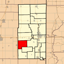 Location in Vermilion County | |
| Coordinates: 40°02′42″N 87°52′47″W / 40.04500°N 87.87972°WCoordinates: 40°02′42″N 87°52′47″W / 40.04500°N 87.87972°W | |
| Country | United States |
| State | Illinois |
| County | Vermilion |
| Created | 1866 |
| Area | |
| • Total | 40.03 sq mi (103.7 km2) |
| • Land | 39.96 sq mi (103.5 km2) |
| • Water | 0.08 sq mi (0.2 km2) 0.20% |
| Elevation | 666 ft (203 m) |
| Population (2010) | |
| • Estimate (2016)[1] | 1,010 |
| • Density | 26.5/sq mi (10.2/km2) |
| Time zone | UTC-6 (CST) |
| • Summer (DST) | UTC-5 (CDT) |
| FIPS code | 17-183-77304 |
Vance Township is a township in Vermilion County, Illinois, USA. As of the 2010 census, its population was 1,057 and it contained 457 housing units.[2]
History
Vance Township was created in 1866.
Geography
According to the 2010 census, the township has a total area of 40.03 square miles (103.7 km2), of which 39.96 square miles (103.5 km2) (or 99.83%) is land and 0.08 square miles (0.21 km2) (or 0.20%) is water.[2]
Cities and towns
Adjacent townships
- Oakwood Township (northeast)
- Catlin Township (east)
- Jamaica Township (southeast)
- Sidell Township (south)
- South Homer Township, Champaign County (west)
- Ogden Township, Champaign County (northwest)
Cemeteries
The township contains two cemeteries: Bodkin and Davis.
Airports and landing strips
- Catlett Landing Strip
- Rockin 'B' Farms Airport
Demographics
| Historical population | |||
|---|---|---|---|
| Census | Pop. | %± | |
| Est. 2016 | 1,010 | [1] | |
| U.S. Decennial Census[3] | |||
References
- 1 2 "Population and Housing Unit Estimates". Retrieved June 9, 2017.
- 1 2 "Population, Housing Units, Area, and Density: 2010 - County -- County Subdivision and Place -- 2010 Census Summary File 1". United States Census. Retrieved 2013-05-28.
- ↑ "Census of Population and Housing". Census.gov. Retrieved June 4, 2016.
External links
Municipalities and communities of Vermilion County, Illinois, United States | ||
|---|---|---|
| Cities | ||
| Villages | ||
| Townships | ||
| CDP | ||
| Other unincorporated communities | ||
| Footnotes | ‡This populated place also has portions in an adjacent county or counties | |
This article is issued from
Wikipedia.
The text is licensed under Creative Commons - Attribution - Sharealike.
Additional terms may apply for the media files.