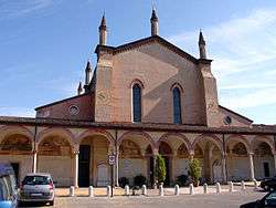
Curtatone
| Curtatone Cürtatun (Lombard) | |
|---|---|
| Comune | |
| Città di Curtatone | |
 | |
 Curtatone Location of Curtatone in Italy | |
| Coordinates: 45°9′N 10°43′E / 45.150°N 10.717°ECoordinates: 45°9′N 10°43′E / 45.150°N 10.717°E | |
| Country | Italy |
| Region | Lombardy |
| Province | Mantua (MN) |
| Frazioni | Buscoldo, Eremo, Grazie, Levata, Montanara (municipal seat), Ponteventuno, San Lorenzo, San Silvestro |
| Government | |
| • Mayor | Carlo Bottani |
| Area | |
| • Total | 67.47 km2 (26.05 sq mi) |
| Elevation | 26 m (85 ft) |
| Population (28 February 2017)[1] | |
| • Total | 14,818 |
| • Density | 220/km2 (570/sq mi) |
| Demonym(s) | Curtatonesi |
| Time zone | UTC+1 (CET) |
| • Summer (DST) | UTC+2 (CEST) |
| Postal code | 46010 |
| Dialing code | 0376 |
| Website | Official website |
Curtatone (Mantovano: Cürtatun) is a comune (municipality) in the Province of Mantua in the Italian region Lombardy, located about 130 kilometres (81 mi) southeast of Milan and about 7 kilometres (4 mi) southwest of Mantua.
The municipality of Curtatone is formed by the frazioni (subdivisions, mainly villages and hamlets) Buscoldo, Eremo, Grazie, Levata, Montanara (municipal seat), Ponteventuno, San Lorenzo, and San Silvestro.
Curtatone borders the following municipalities: Borgo Virgilio, Castellucchio, Mantua, Marcaria, Porto Mantovano, Rodigo.
Curtatone received the honorary title of city with a presidential decree on July 2, 2002.
References
- ↑ All demographics and other statistics: Istituto Nazionale di Statistica (Istat).
External links

This article is issued from
Wikipedia.
The text is licensed under Creative Commons - Attribution - Sharealike.
Additional terms may apply for the media files.