Castelbelforte
| Castelbelforte | |
|---|---|
| Comune | |
| Comune di Castelbelforte | |
 Castelbelforte Location of Castelbelforte in Italy | |
| Coordinates: 45°13′N 10°53′E / 45.217°N 10.883°ECoordinates: 45°13′N 10°53′E / 45.217°N 10.883°E | |
| Country | Italy |
| Region | Lombardy |
| Province | Province of Mantua (MN) |
| Area | |
| • Total | 22.3 km2 (8.6 sq mi) |
| Population (Dec. 2004) | |
| • Total | 2,636 |
| • Density | 120/km2 (310/sq mi) |
| Time zone | UTC+1 (CET) |
| • Summer (DST) | UTC+2 (CEST) |
| Postal code | 46032 |
| Dialing code | 0376 |
Castelbelforte (Mantovano: I Castei) is a comune (municipality) in the Province of Mantua in the Italian region Lombardy, located about 140 kilometres (87 mi) east of Milan and about 9 kilometres (6 mi) northeast of Mantua. As of 31 December 2004, it had a population of 2,636 and an area of 22.3 square kilometres (8.6 sq mi).[1]
Castelbelforte borders the following municipalities: Bigarello, Erbè, Roverbella, San Giorgio di Mantova, Sorgà, Trevenzuolo.
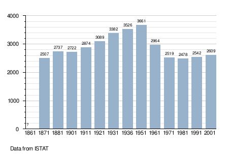
Demographic evolution
References
- ↑ All demographics and other statistics: Istituto Nazionale di Statistica (Istat).

This article is issued from
Wikipedia.
The text is licensed under Creative Commons - Attribution - Sharealike.
Additional terms may apply for the media files.