County of Yarrol

Yarrol
Queensland
Location within Queensland
Lands administrative divisions around Yarrol:
Rawbelle Clinton Flinders
Rawbelle Yarrol Bowen
Wicklow Bowen Bowen

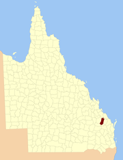
The County of Yarrol is a county (a cadastral division) in Queensland, Australia, located in the Wide Bay–Burnett region to the west of Bundaberg.[1][2] On 7 March 1901, the Governor issued a proclamation legally dividing Queensland into counties under the Land Act 1897.[3] Its schedule described Yarrol thus:

Bounded on the east by the county of Bowen; on the south and west by the Burnett River upwards to the western watershed of Three Moon Creek, by that watershed northerly to the southern watershed of Glassford Creek; and on the north by the southern boundary of the parish of Bompa.

Parishes

Yarrol is divided into parishes, as listed below:

ParishLGACoordinatesTowns
BaniaNorth Burnett24°57′S 151°30′E / 24.950°S 151.500°E / -24.950; 151.500 (Bania Parish)
BaywullaNorth Burnett25°05′S 151°25′E / 25.083°S 151.417°E / -25.083; 151.417 (Baywulla Parish)Yarrol
BorillaNorth Burnett24°46′S 151°26′E / 24.767°S 151.433°E / -24.767; 151.433 (Borilla Parish)
CannindahNorth Burnett24°52′S 151°16′E / 24.867°S 151.267°E / -24.867; 151.267 (Cannindah Parish)Bancroft
CynthiaNorth Burnett25°11′S 151°09′E / 25.183°S 151.150°E / -25.183; 151.150 (Cynthia Parish)Abercorn
DalgangalNorth Burnett25°13′S 151°16′E / 25.217°S 151.267°E / -25.217; 151.267 (Dalgangal Parish)
HollywellNorth Burnett25°21′S 151°09′E / 25.350°S 151.150°E / -25.350; 151.150 (Hollywell Parish)Eidsvold
LochaberNorth Burnett25°25′S 151°16′E / 25.417°S 151.267°E / -25.417; 151.267 (Lochaber Parish)
MalmoeNorth Burnett25°29′S 151°13′E / 25.483°S 151.217°E / -25.483; 151.217 (Malmoe Parish)Riverleigh
MinervaBundaberg24°38′S 151°27′E / 24.633°S 151.450°E / -24.633; 151.450 (Minerva Parish)
MolangulBundaberg24°47′S 151°34′E / 24.783°S 151.567°E / -24.783; 151.567 (Molangul Parish)
MundowranNorth Burnett25°33′S 151°19′E / 25.550°S 151.317°E / -25.550; 151.317 (Mundowran Parish)Mundubbera
MungyNorth Burnett25°17′S 151°26′E / 25.283°S 151.433°E / -25.283; 151.433 (Mungy Parish)
New CannindahNorth Burnett24°43′S 151°16′E / 24.717°S 151.267°E / -24.717; 151.267 (New Cannindah Parish)Kalpowar
Nour NourNorth Burnett25°10′S 151°27′E / 25.167°S 151.450°E / -25.167; 151.450 (Nour Nour Parish)
ReidNorth Burnett25°25′S 151°24′E / 25.417°S 151.400°E / -25.417; 151.400 (Reid Parish)Gurgeena
TellebangNorth Burnett25°03′S 151°14′E / 25.050°S 151.233°E / -25.050; 151.233 (Tellebang Parish)
YarrolNorth Burnett24°54′S 151°25′E / 24.900°S 151.417°E / -24.900; 151.417 (Yarrol Parish)

References

  1. "Yarrol (entry 38550)". Queensland Place Names. Queensland Government. Retrieved 8 September 2015.
  2. Wide Bay/Burnett Districts, County of Yarrol Maps – E3 Series at Queensland Archives.
  3. "A Proclamation". Queensland Government Gazette. 75. 8 March 1901. pp. 967–980.

Coordinates: 25°06′S 151°20′E / 25.100°S 151.333°E / -25.100; 151.333


This article is issued from Wikipedia. The text is licensed under Creative Commons - Attribution - Sharealike. Additional terms may apply for the media files.