Yampai, Arizona
| Yampai, Arizona | |
|---|---|
| Populated place | |
 Yampai Location within the state of Arizona  Yampai Yampai (the US) | |
| Coordinates: 35°29′22″N 113°12′02″W / 35.48944°N 113.20056°WCoordinates: 35°29′22″N 113°12′02″W / 35.48944°N 113.20056°W | |
| Country | United States |
| State | Arizona |
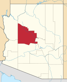
| County | Yavapai |
| Elevation[1] | 5,607 ft (1,709 m) |
| Time zone | UTC-7 (Mountain (MST)) |
| • Summer (DST) | UTC-7 (MST) |
| Area code(s) | 928 |
| FIPS code | 04-84700 |
| GNIS feature ID | 14035 |

Aerial view of the Arizona high desert and oak woodlands, looking south from above the Grand Canyon, including the stretch of Route 66 between Seligman (left) and Yampai (right)
Yampai is a populated place situated in Yavapai County, Arizona.[2] It has an estimated elevation of 5,607 feet (1,709 m) above sea level.[1]
References
- 1 2 "Feature Detail Report for: Yampai". Geographic Names Information System. United States Geological Survey.
- ↑ "Yampai (in Yavapai County, AZ) Populated Place Profile". AZ Hometown Locator. Retrieved August 9, 2017.
This article is issued from
Wikipedia.
The text is licensed under Creative Commons - Attribution - Sharealike.
Additional terms may apply for the media files.