Corning, California
| City of Corning | |
|---|---|
| city | |
 Solano Street in 2013 | |
| Nickname(s): "The Olive City" | |
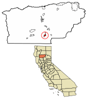 Location of Corning in Tehama County, California. | |
 City of Corning Location in the United States | |
| Coordinates: 39°55′34″N 122°10′50″W / 39.92611°N 122.18056°WCoordinates: 39°55′34″N 122°10′50″W / 39.92611°N 122.18056°W | |
| Country |
|
| State |
|
| County | Tehama |
| Incorporated | 6 August 1907[1] |
| Area[2] | |
| • Total | 3.55 sq mi (9.19 km2) |
| • Land | 3.55 sq mi (9.19 km2) |
| • Water | 0.00 sq mi (0.00 km2) 0% |
| Elevation | 276 ft (84 m) |
| Population (2010)[3] | |
| • Total | 7,663 |
| • Estimate (2016)[4] | 7,535 |
| • Density | 2,122.54/sq mi (819.61/km2) |
| Time zone | UTC−8 (Pacific (PST)) |
| • Summer (DST) | UTC−7 (PDT) |
| ZIP codes | 96021, 96029, (96092) |
| Area code(s) | 530 |
| FIPS code | 06-16322 |
| GNIS feature ID | 0277491 |
| Website |
corning |
Corning is a city in Tehama County, California that is located about 19 miles south of Red Bluff and about 100 miles north of Sacramento. The population was 7,663 at the 2010 census, up from 6,741 at the 2000 census.
History
Corning had its start in 1882 when the railroad was extended to that point.[5] The community was named after John Corning, a railroad official.[5]
Geography
Corning is located at 39°55′34″N 122°10′50″W / 39.92611°N 122.18056°W (39.926182, -122.180489).[6]
According to the United States Census Bureau, the city has a total area of 3.55 square miles (9.2 km2), all of it land / none of it water.
Climate
According to the Köppen Climate Classification system, Corning has a warm-summer Mediterranean climate, abbreviated "Csa" on climate maps.[7]
Demographics
| Historical population | |||
|---|---|---|---|
| Census | Pop. | %± | |
| 1890 | 210 | — | |
| 1900 | . | −100.0% | |
| 1910 | 972 | — | |
| 1920 | 1,449 | 49.1% | |
| 1930 | 1,377 | −5.0% | |
| 1940 | 1,472 | 6.9% | |
| 1950 | 2,537 | 72.4% | |
| 1960 | 3,006 | 18.5% | |
| 1970 | 3,573 | 18.9% | |
| 1980 | 4,745 | 32.8% | |
| 1990 | 5,870 | 23.7% | |
| 2000 | 6,741 | 14.8% | |
| 2010 | 7,663 | 13.7% | |
| Est. 2016 | 7,535 | [4] | −1.7% |
| U.S. Decennial Census[8] | |||
2010
The 2010 United States Census[9] reported that Corning had a population of 7,663 people. The population density was 2,158.8 people per square mile (833.5/km²). The racial makeup of Corning was 5,510 (71.9%) White, 44 (0.6%) African American, 201 (2.6%) Native American, 82 (1.1%) Asian, 11 (0.1%) Pacific Islander, 1,496 (19.5%) from other races, and 319 (4.2%) from two or more races. Hispanic or Latino of any race were 3,271 individuals (42.7%).
The Census reported that 7,638 people (99.7% of the population) lived in households, 19 (0.2%) lived in non-institutionalized group quarters, and 6 (0.1%) were institutionalized.
There were 2,630 households, out of which 1,193 (45.4%) had children under age 18 living in them, 1,136 (43.2%) were opposite-sex married couples living together, 533 (20.3%) had a female householder with no husband present, 179 (6.8%) had a male householder with no wife present. There were 224 (8.5%) unmarried opposite-sex partnerships, and 12 (0.5%) same-sex married couples or partnerships. 633 households (24.1%) were made up of individuals and 259 (9.8%) had someone living alone who was 65 years of age or older. The average household size was 2.90. There were 1,848 families (70.3% of all households); the average family size was 3.44 persons.
The population was spread out with 2,479 people (32.4%) under age 18, 864 people (11.3%) aged 18 to 24, 1,931 people (25.2%) aged 25 to 44, 1,617 people (21.1%) aged 45 to 64, and 772 people (10.1%) who were 65 years of age or older. The median age was 29.2 years. For every 100 females there were 94.5 males. For every 100 females aged 18 and over, there were 89.5 males.
There were 2,871 housing units at an average density of 808.8 per square mile (312.3/km²), of which 1,302 (49.5%) were owner-occupied, and 1,328 (50.5%) were occupied by renters. The homeowner vacancy rate was 3.1%; the rental vacancy rate was 8.4%. 3,765 people (49.1% of the population) lived in owner-occupied housing units and 3,873 people (50.5%) lived in rental housing units.
2000
As of the census[10] of 2000, there were 6,741 people, 2,422 households, and 1,642 families residing in the city. The population density was 2,320.3 people per square mile (894.4/km²). There were 2,614 housing units at an average density of 899.8 per square mile (346.8/km²). The racial makeup of the city was 74.48% White, 0.52% African American, 2.18% Native American, 0.53% Asian, 0.09% Pacific Islander, 17.42% from other races, and 4.78% from two or more races. Hispanic or Latino of any race were 50.82% of the population.
There were 2,422 households out of which 40.2% had children under the age of 18 living with them, 45.1% were married couples living together, 16.3% had a female householder with no husband present, and 32.2% were non-families. 26.9% of all households were made up of individuals and 14.0% had someone living alone who was 65 years of age or older. The average household size was 2.76 and the average family size was 3.33 individuals.
In the city, the population was spread out with 32.5% under age 18, 10.0% aged 18 to 24, 28.0% aged 25 to 44, 17.7% aged 45 to 64, and 11.8% aged 65 years or older. The median age was 31 years. For every 100 females there were 92.9 males. For every 100 females aged 18 and over, there were 90.5 males.
The median income for a household in the city was $25,357, and the median income for a family was $32,151. Males had a median income of $30,563 versus $19,736 for females. The per capita income for the city was $12,357. About 21.1% of families and 26.3% of the population were below the poverty line, including 33.6% of those under age 18 and 15.6% of those aged 65 or over.
These compare to the national median household income of $45,135 and national per capita income of $23,201; 69.4% of the residents in the city have graduated from High School or achieved further education compared to 80.35% nationally.
Government
In the California State Legislature, Corning is in the 4th Senate District, represented by Republican Jim Nielsen, and in the 3rd Assembly District, represented by Republican James Gallagher.[11]
In the United States House of Representatives, Corning is in California's 1st congressional district, represented by Republican Doug LaMalfa.[12]
Major industries
The major local industry is growing and preparing table olives. Corning also has a significant agricultural industry based on olive oil, dried plums (prunes, including the Sunsweet label), walnuts, and almonds.
- Bell-Carter Foods
Corning is home to Bell-Carter Foods, Inc., the second-largest table olive processor in the world and the largest in the United States.[13] Bell Carter produces Lindsay Olives.
- Lucero Olive Oil
North America's most award-winning extra virgin olive oil company, Lucero Olive Oil,[14][15][16][17][18][19] is based in Corning, with orchards, olive mill, bottling facility, and a public tasting room.
- Other local destinations & landmarks
- The House of Brews, a music-based coffee shop
- Rodgers Theater, a restored historic cinema building
- Corning Museum
- Rolling Hills Casino
- The Corning Equestrian Center
- Sevillano Links Golf Course, a championship 18 hole golf course, about one mile south of town
- The Olive Pit, a popular tourist stop since 1967 that specializes in many varieties of table olives with olive tasting, a wine bar, and a cafe
Corning Olive Festival
The annual Corning Olive Festival on the 2nd Saturday in October each year is the longest-running olive festival in the United States. Started in 1946 by the local Catholic church as a fundraiser, the festival is now organized and operated by the Corning Chamber of Commerce.[20]
Transportation
Interstate 5 and Highway 99 both serve Corning, along with the California Northern Railroad. The California Northern has been leasing and operating the 110.7-mile (178.2 km) line between Davis and Tehama county through Corning from Southern Pacific (now Union Pacific) since 26 September 1993. The line was built by Southern Pacific's subsidiary, the Northern Railway Company, in August / September 1882.
Notable people
- Mark Acre, Former Major League Baseball pitcher
- Clair Engle, U.S. Senator
- Ralph Goings, American artist
- Lee Grissom, Major League Baseball pitcher
- Mark Risley, Emmy-winning director
- France Silva, Medal of Honor recipient, veteran of the Boxer Rebellion
- Jeff Stover, NFL player
- Tyler Reddick, NASCAR driver
- Blaire White, Youtube personality
- Joe Banich, WWII Veteran & Grandfather extraordinaire
Photo gallery
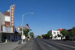
- Solano Street, Corning, California, in 2013.
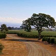
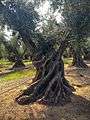
- The old Sevillano tree in Corning, 2015.
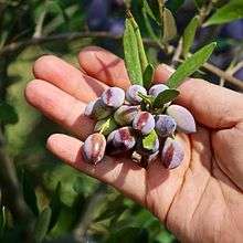
- An olive grower showing ripe Koroneiki olives, Corning, CA, Nov 2015.
- High density Arbequina olive orchard in Corning, CA, Nov 2015.
References
- ↑ "California Cities by Incorporation Date". California Association of Local Agency Formation Commissions. Archived from the original (Word) on 3 November 2014. Retrieved 25 August 2014.
- ↑ "2016 U.S. Gazetteer Files". United States Census Bureau. Retrieved 19 July 2017.
- ↑ "Corning (city) QuickFacts". United States Census Bureau. Retrieved 9 April 2015.
- 1 2 "Population and Housing Unit Estimates". Retrieved 9 June 2017.
- 1 2 "Place Names" (PDF). Tehama County Department of Education. Retrieved 25 March 2018.
- ↑ "US Gazetteer files: 2010, 2000, and 1990". United States Census Bureau. 2011-02-12. Retrieved 2011-04-23.
- ↑ Climate Summary for Corning, California
- ↑ "Census of Population and Housing". Census.gov. Archived from the original on 12 May 2015. Retrieved 4 June 2015.
- ↑ "2010 Census Interactive Population Search: CA - Corning city". U.S. Census Bureau. Retrieved 12 July 2014.
- ↑ "American FactFinder". United States Census Bureau. Archived from the original on 2013-09-11. Retrieved 2008-01-31.
- ↑ "Statewide Database". Regents of the University of California. Retrieved 9 April 2015.
- ↑ "California's 1st Congressional District - Representatives & District Map". Civic Impulse, LLC. Retrieved 1 March 2013.
- ↑ "Insights & News". Bell-Carter Foods. Retrieved 12 April 2015.
- ↑ "EVOO World Ranking 2015". Retrieved 22 May 2016.
- ↑ "EVOO World Ranking 2016". Retrieved 25 May 2017.
- ↑ "World's Best Olive Oils 2016". Retrieved 22 May 2016.
- ↑ "Olive Japan 2016 Premier Olive Oil Winners". Retrieved 22 May 2016.
- ↑ "TerraOlivo Jerusalem 2015 Prestige Gold Winners". Retrieved 22 May 2016.
- ↑ "EVOO World Ranking 2017". Retrieved 2 January 2018.
- ↑ "Official Corning Olive Festival Facebook page". Retrieved 31 July 2016.
External links
- Official website

- TehamaPulse.com is an events calendar for Tehama County, including Corning, CA.
Municipalities and communities of Tehama County, California, United States | ||
|---|---|---|
| Cities | 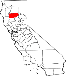 | |
| CDPs | ||
| Unincorporated communities | ||
| Footnotes | ‡This populated place also has portions in an adjacent county or counties | |