Ancramdale, New York
| Ancramdale, New York | |
|---|---|
| Hamlet | |
 Ancramdale, New York  Ancramdale, New York | |
| Coordinates: 42°01′05″N 73°35′28″W / 42.01806°N 73.59111°WCoordinates: 42°01′05″N 73°35′28″W / 42.01806°N 73.59111°W | |
| Country | United States |
| State | New York |
| County | Columbia |
| Elevation | 548 ft (167 m) |
| Time zone | UTC-5 (Eastern (EST)) |
| • Summer (DST) | UTC-4 (EDT) |
| ZIP code | 12503 |
| Area code(s) | 518 & 838 |
| GNIS feature ID | 942456[1] |
Ancramdale is a hamlet in Columbia County, New York, United States. The community is located along New York State Route 82 in the southeast corner of the county, 19 miles (31 km) southeast of Hudson. Ancramdale has a post office with ZIP code 12503.[2][3]
References
- ↑ "Ancramdale". Geographic Names Information System. United States Geological Survey.
- ↑ United States Postal Service. "USPS - Look Up a ZIP Code". Retrieved September 9, 2017.
- ↑ "Postmaster Finder - Post Offices by ZIP Code". United States Postal Service. Retrieved September 9, 2017.
Municipalities and communities of Columbia County, New York, United States | ||
|---|---|---|
| City | 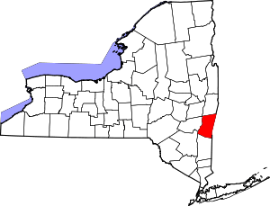 | |
| Towns | ||
| Villages | ||
| CDPs | ||
| Other hamlets | ||
| Footnotes | ‡This populated place also has portions in an adjacent county or counties | |
This article is issued from
Wikipedia.
The text is licensed under Creative Commons - Attribution - Sharealike.
Additional terms may apply for the media files.