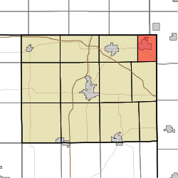
Clear Lake Township, Steuben County, Indiana
| Clear Lake Township | |
|---|---|
| Township | |
 Location in Steuben County | |
| Coordinates: 41°43′47″N 84°50′09″W / 41.72972°N 84.83583°WCoordinates: 41°43′47″N 84°50′09″W / 41.72972°N 84.83583°W | |
| Country | United States |
| State | Indiana |
| County | Steuben |
| Government | |
| • Type | Indiana township |
| Area | |
| • Total | 11.1 sq mi (29 km2) |
| • Land | 9.56 sq mi (24.8 km2) |
| • Water | 1.54 sq mi (4.0 km2) 13.87% |
| Elevation[1] | 1,033 ft (315 m) |
| Population (2010) | |
| • Total | 799 |
| • Density | 83.6/sq mi (32.3/km2) |
| Time zone | UTC-5 (Eastern (EST)) |
| • Summer (DST) | UTC-4 (EDT) |
| Area code(s) | 260 |
| GNIS feature ID | 453223 |
Clear Lake Township is one of twelve townships in Steuben County, Indiana, United States. As of the 2010 census, its population was 799 and it contained 928 housing units.[2] It is the north easternmost township in the state.
History
William L. Lords House was listed on the National Register of Historic Places in 1983.[3]
Geography
According to the 2010 census, the township has a total area of 11.1 square miles (29 km2), of which 9.56 square miles (24.8 km2) (or 86.13%) is land and 1.54 square miles (4.0 km2) (or 13.87%) is water.[2] Lakes in this township include Clear Lake, Handy Lake, Lake Anne, Long Lake, Mirror Lake, Mud Lake, and Round Lake.
Cities and towns
Cemeteries
The township contains three cemeteries: Teeters, Clear Lake Baptist, and Clear Lake Lutheran.[4]
Major highways
Education
Clear Lake Township residents may obtain a free library card from the Fremont Public Library.[5]
References
- "Clear Lake Township, Steuben County, Indiana". Geographic Names Information System. United States Geological Survey. Retrieved 2009-09-24.
- "Steuben County Cemeteries", Steuben County, Indiana, INGenWeb Site, accessed August 12, 2008.
- United States Census Bureau cartographic boundary files
- ↑ "US Board on Geographic Names". United States Geological Survey. October 25, 2007. Retrieved 2017-05-08.
- 1 2 "Population, Housing Units, Area, and Density: 2010 - County -- County Subdivision and Place -- 2010 Census Summary File 1". United States Census. Retrieved 2013-05-10.
- ↑ National Park Service (2010-07-09). "National Register Information System". National Register of Historic Places. National Park Service.
- ↑ "Steuben County Cemeteries"
- ↑ "Circulation Policies". Fremont Public Library. Retrieved 15 March 2018.